CAPE PERPETUA, OR Campground Reservation, Info, Images, Map, Directions

CAPE PERPETUA, Oregon Campground Images, Info & Reservations

Listen

Directions

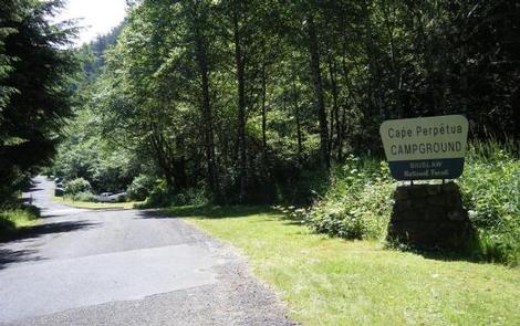
Campground is located North of Florence, Oregon along Highway 101, 22 miles north of Florence, Oregon and 3 miles south of Yachats, Oregon. Campground is located on the east side of the highway in the Cape Perpetua Scenic area. After turning off Highway 101, take a right at the split with the signed road to the Cape Perpetua Campground.

Phone

541-547-4580

Activities

CAMPING, INTERPRETIVE PROGRAMS, HIKING, VISITOR CENTER, WILDLIFE VIEWING, BEACHCOMBING, WHALE WATCHING

Keywords

CAPG,PERPETUA,CAPE PERPETUAL,CAPE POINT,SIUSLAW NF – FS

Related Link(s)

Rec Area Info & Images

Forest Service Concessionaire

Oregon State Road Conditions

Oregon State Tourism

Overview

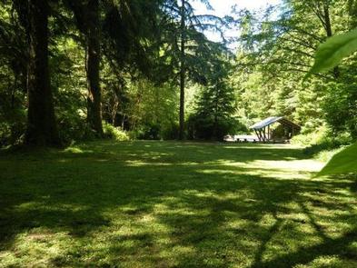
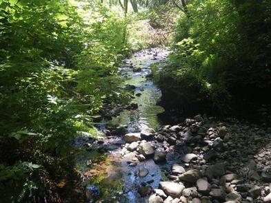
Cape Perpetua Campground is nestled along the banks of Cape Creek, within reach of the beautiful Oregon Coast. The campground is esteemed for its incredible location between the forest and the beach, and for its easy access to impressive hiking trails and prime ocean views.

Recreation

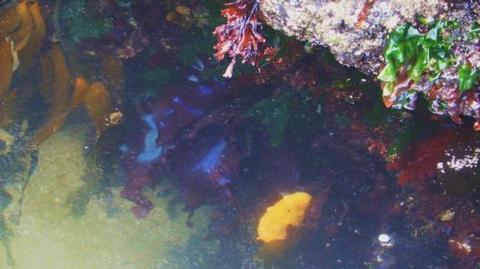
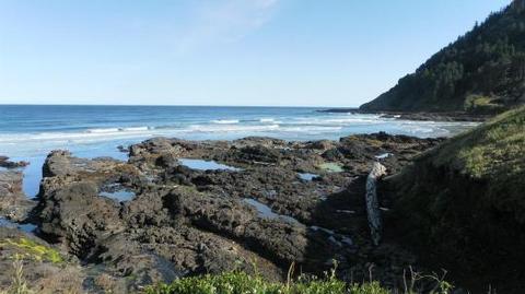
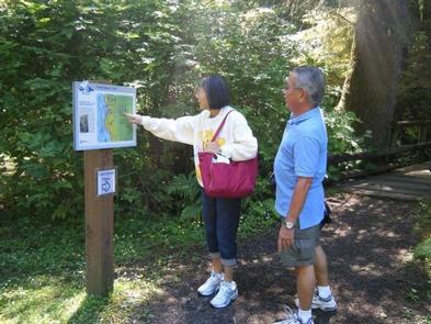
Visitors enjoy relaxing on the shore and exploring tide pools. A 23-mile trail system surrounds the campground. Several paths lead through dense, old-growth forests and to rocky coastal overlooks.

Facilities

Many sites in the campground are situated along Cape Creek. Each site is equipped with a picnic table and campfire ring. Flush toilets and drinking water are provided.

The Cape Perpetua Visitor Center is a short, moderate hike from the campground. The center has a phenomenal view of the ocean. A variety of short films are shown in the theater.

The nearest dump station is located in Waldport, about 12 miles north of the campground. Another dump station can be found about 12 miles south at the Carl G. Washburn State Park.

Natural Features

The campground is surrounded by large Sitka spruce, Douglas fir and alder trees within the Siuslaw National Forest. When exploring the area, visitors will find steep cliffs, rolling hills, sand dunes and lush forests. Siuslaw is one of only two national forests bordering the Pacific Ocean.

Nearby Attractions

Heceta Beach is located nearby, giving visitors the opportunity to enjoy the Pacific Ocean.

Reservation

More from CampingHiking.net:

MIDWAY, Texas Campground Images, Info & Reservations

Listen Directions From I-35, take the exit for Hwy 6 N toward Meridian (330B) for about 5 miles. Immediately before crossing the lake, exit right at Midway Park Exit. At the exit, drive under the bridge and the park is a quarter-mile down the east-bound service road. Phone 254-756-5359 Activities

PARKSIDE, Montana Campground Images, Info & Reservations

Listen Directions From U.S. Highway 212, turn off at Rock Creek Road (Forest Road 2421). Go 0.3 miles to the campground entrance on the right. Phone 406-587-9054 Activities BIKING, BOATING, CAMPING, FISHING, HIKING Keywords PKSD,CUSTER NF – FS Related Link(s) Rec Area Info & Images Overview Parkside Campground is located

RIVER EDGE, Oregon Campground Images, Info & Reservations

Listen Directions From Waldport, head east on Highway 34 for about 26 miles and look for campground signs on the right. Phone 541-528-7725 Activities BIKING, BOATING, CAMPING, FISHING, HIKING, HUNTING, WILDLIFE VIEWING, SWIMMING, MOUNTAIN BIKING, CANOEING, BERRY PICKING Keywords REDG,RIVERS EDGE,RIVEREDGE,RIVERSEDGE,RIVER SIDE,SIUSLAW NF – FS Related Link(s) Rec Area Info

INDIAN POINT, Missouri Campground Images, Info & Reservations

Listen Directions From Branson, Missouri, take Highway 76 west for 3 miles, then turn south on Indian Point Road and follow for 2 miles to park entrance. Phone 417-338-2121 Activities BOATING, CAMPING, FISHING, HIKING, PICNICKING, WATER SPORTS, WILDLIFE VIEWING, DAY USE AREA, SWIMMING SITE, PHOTOGRAPHY, RANGER STATION, KAYAKING, WATER ACCESS

CLEARWATER CAMPGROUND, Wyoming Campground Images, Info & Reservations

Listen Directions From Cody, Wyo., follow Sheridan Avenue west through Cody until the road leaves town, and becomes the Buffalo Bill Cody Scenic Byway (U.S. Highway 14/16/20). The campground is 32 miles west of Cody, on the south side of the highway and next to the river. Phone 307-527-6921 –

RICHARDSON LAKE CAMPGROUND, Wisconsin Campground Images, Info & Reservations

Listen Directions From Wabeno, drive north 0.8 miles on Highway 32 to Highway 52. Turn left (west) on Highway 52 and drive 2.4 miles to Richardson Lake Road (FR2880). Turn right (north) on Richardson Lake Road and continue 0.4 miles to the campground. Phone 715-674-4481 Activities CAMPING Keywords Related Link(s)