SAILOR LAKE PAVILION, WI Campground Reservation, Info, Images, Map, Directions

SAILOR LAKE PAVILION, Wisconsin Campground Images, Info & Reservations

Directions

From the intersection of Highways 13 and 70 in Fifield, drive about 8 miles east on Highway 70 to Forest Road 139. Turn right (south) and continue on Forest Road 139 about 3 miles to the Sailor Lake Boat Landing and Picnic Area, just past the campground road.

Phone

715-762-2461

Activities

BIKING, BOATING, CAMPING, FISHING, HIKING, WILDLIFE VIEWING, SWIMMING, KAYAKING, CANOEING, WATER ACCESS, ICE FISHING

Keywords

SLKP,CHEQUAMEGON-NICOLET NF – FS

Related Link(s)

Rec Area Info & Images

Wisconsin State Road Conditions

Wisconsin State Tourism

Overview

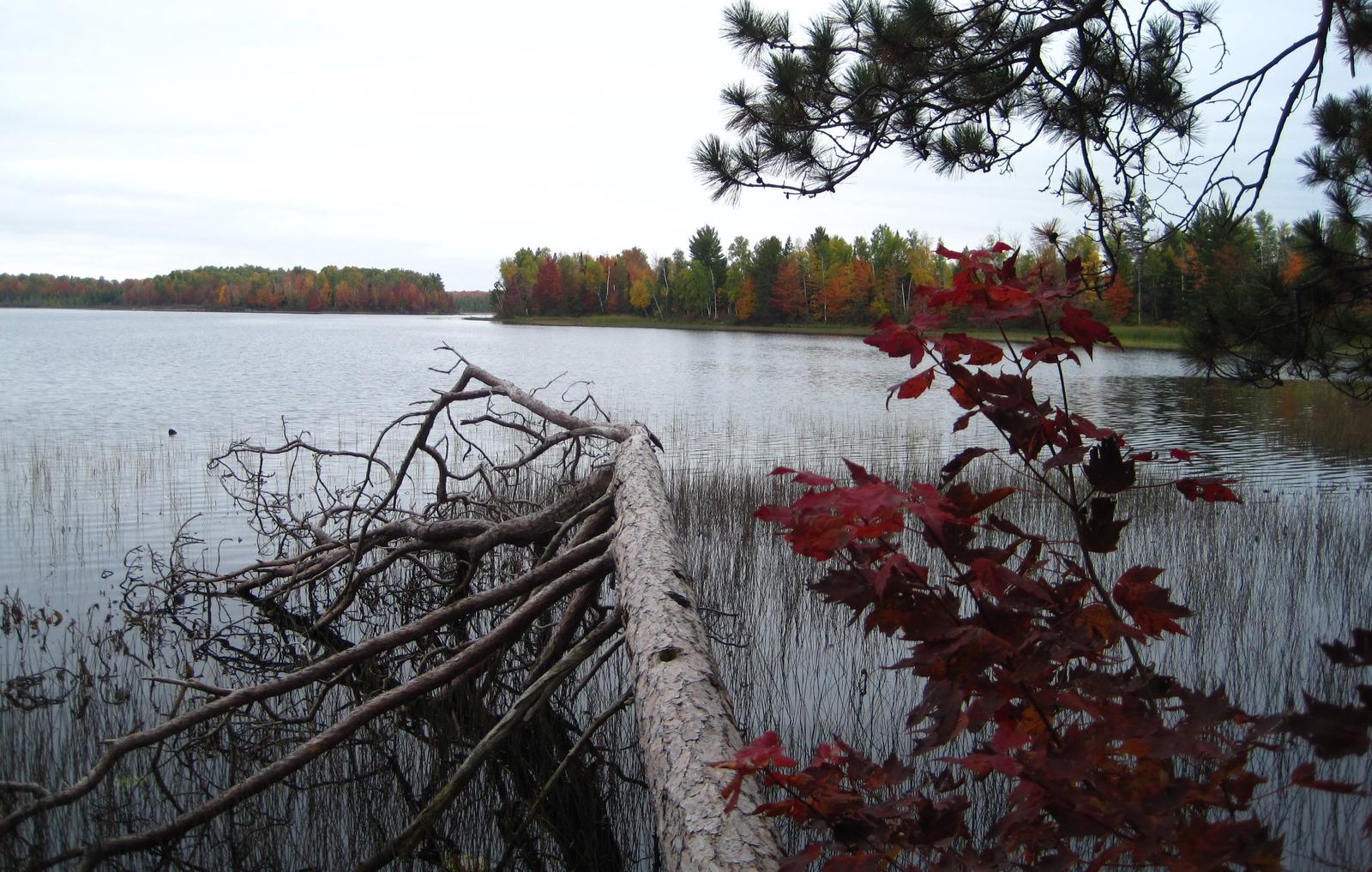
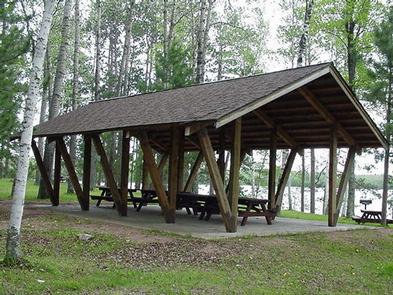
Sailor Lake Pavilion is located near Sailor Lake Campground, both adjacent to scenic Sailor Lake. Its secluded setting makes it a popular location for family and group events. The pavilion is located on Sailor Lake which is popular for fishing. Nearby off-road vehicle trails are also quite the draw.

Recreation

Sailor Lake Pavilion provides access to the 70-mile Flambeau Trail System. The trail is highlighted by rolling terrain, tree-lined corridors, wooden bridges and vistas overlooking various bogs and lakes. It is a popular snowmobiling location during winter months. There is a boat ramp with dock in the Sailor Lake Picnic Area, which is where the Pavilion is located. Anglers will find healthy populations of pan fish and northern pike in Sailor Lake.

Facilities

The pavilion is a day-use picnic area that can accommodate groups of up to 30 people. No overnight camping is available at the site. The pavilion is equipped with multiple tables, grills and a campfire circle. Vault toilets and drinking water are provided.

Natural Features

The pavilion is situated on the northwestern shore of Sailor Lake at an elevation of about 1,460 feet. The area is shaded by a mixed hardwood forest.

Nearby Attractions

Sailor Lake is located approximately 11 miles southeast of Fifield. The area boasts a variety of tourist attractions, including historic sites, a reconstructed logging dam and a couple of war memorials.

Reservation

More from CampingHiking.net:

DEER FLAT BOAT IN CAMPGROUND, California Campground Images, Info & Reservations

Directions From Stockton California, take State Highway 26 east for 30 miles. Turn right on Hogan Dam Road and continue for 3 miles, then follow signs to the Park Headquarters. The Observation Point and Picnic Shelter is located at the Park Headquarters parking lot. Phone 209-772-1343 Activities BOATING, CAMPING, FISHING,

GUANELLA PASS, Colorado Campground Images, Info & Reservations

Directions From I-25 in Denver, take I-70 West to Georgetown Exit 228. Go south on County Road 381 (Guanella Pass Scenic Byway) for 9 miles. From Denver take Highway 285 to Grant. Turn right (north) on to Park County Road 62. Drive approx. 14.5 miles to the campground. Phone 801-226-3564

BOISE CREEK, California Campground Images, Info & Reservations

Directions From Willow Creek, California, take State Route 299 for 2 miles west. Enter the campground directly from the highway. Phone 530-629-2118 Activities BIKING, BOATING, HISTORIC & CULTURAL SITE, CAMPING, FISHING, HIKING, HUNTING, VISITOR CENTER, WATER SPORTS, WILDLIFE VIEWING, SWIMMING SITE Keywords BOCR,Boise Creek Campground Related Link(s) Rec Area Info

HOSPITAL FLAT, California Campground Images, Info & Reservations

Directions From Kernville, go 6.5 miles north on Sierra Way (Mountain 99) to the campground. Phone 760-376-1815 Activities BOATING, CAMPING, FISHING, SWIMMING SITE Keywords HOSP,KERN RIVER,UPPER KERN CANYON,SEQUOIA NF – FS Related Link(s) Rec Area Info & Images California State Tourism Forest Service Concessionaire California State Road Conditions Overview Hospital

WOLF CREEK GROUP SITE, Oregon Campground Images, Info & Reservations

Directions From Roseburg, OR, travel east on NE Diamond Lake Blvd./OR-138 East for approximately 16 miles. Turn right onto Little River Road 17. Continue on Little River Road for 12 miles to Wolf Creek Campground, located on the right side of the road. The group site is within the campground.

TRILLIUM, Oregon Campground Images, Info & Reservations

Directions From Portland, travel southeast on Highway 26 for about 40 miles. Turn right a mile east of Government Camp. Continue 2 miles to the campground entrance. Phone 503-630-5721 Activities HISTORIC & CULTURAL SITE, CAMPING, INTERPRETIVE PROGRAMS, FISHING, HIKING, DAY USE AREA, SWIMMING SITE Keywords TRIL,MT. HOOD NF – FS