PINE CREEK CAMPGROUND, MONTANA Campground Reservation, Info, Images, Map, Directions

PINE CREEK CAMPGROUND, Montana Campground Images, Info & Reservations

Directions

From Livingston, head south on Highway 89 for 9 miles. Turn left onto East Side Road and continue 6 miles. Go a quarter-mile past the town of Pine Creek and turn onto Forest Road 202. Continue 3 miles south to the campground.

From Gardiner, travel north on Highway 89 to the Pray turnoff on Mill Creek Road. Turn right onto Mill Creek Road and go a half-mile to the stop sign at the junction with East Side Road. Turn left on East Side Road and go about 10 miles to Forest Road 202. Turn right onto 202 and go 3 miles south to the campground.

Phone

406-646-1012

Activities

BIKING, CAMPING, FISHING, HIKING, PICNICKING, WILDLIFE VIEWING, DAY USE AREA, PHOTOGRAPHY, BERRY PICKING, STAR GAZING, BIRDING, WATER ACCESS, BACKPACKING, MUSHROOM PICKING

Keywords

PCRE,Pine Creek,Pinecreek,GALLATIN NF – FS

Related Link(s)

Rec Area Info & Images

Montana State Tourism

Montana State Road Conditions

Forest Service Concessionaire

Overview

Pine Creek Campground is located approximately 13 miles south of Livingston, and a few miles east of the Yellowstone River and Highway 89, in Montana. Visitors enjoy the area for its hiking and fishing opportunities in a beautiful natural setting.

Recreation

Pine Creek offers anglers the opportunity to fish for whitefish, rainbow and brown trout. An accessible fishing dock is located within the campground.

Creekside Trail is an accessible nature trail that meanders along Pine Creek for a half-mile in the campground.

The Pine Creek Trailhead offers hiking and horseback riding. Pine Creek Trail climbs five miles up to Pine Creek Lake, a beautiful 32-acre alpine lake. A mile up the trail from the campground, hikers are awarded beautiful views of Pine Creek Falls.

Facilities

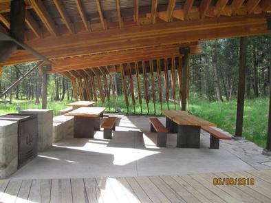
The campground offers several single-family campsites, as well as an OVERNIGHT GROUP CAMPING AREA (SITE 26) and GROUP PICNIC AREA (SITE 28) is available for DAY-USE ONLY. Tables and campfire rings are provided, as are vault toilets, drinking water and trash collection.

Natural Features

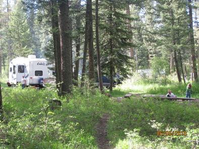
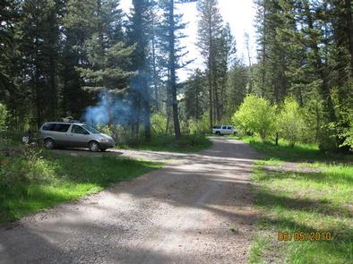
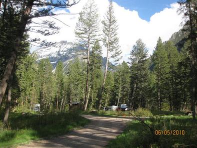
Pine Creek is situated in the foothills of the Absaroka Mountains in the heart of beautiful Paradise Valley. A forest of mature Douglas fir and spruce trees covers the campground.

Reservation

More from CampingHiking.net:

CHIPPEWA LOOP, Minnesota Campground Images, Info & Reservations

Directions From Cass Lake, Minn., take U.S. Highway 2 east for 4 miles, to the Norway Beach Recreation Area. Turn left and follow the campground road until the signs indicate the Chippewa Loop. Phone 218-335-8600 Activities BIKING, BOATING, HISTORIC & CULTURAL SITE, CAMPING, INTERPRETIVE PROGRAMS, FISHING, WATER SPORTS, SWIMMING SITE

BEARD’S BLUFF PARK (AR), Arkansas Campground Images, Info & Reservations

Directions Beard’s Bluff Park is located 13 miles east of Ashdown on State Highway 32. When driving from Ashdown, cross Millwood Dam and take the second left. Phone 870-388-9556 Activities BOATING, CAMPING, FISHING, WILDLIFE VIEWING Keywords Related Link(s) Rec Area Info & Images Arkansas State Tourism Arkansas State Road Conditions

BASIN STATION CABIN, Montana Campground Images, Info & Reservations

Directions Summer directions from West Yellowstone: Proceed west on U.S. Highway 20 for approximately 6.5 miles. Turn right on Denny Creek Road and continue approximately two miles north. The cabin is located on the right side of the road. Winter directions from West Yellowstone: Proceed west on U.S. Highway 20

LOWER TWIN LAKES AT BRIDGEPORT, California Campground Images, Info & Reservations

Directions From Bridgeport, California, take Highway 395 and turn south at Twin Lakes Road and travel 9.6 miles. Turn left onto South Twin Road and travel approximately 0.6 miles across the bridge to the campground. Phone 760-932-7092 Activities CAMPING, FISHING Keywords LOTL,HUMBOLDT-TOIYABE NF-FS Related Link(s) Rec Area Info & Images

ROBERT W CRAIG, West Virginia Campground Images, Info & Reservations

Directions From Cumberland, MD: Take US 220 south to US 50W, go west to WV 42N, go north to WV 46E. Follow the signs to the Robert W. Craig Campground. Phone 304-355-2346 Activities BOATING, CAMPING, FISHING, HIKING, WATER SPORTS, DAY USE AREA, OTHER RECREATION CONCESSION SITE Keywords ROBE,JENNING RANDOLPH LAKE,JENNINGS