

Directions
In summer: from Idaho City, travel 20 miles northeast on State Highway 21. Turn right on Forest Road #362 and travel 1/2 mile to the cabin.
In winter: from Idaho City, travel approximately 18 miles northeast on State Highway 21 to the Whoop-Um-Up Parking Area. Ski or snowshoe 1.5 miles to the cabin on the Pilgrim Trail.
Phone
208-392-6681
Activities
BIKING, CAMPING, FISHING, HIKING, HUNTING, WINTER SPORTS, WILDLIFE VIEWING
Keywords
BEAC,Beaver Creek Cabin,BOISE NF – FS
Related Link(s)
Overview
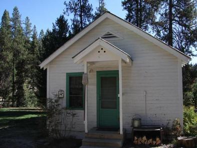
The Beaver Creek Cabin site was established for administrative use in 1912. The current dwelling was built in the 1930s by the Civilian Conservation Corps using standard blueprints for that time.
Beaver Creek Cabin is open year-round. It’s accessible by car in the summer months and by snowshoes or cross-country skis in winter. Guests arriving in winter should park at the Whoop-Um-Up Park N’ Ski Area (permit required) and access the 1.5 mile Pilgrim Trail to reach the cabin. The trail is moderately difficult in normal conditions, and guests are responsible for their own safety.
The cabin offers many creature comforts for an enjoyable stay. However, several of the amenities are only available seasonally. Guests should be prepared to bring certain supplies or gear according to the season.
Recreation
Numerous hiking, biking, horse, off-road vehicle and motorcycle trails are in the vicinity. Click here for an Idaho OHV Safety Message. During the winter months, miles of cross-country ski and snowshoe trails are right out the front door.
The Crooked River, Beaver Creek and beaver ponds all offer good rainbow, brook and cutthroat trout fishing. The 1-mile Beaver Creek Trail leads to the Crooked River and several small swimming holes.
Good hunting can be found in this area in season.
Facilities
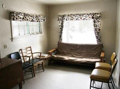
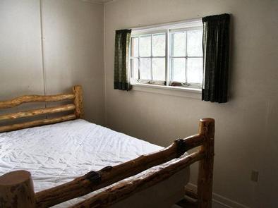
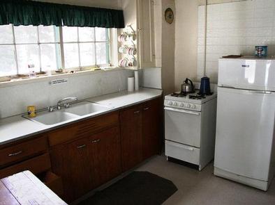
The cabin can accommodate a maximum of six people with two twin beds with mattresses and two futons in the living room. The kitchen is equipped with a sink, table, chairs and a propane stove. A wood stove provides heat. A picnic table and campfire ring are located outside. Be prepared to collect firewood during the summer months. The indoor bathroom is open in the summer and equipped with a sink, flush toilet and shower. Water is only available from May 20th through September 15th. The propane refrigerator in the kitchen is only available during the summer. Garbage service is also provided in the summer months. An outhouse with vault toilet is available for winter use. Firewood is available November- April in the woodshed. Be prepared to split your own wood. The cabin does not have electricity, so guests must bring their own light sources along with extra batteries or propane. Bedding, towels and pillows are not available. The cabin rental includes the group site across the driveway which has 5 picnic tables and 1 standard fire ring. RV’s and tents are allowed although there are no developed tent pads, it’s native surface. Tents are not allowed close to the cabin.
Natural Features
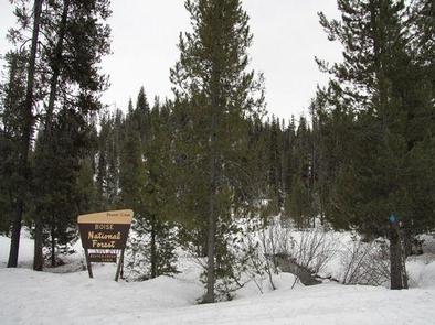
A mixed-growth pine forest surrounds the area, offering pretty scenery and partial shade. Several creeks and rivers flow nearby, the closest being Beaver Creek. The cabin is nestled within the Boise Mountain Range at an elevation of 5,100 feet.
Beavers are a common sight in this area, and several beaver ponds are nearby. Other wildlife includes mule deer, Rocky Mountain elk, chukars, wild turkeys, eagles and the occasional black bear or wolf.
Nearby Attractions
State Highway 21 is known as the Ponderosa Pine Scenic Byway. This 131-mile route starts in Boise and meanders through Boise, Salmon-Challis and Sawtooth National Forests with several points of interest along the way.