ST. CHARLES CAMPGROUND, UT Campground Reservation, Info, Images, Map, Directions

ST. CHARLES CAMPGROUND, Utah Campground Images, Info & Reservations

Directions

From U.S. Highway 89 in St. Charles, turn west onto Forest Road #412 and travel approximately 3 miles to the forest boundary. The campground entrance is just around the bend.

Phone

541-351-1182

Activities

BIKING, BOATING, CAMPING, FISHING, HIKING, HUNTING, WATER SPORTS, SWIMMING SITE

Keywords

SCRL,ST CHARLES CAMPGROUND,CARIBOU-TARGHEE NF – FS

Related Link(s)

Rec Area Info & Images

Forest Service Concessionaire

Idaho State Tourism

Idaho State Road Conditions

Overview

St. Charles Campground is situated on its namesake creek in the scenic St. Charles Canyon, approximately 8 miles from Bear Lake State Park and North Beach.

Recreation

Nearby, the North Fork Trail and its associated trails access the Highline Trail #316. The Highline Trail is part of the National Trail System and is the area’s premier trail. It stretches 55 miles along the backbone of the Wasatch Mountains and is open to hikers, mountain bikers, horseback riders and motorcyclists, attracting trail users from around the world.

The Idaho Department of Fish and Game manages the river fisheries, providing good to excellent fishing most of the year, including in St. Charles Creek. In-season big game hunting is also a popular activity.

Facilities

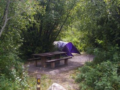
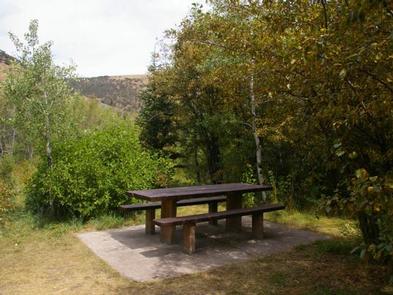
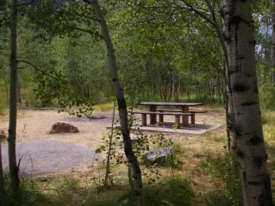
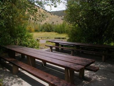
The campground offers one group site that can accommodate up to 20 people. Six single sites are also available. Flush toilets and drinking water are provided. A paved road leads to the campground.

Natural Features

Stands of aspens provide partial shade, while lodgepole pines, willow, dogwoods, Engelmann spruce and wild roses dot the landscape. The varied vegetation provides plenty of privacy from site to site.

Nearby Attractions

Minnetonka Cave, one of only two developed caves in the Forest Service, is a few miles from the campground. Guided cave tours are scheduled every 30 minutes daily from early June until Labor Day.

The Bear Lake National Wildlife Refuge is just north of Bear Lake, offering excellent bird watching.

Bear Lake’s Raspberry Days Festival occurs the first weekend in August every year, with a parade, fireworks, craft booths and a rodeo.

Reservation

More from CampingHiking.net:

Goose Island Group Sites, Utah Campground Images, Info & Reservations

Directions From Moab, drive north on Highway 191 to the junction of State Route 128. Drive two miles on SR 128 to the entrance to Goose Island campground. The group sites are at the far end of the campground. Phone 435-259-2100 Activities AUTO TOURING, BIKING, CAMPING, PHOTOGRAPHY, MOUNTAIN BIKING, SCENIC

ARROWHEAD CAMPGROUND, North Carolina Campground Images, Info & Reservations

Directions From Troy, North Carolina, take State Highway 109 north for approximately 10 miles. Turn left onto Mullinix Road (County Highway 1154), and travel approximately 1.5 miles to a stop sign and "T" intersection. Turn right, and go approximately 2 miles to another stop sign and "T" intersection. Turn left

LIGHTFOOT LANDING, Missouri Campground Images, Info & Reservations

Directions From Springfield, MO, go north on Highway 13 to Bolivar, MO. Take Highway 83 northeast to RB Highway. Follow the RB Highway east to the Lightfoot Park entrance. Phone 417-282-6890 Activities CAMPING, PICNICKING Keywords LIGL,POMME DE TERRE LAKE,POMME DE TERRE LAKE Related Link(s) Rec Area Info & Images Missouri

FRANKLIN LAKE, Wisconsin Campground Images, Info & Reservations

Directions Drive approximately 8 miles east from Eagle River on Highway 70. Turn south onto Military Road/Forest Road 2178 and continue about 2 miles, to Butternut Lake Road/Forest Road 2181, and continue approximately 4 miles to the campground. Phone 715-479-2827 Activities BOATING, HISTORIC & CULTURAL SITE, CAMPING, INTERPRETIVE PROGRAMS, FISHING,

BROKEN ARROW CAMPGROUND, Oregon Campground Images, Info & Reservations

Directions From Roseburg, OR, turn left onto OR-138 East / NE Diamond Lake Boulevard for approximately 80 miles. Turn right onto Forest Road 4795 / Diamond Lake Loop at the north entrance to Diamond Lake Recreation Area. Continue 3.2 miles and turn right after the pizza parlor. Drive half a