ALTURAS LAKE INLET, ID Campground Reservation, Info, Images, Map, Directions

ALTURAS LAKE INLET, Idaho Campground Images, Info & Reservations

Directions

From Highway 75, turn onto Forest Road 205/Alturas Lake Road. Travel approximately 3 miles to the campground.

Phone

928-537-8888

Activities

BIKING, BOATING, CAMPING, FISHING, HIKING, WATER SPORTS, SWIMMING SITE

Keywords

ALTL,ALTURAS INLET,SAWTOOTH NF – FS

Related Link(s)

Rec Area Info & Images

Idaho State Tourism

Idaho State Road Conditions

Forest Service Concessionaire

Overview

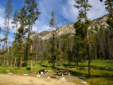
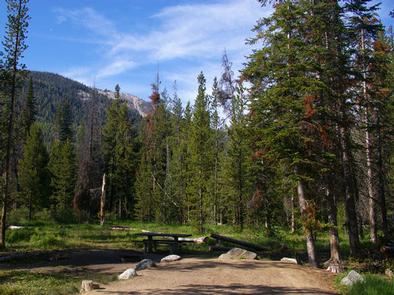
Alturas Lake Inlet Campground is located on the shores of scenic Alturas Lake at the foot of the Sawtooth Mountain Range.

Recreation

This site is part of the Sawtooth National Recreation Area, where outdoor activities abound. Alturas Lake offers excellent boating, water skiing, canoeing, kayaking and fishing for bull trout and Kokanee salmon.

The 10-mile round trip Alpine Meadows Trail begins nearby, with spectacular canyon, meadow and alpine lake views. The trail is also a popular area for bird watching.

Facilities

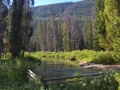
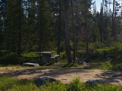
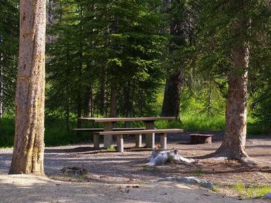
This campground contains several family campsites, some of which have lake or creek views. Vault toilets and drinking water are provided. Roads and parking spurs are gravel.

A day-use site is adjacent to the campground with a designated swim beach. Smokey Bear Boat Ramp is less than 1/4-mile away.

Natural Features

Alturas Creek runs through the campground, where summer wildflowers are plentiful and a mixed-growth conifer forest provides partial shade. Temperatures are cool, with an average summer high of 78 degrees and a low of 40 degrees.

Nearby Attractions

The Sawtooth National Recreation Area offers a myriad of excellent hiking and biking opportunities, and an estimated 750 miles of trails crisscross the valley and surrounding mountains.

Perkins Lake is less than 2 miles away, with excellent fishing and canoeing. Pettit and Yellowbelly Lakes are nearby, with more fishing, canoeing and hiking. The Salmon River offers fishing for rainbow trout, Westslope cutthroat trout and occasional hybrid cutbows and bull trout.

Popular area events include an Arts and Crafts Fair in July, and Wagon Days, Salmon Festival, Quilt Fair and Fireman’s Ball in September.

Reservation

More from CampingHiking.net:

RIBBONWOOD EQUESTRIAN CG, California Campground Images, Info & Reservations

Directions From Palm Desert, California, take the Palms to Pines Highway/Highway 74 south for approximately 16 miles to the community of Pinyon. Turn left onto South Pinyon Drive and the entrance to the campground is on the right. Phone (760) 862-9984 Activities CAMPING, FISHING, HORSEBACK RIDING, HORSE CAMPING, MOUNTAIN BIKING

VENANGO PARK, Kansas Campground Images, Info & Reservations

Directions From the North: Take HWY 140 to HWY 141. Travel south on HWY 141, then 1/2 mile west on Venango Road; look for signs to the park. From the South: Take HWY 4 to HWY 141. Travel north on HWY 141, then 1/2 mile west on Veanago Road; look

NAVAJO CLIFFS, Utah Campground Images, Info & Reservations

Directions From Manila, Utah: Travel 7 miles south on Highway 44 to Sheep Creek Geological Loop. Site is a short distance from Carmel Campground on Sheep Creek. Phone 435-784-3483 Activities BIKING, BOATING, CAMPING, INTERPRETIVE PROGRAMS, FISHING, HIKING, WILDLIFE VIEWING, SWIMMING SITE Keywords NVJC,NAVAJO,NAVAJO CLIFFS,NAVAJO CLIFF,FLAMING GORGE,ASHLEY NF – FS Related

TYEE CAMPGROUND (UMPQUA RIVER), Oregon Campground Images, Info & Reservations

Directions From I-5 in Sutherlin, head west 12 miles on Highway 138. Turn left and cross over Bullock Bridge and immediately turn right only Country Road 57 (Bullock Road). Travel .5 miles to the campground. Phone 541-440-4930 Activities CAMPING, FISHING Keywords Related Link(s) Rec Area Info & Images Oregon State

FORD CABIN, Montana Campground Images, Info & Reservations

Directions From Columbia Falls, travel north on Nucleus Avenue until the road ends at the intersection of Railroad Street. Turn right (east) on Railroad Street. Continue on Railroad Street; it becomes the North Fork Road. Continue north on the North Fork Road for 45 miles. Turn right on Road 308