
Directions
Cedar Springs Marina is the closest boat ramp to Jarvies. Jarvies Canyon is the first canyon west and a little north of the marina and is only accessed by boat.
From Vernal, Utah, take U.S. 191 north 42 miles. Turn north onto Forest Road 183 and travel approximately 2 miles to Cedar Springs Marina.
From Manila, Utah, take Highway 44 for 28 miles. Turn left on U.S. 191 and go north for about 4 miles. Turn north onto Forest Road 183 and travel approximately 2 miles to Cedar Springs Marina.
From Rock Springs, Wyoming, take I-80 west toward Green River about 6 miles to the junction with U.S. 191/Flaming Gorge Road. Take U.S. 191 south for 67 miles, passing through Dutch John. Turn north onto Forest Road 183 and travel approximately 2 miles to Cedar Springs Marina.
Phone
435-889-3000
Activities
CAMPING, FISHING, HIKING, WATER SPORTS, SWIMMING SITE
Keywords
JARG,Jarvies,Jarvies Group,Flaming Gorge,ASHLEY NF – FS,Flaming Gorge National Recreation Area
Related Link(s)
Overview
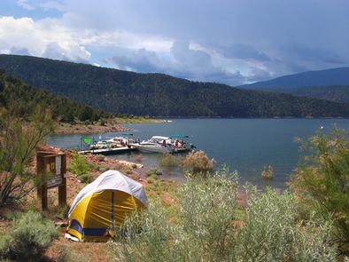
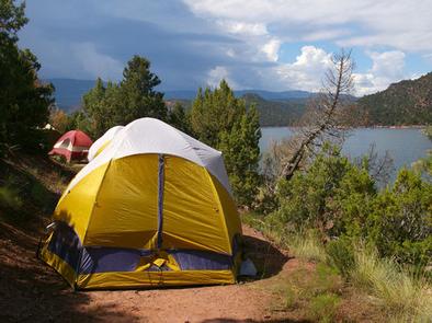
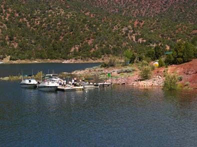
Jarvies Boat-in Group Campground is located on beautiful Flaming Gorge Reservoir in Jarvies Canyon at an elevation of 6,040 feet. The campground is part of the Flaming Gorge Recreation Area on the Ashley National Forest. Campers must boat-in to the facility, and the nearest boat ramps are located at Cedar Springs and Mustang Ridge Marinas, both 20 minutes across the water.
Recreation
Boating, water skiing, fishing and swimming are popular activities. A hiking trail passes through the site as well.
Facilities
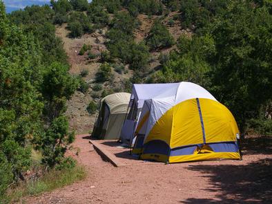
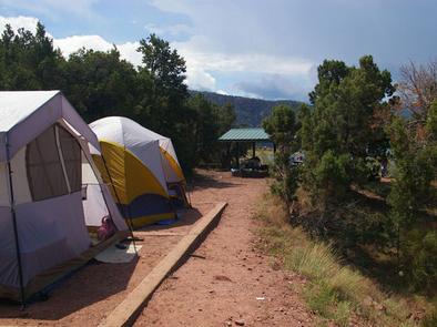
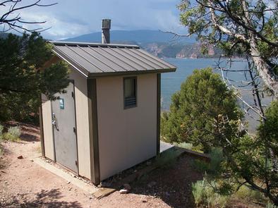
This spacious group site can accommodate up to 40 people. It is equipped with a large picnic shelter, tables, two campfire rings, two grills and three tent pads. One vault toilet is provided.
A private dock is down a short hill on the shoreline.
Natural Features
The campground is situated among dense stands of juniper and pinyon pine on a hillside overlooking the reservoir. The vegetation offers limited shade. From the picnic shelter campers are awarded expansive views of the reservoir and its surrounding red cliffs.
Nearby Attractions
Flaming Gorge Dam offers guided tours of the working hydroelectric plant and the dam, and the adjacent visitor center contains area history exhibits.
The Green River below the dam provides spectacular rafting opportunities. A trip down the river offers unique geology, outlaw history and Native American rock art.