PHILIPSBURG BAY CAMPGROUND, MT Campground Reservation, Info, Images, Map, Directions

PHILIPSBURG BAY CAMPGROUND, Montana Campground Images, Info & Reservations

Directions

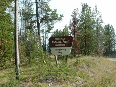
The campground is located in southwestern Montana, about 11 miles south of Philipsburg. Follow U.S. Route 1 south and take a right on Georgetown Lake Road. The campground is on the left adjacent to the lake.

Phone

406-210-8199

Activities

BIKING, BOATING, CAMPING, FISHING, HIKING, HUNTING, WATER SPORTS, WILDLIFE VIEWING, SWIMMING SITE

Keywords

PBCG,BEAVERHEAD-DEERLODGE NF -FS,Philibsburg,Georgetown Lake

Related Link(s)

Rec Area Info & Images

Montana State Tourism

Montana State Road Conditions

Overview

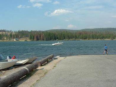
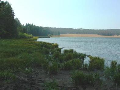
Philipsburg Bay Campground is adjacent to Georgetown Lake and provides ideal access to fishing, boating and water skiing. It is located in the Pintler Ranger District of the Beaverhead-Deerlodge National Forest, the largest national forest in Montana. Surrounded by mountains of outstanding beauty, the location is perfect for visitors who enjoy mountain and water sports or those who prefer relaxing and taking in the spectacular view.

Recreation

Georgetown Lake is a prime destination for fishing and fly fishing with kokanee salmon, rainbow and brook trout being the most sought-after species. Canoeing and boating are also popular activities. Hikers, horseback riders and mountain bikers will find no shortage of trails within a few miles of the campground.

Facilities

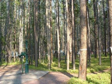
The facility has 69 sites that are all first-come, first-served, with the exception of one loop that can be reserved in advance during the summer season. It is available for RV or tent camping and is boater-friendly with paved roads and a boat ramp.

Natural Features

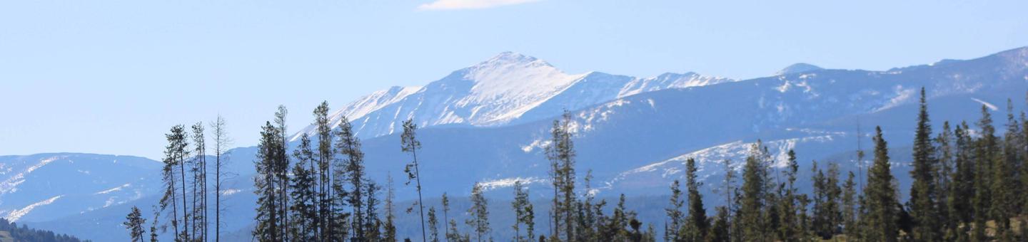
The campground overlooks the Anaconda-Pintler Wilderness. Georgetown Lake is a large mountain lake spanning close to 3,000 acres at an elevation of over 6,000 ft. Lodgepole pines enclose the lake and surrounding mountains, providing a home to abundant wildlife including moose, elk, white-tailed deer and even bighorn sheep. Water birds such as the graceful blue heron as well as hawks and other birds of prey also inhabit the lake area.

Nearby Attractions

Town of Philipsburg and Anacaonda, gem mining, hiking, fly fishing, atving.

Charges & Cancellations

Must cancel 4 days in advance

Reservation

More from CampingHiking.net:

WISHON, California Campground Images, Info & Reservations

Directions From Highway 99, turn east on 190. Travel on 190 through Springville to Wishon Drive/M208. Turn left on Wishon Drive and travel about 4 miles. The entrance to Wishon Campground is on the right as the road curves to Doyle Springs. Phone 559-539-5230 Activities CAMPING, FISHING, HIKING Keywords WISO,WISHON

NARROWS (AR), Arkansas Campground Images, Info & Reservations

Directions From Greers Ferry, AR, take SR-16 southwest for 2.5 miles. Follow signs to the campground. Phone 501-825-7602 Activities BOATING, CAMPING Keywords NARR,GREERS FERRY LAKE,GREERS FERRY LAKE Related Link(s) Rec Area Info & Images Arkansas State Road Conditions Arkansas State Tourism Overview Narrows Campground is located on Greers Ferry Lake

CROW PASS CABIN, Alaska Campground Images, Info & Reservations

Directions The cabin is located near Crow Pass in the Chugach Mountains, 3 miles from the Crow Pass Trailhead. Cabin users can expect to encounter small stream crossings during wet periods. Access: At mile 90, AK-1 S/Seward Highway (35 miles south of Anchorage). Turn left onto paved road leading to

NORTH SHORE PICNIC AREA, Idaho Campground Images, Info & Reservations

Directions From Stanley, Idaho, take State Highway 75 south for 4 miles. Turn west onto Forest Road 214 at the Redfish Lake sign and travel approximately 2 miles. Turn right at the North Shore Picnic Area entrance sign. Phone 928-537-8888 Activities BIKING, BOATING, CAMPING, FISHING, HIKING, HORSEBACK RIDING, WATER SPORTS,

WRIGHTS LAKE, California Campground Images, Info & Reservations

Directions Take Highway 50 east of Placerville, California, for 11 miles. Turn left onto Ice House Road and continue for 9 miles, then turn right onto Wrights Lake tie road. After 2 miles, turn left onto Wrights Lake Road. Phone 831-245-6891 Activities CAMPING, FISHING, HIKING, DAY USE AREA, SWIMMING SITE,

IRON LAKE, Minnesota Campground Images, Info & Reservations

Directions From Grand Marais, Minnesota, take Gunflint Trail (County Road 12) 36 miles north, turn left on County Road 92 and travel 2 miles on a narrow gravel road to Iron Lake Campground. Phone (218)388-2212 Activities BOATING, CAMPING, FISHING, CANOEING Keywords IROL,SUPERIOR NATIONAL FOREST,SUPERIOR NF – FS Related Link(s) Rec