


Directions
From Naches, take Highway 410 to milepost 88.4. Turn left on Bumping Lake Road and go 0.6 miles to the campground.
Phone
541-338-7869
Activities
CAMPING, FISHING, HIKING
Keywords
CESP,Bumping River,Naches,OKANOGAN – WENATCHEE NF -FS,CEDAR SPRINGS,CEDAR SPRINGS CAMPGROUND
Related Link(s)
Washington State Road Conditions
Overview
Cedar Springs Campground is set on the forested banks of the Bumping River, within Okanogan-Wenatchee National Forest. The area offers a delightful setting for visitors seeking recreation and relaxation.
Recreation
Cedar Springs Campground offers outdoor enthusiasts the opportunity to hike, fish, ski, raft and enjoy a multitude of year-round recreational activities.
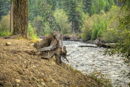
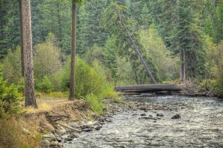
The Bumping River runs next to the campground, offering a scenic backdrop for swimmers braving its cold, refreshing waters. Anglers enjoy casting a line into the deep pools lining the shore. Populations of rainbow, brook and steelhead trout prevail in this waterway.
American Ridge Trail is open to hikers, backpackers and horseback riders. Extending from Bumping River to the notable Pacific Crest Trail, the American Ridge Trail offers over 26 miles of towering forests, stretches of meadows, alpine lakes and ridgeline views.
Facilities
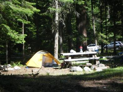
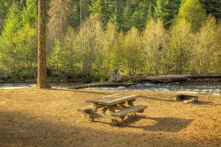
The Cedar Springs Campground offers sites that can accommodate tents, trailers and RVs. Each site is equipped with a picnic table and campfire ring. Vault toilets and drinking water are provided, but electrical hookups are not available.
Natural Features
The Okanogan-Wenatchee is comprised of glaciated alpine peaks that tower along the Cascade Crest. Lush valleys of old-growth forest define its western boundary and at its eastern edge, rugged shrub-steppe country comprises a more arid region. Elevations range from below 1,000 feet to over 9,000 feet.
Precipitation varies greatly throughout the area, ranging from approximately 140 inches along the Cascade Crest to only 10 inches along the eastern edge. Visitors can expect many days of warm, sunny weather in the summer, and clear skies and plenty of snow in winter.
Nearby Attractions
Boulder Cave National Recreation Trail is one of the most popular places in the Naches District. Visitors can walk the accessible trail along the river or explore Boulder Cave. Interpretive signs along the way explain the geology, plants, animals and fire history of the area.
The Chinook Scenic Byway, considered one of Washington’s premier driving excursions, beings in Naches and follows along Highway 410. Spectacular views of Mount Rainier, old-growth forests, alpine peaks, jagged ridges and river canyons dominate this 92-mile journey.
Visitors enjoy making day trips to nearby Mount Rainier National Park. The park offers fantastic glimpses of glaciers, subalpine ecology and volcanic landscapes.
Hikers may want to traverse a portion of the spectacular Pacific Crest Trail (PCT), one of the world’s premier National Scenic Trails. This trail showcases some of North America’s best scenery as it winds its way from Mexico to Canada through California, Oregon and Washington.