UPPER PAYETTE LAKE CAMPGROUND, ID Campground Reservation, Info, Images, Map, Directions

UPPER PAYETTE LAKE CAMPGROUND, Idaho Campground Images, Info & Reservations

Directions

From McCall, Idaho, take Highway 55 north to Warren Wagon Road/Forest Highway 21. Turn right and continue for 16 miles to gravel Forest Road 495 and follow for a mile into the campground.

Phone

208-634-0400

Activities

BOATING, CAMPING, FISHING, HIKING, HUNTING, WILDLIFE VIEWING, SWIMMING SITE

Keywords

UPPA,Upper Payette Lake Group Sites,PAYETTE NF – FS

Related Link(s)

Rec Area Info & Images

Idaho State Tourism

Idaho State Road Conditions

Overview

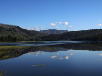
Upper Payette Lake Campground is located 16 miles from McCall, Idaho, on the shores of beautiful Upper Payette Lake. Visitors enjoy fishing, canoeing and exploring local trails.

Recreation

The no-wake lake offers great fishing, canoeing and kayaking opportunities. The paved, mile-long Shoreline Trail begins in the campground and several additional hiking and biking trails begin just across the road from the entrance.

Facilities

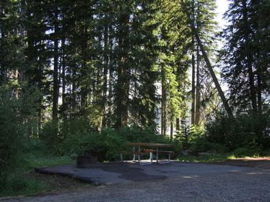
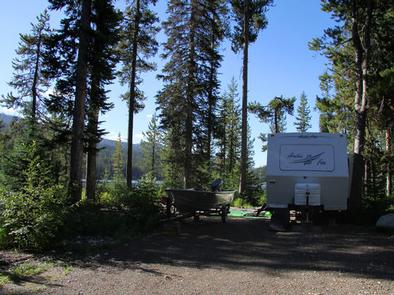
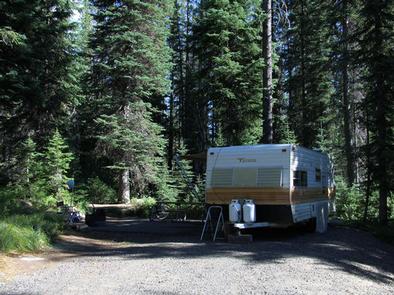
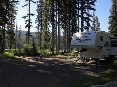
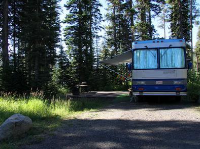
The campground offers two group sites that can accommodate up to 20 and 30 guests. Several additional single and double-family sites are available as well. All sites are accessible; some have lake views and some have lake access.

Vault toilets and drinking water are provided. A boat ramp, day-use site and several paved pathways are located in the campground. Roads and parking spurs are gravel.

Natural Features

The lake is situated at the foot of the Salmon River Mountains at an approximate elevation of 5,900 feet. Engelmann spruce and lodgepole pine forest the site, providing partial shade. Summer wildflowers are abundant. Summer days are typically warm and nights are cool.

Reservation

More from CampingHiking.net:

HOGBACK HOMESTEAD, Montana Campground Images, Info & Reservations

Directions From Missoula, Montana, travel east on Interstate 90 for about 20 miles to exit 126. Drive south on Rock Creek Road for about 29 miles. Rock Creek Road is a hardened surface for 12 miles and the remainder is a gravel, single-lane road, with intermittent pull-outs. It is not

BERRY BEND, Missouri Campground Images, Info & Reservations

Directions From Z Highway, travel approximately 2 miles south on the Berry Bend Access Road. Phone 660-438-3872 Activities BOATING, CAMPING, FISHING, HIKING, FISH HATCHERY, SWIMMING SITE Keywords BERR,TRUMAN LAKE,BERRY BEND SOUTH,HARRY S TRUMAN Related Link(s) Rec Area Info & Images Missouri State Road Conditions Missouri State Tourism Overview Berry Bend

LUNA WHITE DEER CAMPGROUND, Wisconsin Campground Images, Info & Reservations

Directions From Eagle River, travel 13.4 miles on STH 70 to FR2176 (Divide Road). Turn right (south) and continue 5.6 miles to FR2188. Turn right and travel 0.7 miles to the campground. Phone (715) 479-2827 Activities BIKING, BOATING, CAMPING, FISHING, WILDLIFE VIEWING, SWIMMING SITE Keywords Related Link(s) Rec Area Info

HANNA FLAT, California Campground Images, Info & Reservations

Directions Travel east on I10 (Highway 330) to Running Springs. Turn onto Highway 18 and continue to Big Bear Lake Dam but do not cross the dam. Highway 18 becomes Highway 38. Continue to the Fawnskin Fire Station and turn left onto Rim of the World Drive (Forest Route 3N14)