
Directions
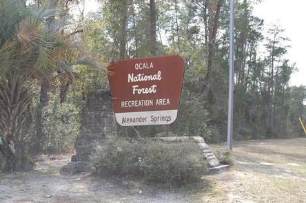
Alexander Springs Recreation Area is located along County Road 445 in the northeast corner of Lake County between Astor and Altoona, Florida.
From I-75, take Highway 40 east through Ocala and Silver Springs approximately 40 miles to Highway 19. Go south on Highway 19 approximately 5 miles to Country Road 445. Go east on 445 for 5 miles to the campground.
From I-95, take the Ocala/Silver Springs Exit (Highway 40) west for approximately 35 miles to Highway 19. Go south on Highway 19 approximately 5 miles to County Road 445. Go east on 445 for 5 miles to the campground.
Phone
352-669-3522
Activities
BIKING, BOATING, CAMPING, FISHING, HIKING, DAY USE AREA, SWIMMING SITE, OTHER RECREATION CONCESSION SITE, KAYAKING, CANOEING
Keywords
ALEX,OCALA NATIONAL FOREST,SEMINOLE DISTRICT,LAKE GEORGE DISTRICT,NFs IN FLORIDA – FS
Related Link(s)
Overview
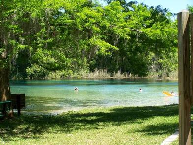
Alexander Springs Recreation Area is located in the Ocala National Forest near the beautiful, turquoise waters of Alexander Springs. With forested scenery and abundant water, the recreation area offers camping, swimming, canoeing, scuba diving (for certified divers), hiking, birding and wildlife viewing.
The Ocala National Forest, located in north central Florida, spans four counties and 383,000 acres. It is the southernmost and oldest national forest east of the Mississippi River, and protects the world’s largest contiguous sand pine scrub forest.
Recreation
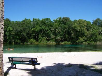
Visitors can swim, snorkel and dive year-round in the crystalline waters of the spring. The spring is the only place in the Ocala National Forest where scuba diving is permitted, and a broad and naturally gently sloped spring pool becomes a natural water park where visitors can picnic, swim and play.
Fishing and canoeing are popular outside the swimming area. Anglers can bring a rod and reel and head down to one of the platforms along the Timucuan Trail to drop a line in Alexander Run. Visitors can rent canoes or bring their own and paddle down Alexander Run into the Alexander Springs Wilderness.
Day hikers will appreciate a short interpretive trail on a boardwalk over the spring and through the palm trees. They can also access two segments of the 1,400-mile Florida National Scenic Trail, which runs through the entire national forest.
Facilities
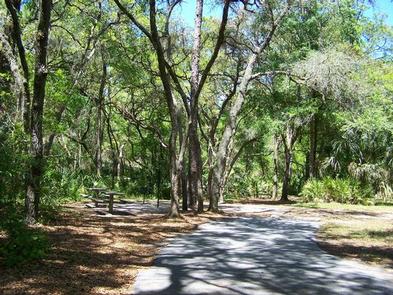
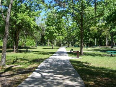
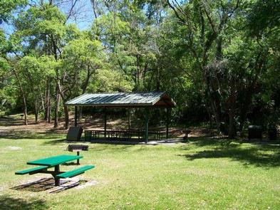
The camping area contains four loops of campsites within an easy walk of the swimming and picnicking area. The sites are shaded with level parking pads for RVs and plenty of space for tents. No hookups are available. Restrooms have flush toilets and showers. Camping necessities and firewood are available at a small general store.
Natural Features
Alexander Springs is among 27 first-magnitude springs in Florida, and is by far one of the easiest for visitors to enjoy. The water is a constant 72 degrees and extraordinarily clear with a sandy bottom.
The area is subtropical, surrounded by a floodplain forest of maples, sweet gum and cabbage palms. Alligators, turtles, deer, raccoons, black bear and numerous birds make their home in the national forest.
Nearby Attractions
Visitors can explore the surrounding Alexander Springs Wilderness Area. A paddle down the spring run is the best option to explore the mosaic of hardwood swamp, hardwood forest and scrub habitats and spot the animals that live there.
The Ocala National Forest is notable for its extensive off-road trail system catering to both ATV enthusiasts and Jeeps, as well as being a traditional destination for deer hunters from around Central Florida. These opportunities are available within a short drive of Alexander Springs.