ROCK CREEK GROUP CAMP (OK) CHICKASAW NRA, OK Campground Reservation, Info, Images, Map, Directions

ROCK CREEK GROUP CAMP (OK) CHICKASAW NRA, Oklahoma Campground Images, Info & Reservations

Directions

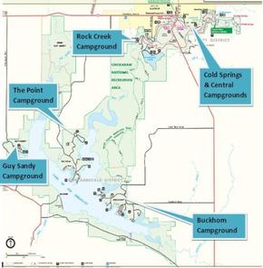
From I-35, take Exit #55 and drive towards the city of Davis, OK. Once in Davis , go east on Highway 7 to the Chickasaw National Recreation Area you desire. Watch for Chickasaw National Recreation Area signs to direct you to your selected area. Rock Creek Campgrounds, Veterans Lake and Pavilion, and Bromide Pavilions (West Historic Platt) – Drive approximatley 7 miles east of Davis to the traffic light (12th street) in the city of Sulphur. Turn south (right) for approximately .6 miles on 12th Street. Turn west (right) at the STOP sign. Bromide Pavilion is the 2nd left off NW Perimeter Road. For Rock Creek or Veterans Lake Pavilion continue west, cross the low water crossing, and follow the signs.

Phone

580-622-7234

Activities

BIKING, BOATING, HISTORIC & CULTURAL SITE, CAMPING, INTERPRETIVE PROGRAMS, HIKING, HUNTING, SWIMMING SITE

Keywords

RCGC,CHICKASAW NATIONAL REC. AREA,PLATT NATIONAL PARK,ARBUCKLE LAKE,LAKE ARBUCKLE,LAKE OF THE ARBUCKLES,CHICKASAW,CHICKSAW

Related Link(s)

Rec Area Info & Images

Oklahoma State Tourism

Oklahoma State Road Conditions

Overview

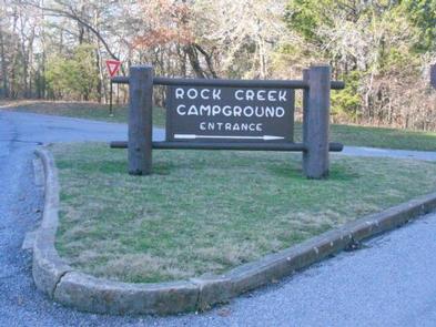
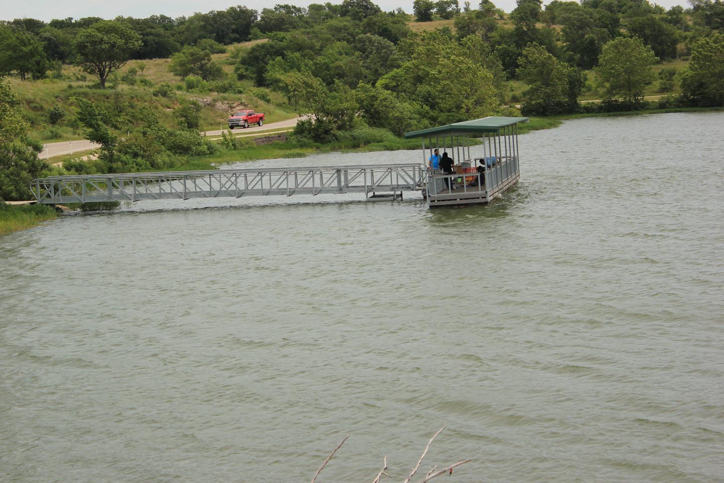
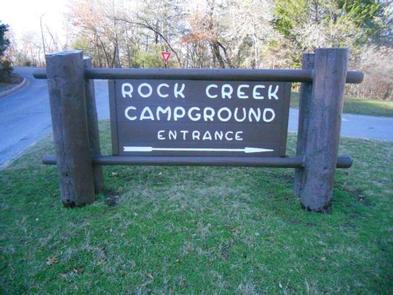
Rock Creek Group Camp is the closest campground to Veteran’s Lake, and is an ideal access point for fishing, hiking, mineral springs and nearby Rock Creek.

Recreation

Swimming opportunities abound, with streams and springs dotting the park landscape. Nearby hiking trails weave along these streams–passing through cool rushing waterfalls–and leading to mineral water and freshwater springs. Wildlife photographers can look out for the red fox, turkey, dear and opossum.

Facilities

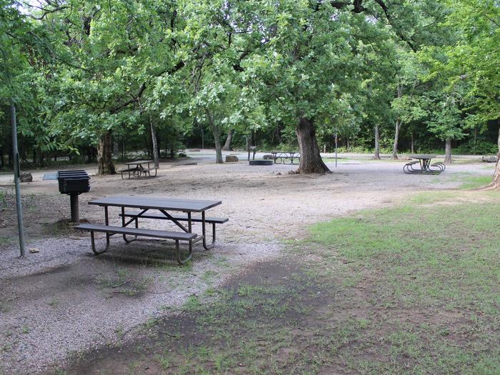
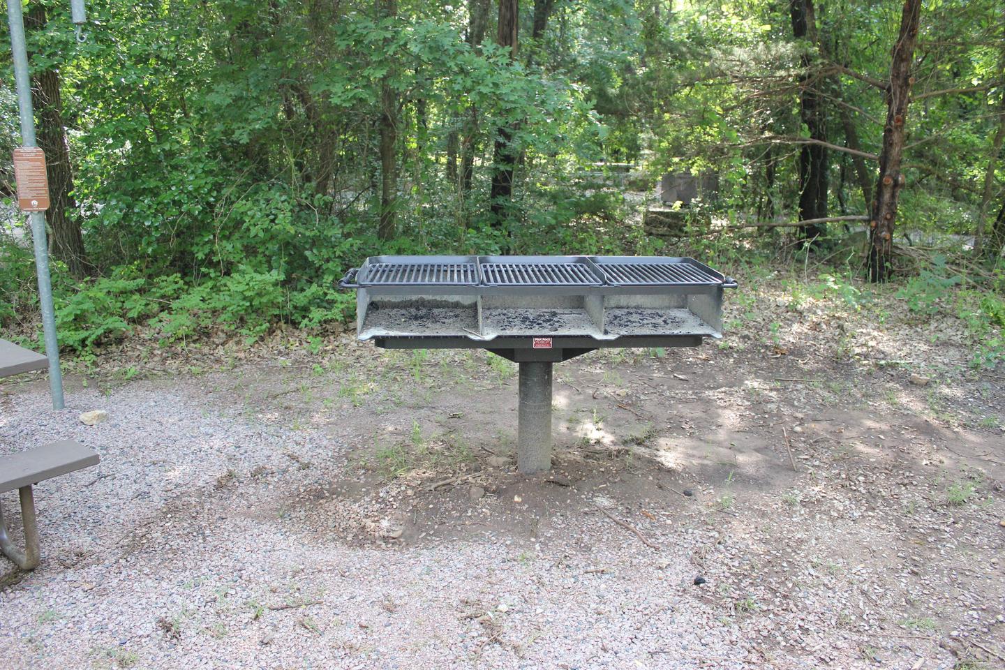
One group site is available at Rock Creek, and it’s open year-round. These are non-electrical sites that are designed for tent camping, but small RVs can be accommodated.

Natural Features

Two ecosystems converge in Chickasaw National Recreation Area: the eastern deciduous forest and the mixed-grass prairie of the west. This creates a unique landscape, attracting a wide variety of plant and animal life.

Nearby Attractions

Visit the impressive Chickasaw Cultural Center to learn about the Native Americans of the region through exhibits, videos and interactive displays. Or head to the bison pasture to watch the beautiful animals grazing.

Reservation

More from CampingHiking.net:

The Ledge Group Sites, Utah Campground Images, Info & Reservations

Directions From Moab, drive 10 miles on the Kane Creek Road. The group site is on the left hand side of the road. Phone 435-259-2100 Activities CAMPING, HIKING, PHOTOGRAPHY, MOUNTAIN BIKING, SCENIC DRIVE Keywords Related Link(s) Rec Area Info & Images Utah State Tourism Utah State Road Conditions Overview The

PANHANDLE, Washington Campground Images, Info & Reservations

Directions From downtown Newport, travel east on U.S. Highway 2 for 0.75 miles. Immediately after crossing the Pend Oreille River bridge, turn left on LeClerc Road and travel 32 miles north to Panhandle Campground. Phone 509-447-7300 Activities BOATING, CAMPING, FISHING, SWIMMING SITE Keywords PANH,COLVILLE NF – FS Related Link(s) Rec

PIONEER PARK, Washington Campground Images, Info & Reservations

Directions From downtown Newport, travel east on U.S. Highway 2 for 0.75 miles. Immediately after crossing the Pend Oreille River bridge, turn left on LeClerc Road and travel 2 miles north to the campground. Phone 509-447-7300 Activities BOATING, CAMPING, FISHING, HIKING Keywords PIOR,COLVILLE NF – FS,PIONEER Related Link(s) Rec Area

ELKS FLAT CAMPGROUND, Idaho Campground Images, Info & Reservations

Directions From Mountain Home, travel east on Highway 20 for 35 miles to the turnoff for Pine/Featherville (Forest Highway 61). Travel north on Highway 61 for 24 miles to the campground. Phone 208-587-7961 Activities BOATING, CAMPING, FISHING, SWIMMING SITE Keywords ELKF,ELK FLATS,JOHNSON BRIDGE,BOISE NF – FS Related Link(s) Rec Area

PAINT CREEK DAM SITE, Ohio Campground Images, Info & Reservations

Directions From Chillicothe Ohio, take Route 50 west for 18 miles to Bainbridge. Ohio. Three miles past Bainbridge, turn right on Rapid Forge Road. Go 2 miles north and turn left into the Paint Creek Dam Site Area. Little Pond Shelter is located on the right just before crossing the

FISH CREEK PAVILION, Idaho Campground Images, Info & Reservations

Directions From Grangeville, head south on Grangeville-Salmon Road for approximately 7 miles to the Fish Creek Meadows area. Turn right onto Forest Road 4600. The entrance to Fish Creek Pavilion is located 300 feet ahead on the left. Phone 208-983-1950 Activities CAMPING, HIKING, HORSEBACK RIDING Keywords None Related Link(s) Rec