LAKE FORK CAMPGROUND, CO Campground Reservation, Info, Images, Map, Directions

LAKE FORK CAMPGROUND, Colorado Campground Images, Info & Reservations

Directions

Lake Fork campground is located off of Hwy 50 between Gunnison and Montrose, along Blue Mesa reservoir.

Phone

970-641-2337

Activities

BIKING, BOATING, CAMPING, FISHING, HIKING, HUNTING, WATER SPORTS, WILDLIFE VIEWING, SWIMMING SITE

Keywords

LAFO,CURECANTI NATIONAL RECREATION,CURECANTI

Related Link(s)

Rec Area Info & Images

Colorado State Road Conditions

Colorado State Tourism

Overview

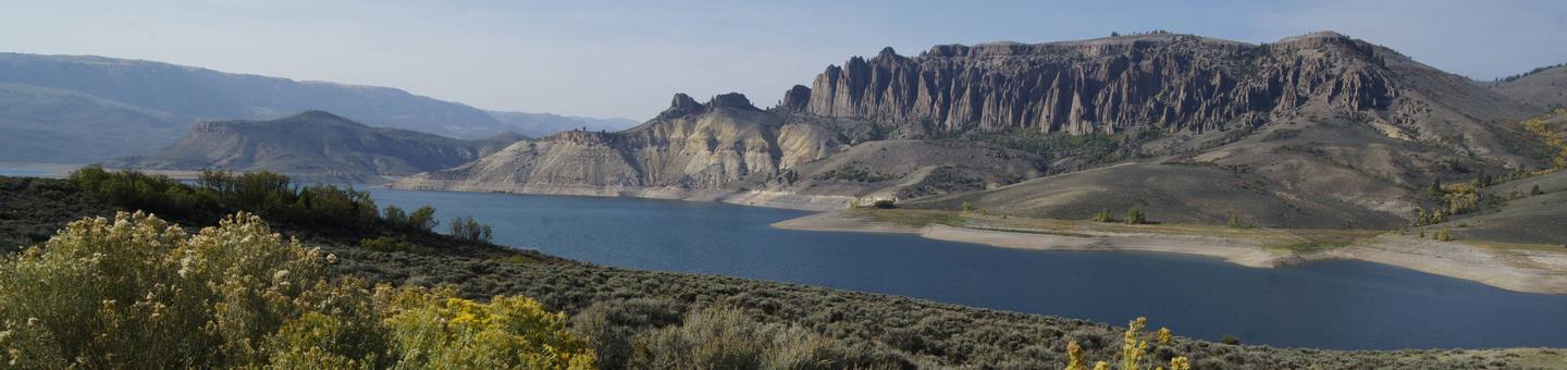
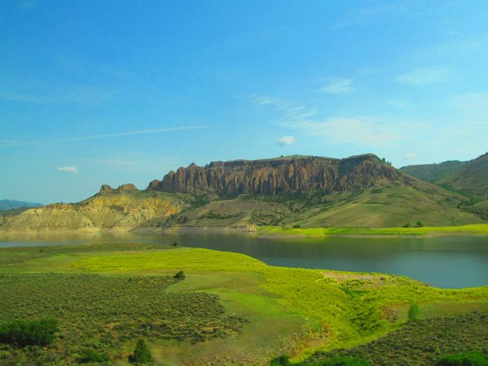
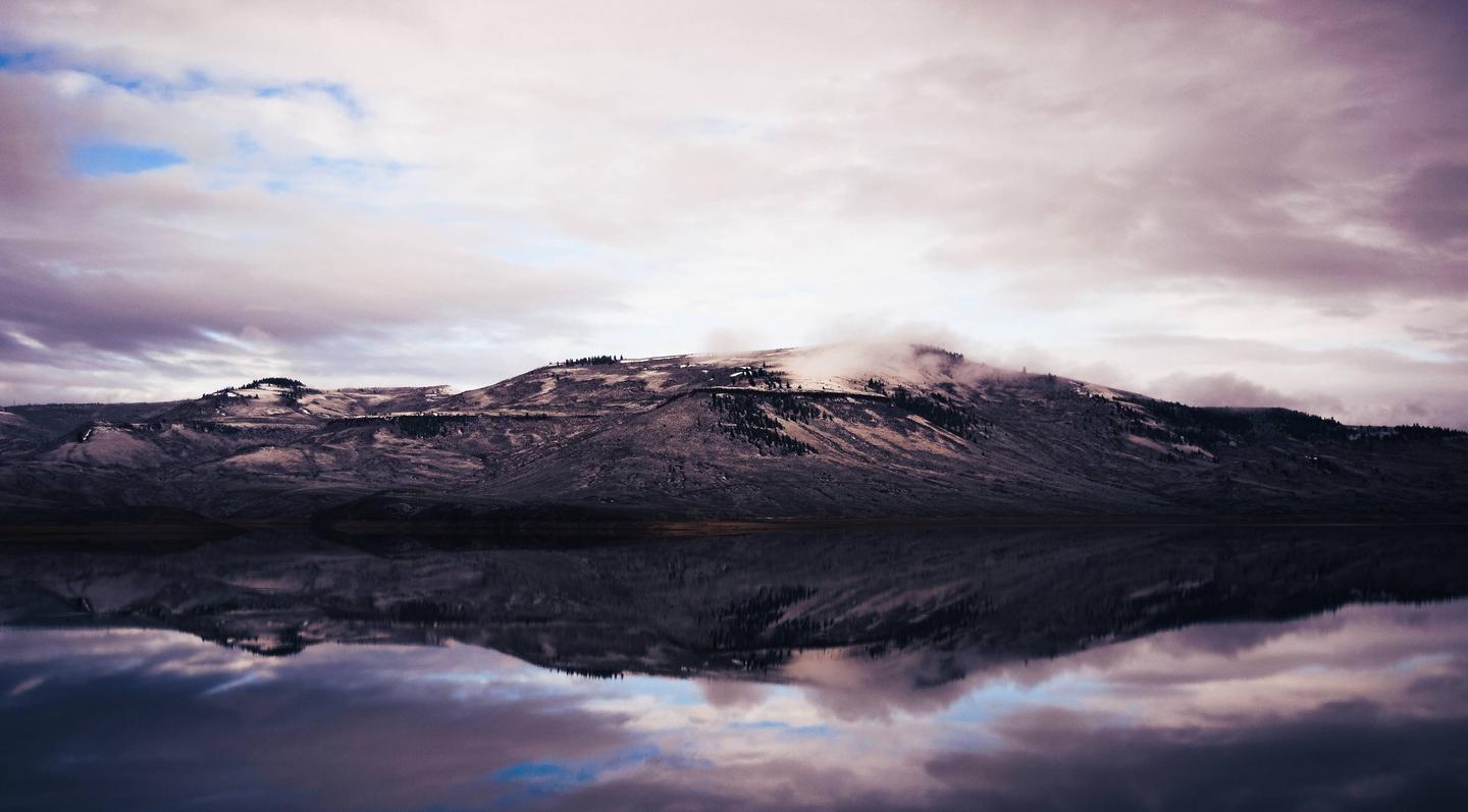
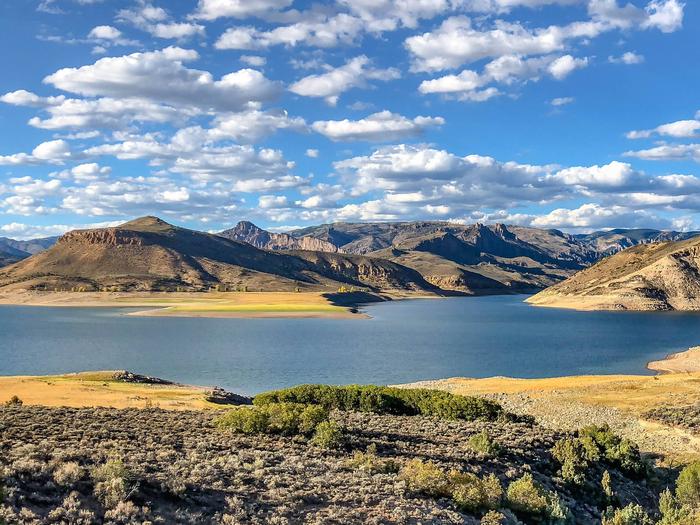
Lake Fork Campground is on the Blue Mesa Reservoir, near the reservoir’s dam. It is a part of the historic Curecanti Recreation Area and is an ideal place to stay for days of boat recreation, hiking and taking in the views of the Black Canyon.

Recreation

Jet skiing, water skiing and canoeing are some of the many water activities available on the reservoir.

Birding is also rewarding, with chances to see the black-billed magpie.

Along the shrubland, visitors can spot Gunnison’s prairie dogs popping out of their holes.

Facilities

Flush toilets are available in summer months. Cell phone service is limited. For anglers, a fish cleaning station is provided for conveniently preparing the days catch. Concession run coin operated showers are nearby open during the summer months..

Natural Features

The steep canyon walls of Gunnison Basin were carved out by the Gunnison River, which once flowed with powerful intensity fueled by the snowmelt of nearby mountains.

Today, the Gunnison river is dammed in three places, creating three large and beautiful reservoirs to be enjoyed by visitors.

The land is characterized by semi-arid shrubland with vast expanses of sagebrush. The natural features and ecosystems of Curecanti vary greatly, with Riparian habitats, epic canyons and lush patches of Ponderosa pine, Douglas fir and aspen trees.

Nearby Attractions

The recreation area is just south of Gunnison National Forest and east of the Black Canyon of the Gunnison National Park. There’s no shortage of options for scenic drives and hikes.

Try hiking the Warner Point Nature Trail on the South Rim of Black Canyon, or the Deadhorse Trail on the North Rim.

Reservation

More from CampingHiking.net:

CATAVEE, California Campground Images, Info & Reservations

Directions From Clovis, California, take Highway 168 north for 70 miles to Huntington Lake Campground Office at Eastwood. Phone 559-893-2111 Activities BOATING, CAMPING, INTERPRETIVE PROGRAMS, FISHING, HIKING, WATER SPORTS, SWIMMING SITE Keywords CATA,HUNTINGTON LAKE,SIERRA NF – FS Related Link(s) Rec Area Info & Images Forest Service Concessionaire California State Road

Webb Creek Park, Missouri Campground Images, Info & Reservations

Directions From Ellington, MO, travel south on MO 21 for 2.6 miles to Route H. Route H ends in the park. Phone 573-223-7777 (CLEARWATER LAKE PROJECT OFFICE) 573-461-2282) Activities BOATING, CAMPING Keywords Related Link(s) Rec Area Info & Images Missouri State Tourism Missouri State Road Conditions Overview Webb Creek Campground

COTTONWOOD GROUP, California Campground Images, Info & Reservations

Directions The address below is not the physical address of the campground. To get to the campground, take Interstate 10 to the Mecca/Twentynine Palms exit and follow signs to Joshua Tree National Park. The exit is 25 miles east of Indio, California. Phone 760-367-5554 Activities CAMPING, INTERPRETIVE PROGRAMS, HIKING, PICNICKING,

WEST FORK CAMPGROUND, Colorado Campground Images, Info & Reservations

Directions From Pagosa Springs, Colo., travel east on U.S. Highway 160 for about 13 miles, then turn northwest on Forest Road 684 and continue more than a mile to the campground entrance on the West Fork Road. Phone 970-264-2268 Activities BOATING, CAMPING, FISHING, HIKING Keywords None Related Link(s) Rec Area

MACKS CREEK PARK, Idaho Campground Images, Info & Reservations

Directions From Gowen Road (Exit 57) off I-84, head east toward South Federal Way. Continue to follow Highway 21 for 12.5 miles. Turn right on Arrow Rock Road immediately after the High Bridge crossing over the lake. Continue 4.5 miles on Arrow Rock Road to Macks Creek Park. Phone 208-343-0671