
Directions
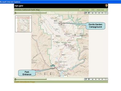
From I-70, take Exit 182. Travel south for 26 miles to the park entrance. Take the park road 18 miles to Devils Garden.
From Moab, take Highway 191 north for 4.5 miles to the park entrance. Take the park road 18 miles to Devils Garden.
Phone
435-719-2299
Activities
CAMPING, INTERPRETIVE PROGRAMS, HIKING, DAY USE AREA
Keywords
DEGA,ARCHES NATIONAL PARK,JUNIPER BASIN,ARCHES
Related Link(s)
Overview
Devils Garden Campground is located deep within the heart of beautiful Arches National Park in Southeastern Utah, at an elevation of approximately 5200 ft.. The campground is situated among natural sandstone arches and fins and is only 18 miles north of the park’s entrance and 23 miles from Moab, Utah.
Recreation
Hiking trails are abundant in Arches, including the Broken Arch Trail, a scenic loop with a trailhead conveniently located within the campground. Trails are varied and offer something for everyone, from the easy 0.3-mile loop around Balanced Rock to the steep and strenuous 3-mile round-trip trail to Delicate Arch. Other recreational activities in the park include guided hiking tours of the Fiery Furnace, an off-road vehicle route, road biking and picnicking.
Facilities
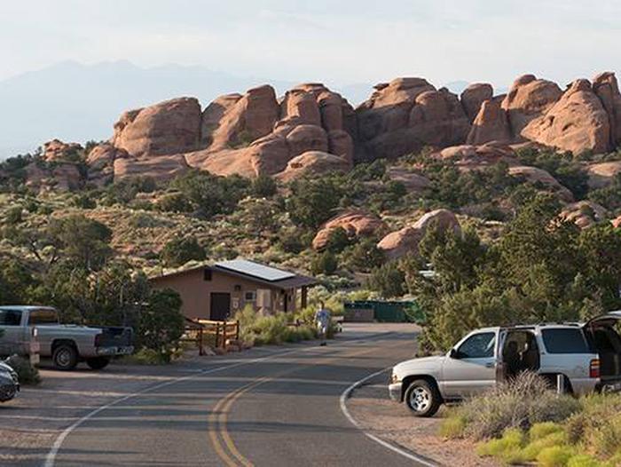
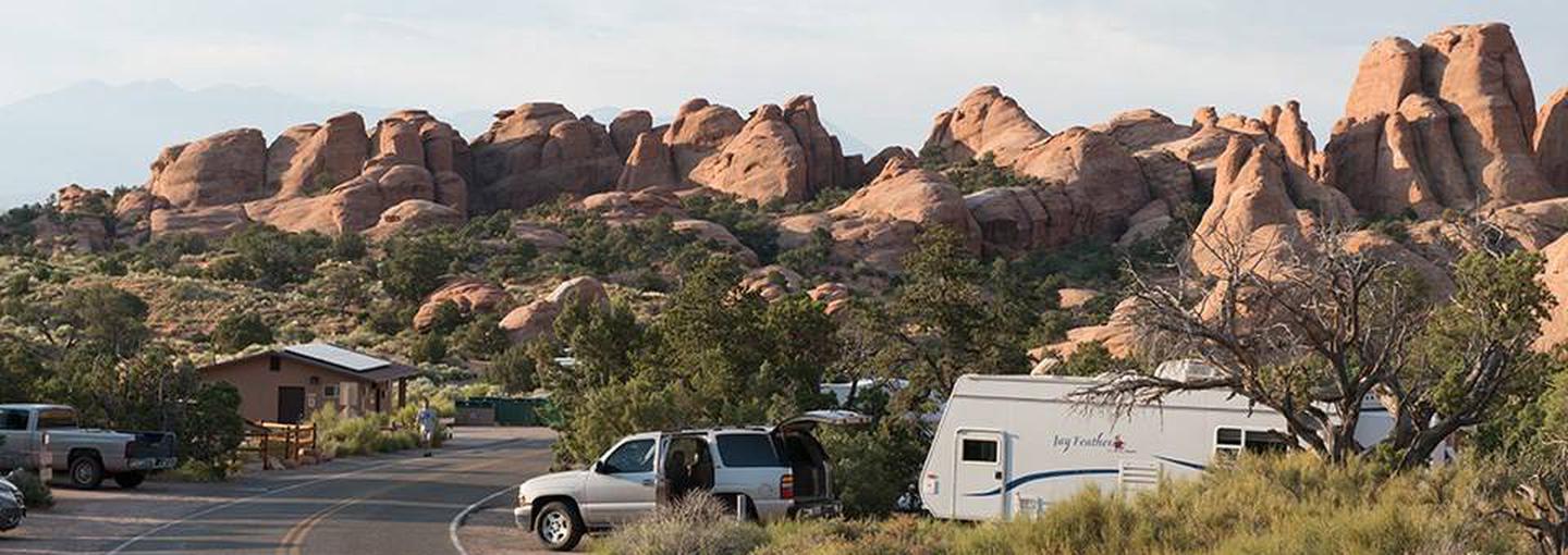
Devils Garden contains 51 campsites that are available for reservation (Including the two group sites and one accessibility site), offering visitors a great opportunity to stay overnight in a unique national park. Roads and parking spurs are paved, allowing smooth access for all types of travelers. A campground host is located on-site. Flush toilets and drinking water are provided, and campsites contain picnic tables and fire rings. The park does not have dump stations, or electric, water, or sewer hook-ups for RVs. There are also no showers.
Natural Features
The campground is forested with mixed stands of Utah juniper and pinyon pine. Flowering prickly pear cacti, yucca and other desert wildflowers dot the landscape, offering vivid color to the surrounding red rock desert.
Arches National Park has the highest concentration of natural arches in the world. Over 2,500 of these unusual rock formations can be found here. Towering spires, fins and balanced rocks complement the arches, creating a remarkable assortment of landforms in a relatively small area. The park is within an arid, high desert environment with hot summers and cold winters.
Nearby Attractions
Southeastern Utah offers breathtaking scenery, hiking, road and mountain biking opportunities, rafting and scenic driving routes. Canyonlands National Park and Dead Horse Point State Park are within a 45-minute drive of Arches’ entrance. Moab offers numerous restaurants, shops and museums. The desert around Moab is a mountain biker’s dream, with hundreds of miles of slickrock and single-track trails for all riding abilities.