
Directions
Take State Highway 395 north from Spokane. Travel 83 miles to the town of Kettle Falls, then take State Highway 25 south and travel 23 miles. Follow signs for the campground. Turn right (west) into the campground.
If coming from the east, travel on State Highway 2 west of Spokane for 32 miles to the town of Davenport. Turn north on State Highway 25 and travel 56 miles. Follow signs for the campground. Turn left (west) into the campground.
Phone
509-754-7889
Activities
BOATING, HISTORIC & CULTURAL SITE, CAMPING, INTERPRETIVE PROGRAMS, FISHING, HIKING, HUNTING, PICNICKING, WATER SPORTS, WILDLIFE VIEWING, SWIMMING, CANOEING, WATER ACCESS
Keywords
GIFF,LAKE ROOSEVELT
Related Link(s)
Washington State Road Conditions
Overview
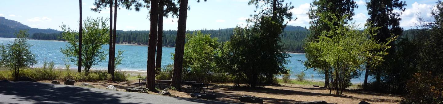
Gifford Group Site is along the shoreline of Lake Roosevelt, adjacent to the main Gifford Campground. It offers spectacular views of the lake from every vantage point. The facility is composed of one group site that can accommodate a group of up to 50 people at a time.
Lake Roosevelt is a 130-mile lake on the Columbia River created by the Grand Coulee Dam. Named after President Franklin D. Roosevelt, it is part of the Lake Roosevelt National Recreation Area, managed by the National Park Service.
Recreation
This site is popular for hunting groups seeking out the many deer and turkey in the area (hunting is allowed in certain areas of the park). There is no designated swimming area, but shallow water and a beachfront, make for ideal swimming conditions. The boat launch provides year-round access to the lake. Boating, fishing, swimming and water skiing are activities that can easily take place from the campground. Campers might also enjoy relaxing and taking in the beautiful view or attending educational ranger programs.
Facilities
Gifford Group Site can be reserved March through November. Great for families, hunters and other large gatherings, there are picnic tables, drinking water, fire pits, a swimming area and a playground within the facility. Other than a small convenience store in the town of Daisy, there is not a lot of shopping nearby, so campers are advised to bring their own goods.
Natural Features
Gifford sits in a thick Ponderosa pine forest that provide plenty of shade. The lake area is abundant with wildlife, including moose, elk, deer and bald eagles. Dozens of species of fish inhabit the lake such as walleye, bass, rainbow trout, salmon and sturgeon; however, fishing for sturgeon is now allowed During a limited season . Much of the water in the lake originates from glaciers and snowmelt in the cold, steep Canadian Rockies, even though temperatures are pleasant for swimming during summer months.
Nearby Attractions
The Gifford Ferry is a free ferry offered by the Colville Confederated Tribes that can take passengers across the river. It runs daily and departs every 15 minutes.