
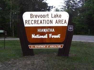
Directions
N4149 Brevort Camp Road Moran Michigan 49760
From St. Ignace, Michigan, take Highway 2 west for about 20 miles. Turn north on Brevort Camp Road/Forest Service Road 3108, then right at Forest Service Road 3473 and continue to the campground entrance.
Phone
906-203-9872
Activities
BIKING, BOATING, CAMPING, FISHING, HIKING, WATER SPORTS, WILDLIFE VIEWING, SWIMMING SITE
Keywords
BREV,LAKE BREVOORT CAMPGROUND,BREVOORT LAKE CAMPGROUND,HIAWATHA NF – FS
Related Link(s)
Michigan State Road Conditions
Overview
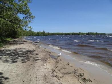
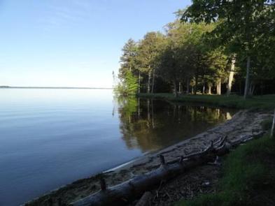
Brevoort Lake Campground stretches along the western shore of its namesake in the Hiawatha National Forest. This popular fishing destination is situated on a peninsula that juts into the lake and Beodne Bay. Visitors to the campground enjoy the easy access to the pristine sandy beaches.
Recreation
The 4,233-acre Brevoort Lake provides ample opportunities for recreation. Boat access is available from the center of the campground on Boedne Bay.
In 1985, the Forest Service completed the construction of a walleye spawning reef in Brevoort Lake, providing plentiful fishing in the area. Anglers can also expect healthy populations of pike, bass, perch and a variety of other fish.
Hiking is also a popular pastime of visitors to the campground. The Ridge, Sand Dunes Cross Country and North Country National Scenic trails pass near the campground.
A 10-minute ferry ride to Mackinac Island makes for an interesting day trip. The 3.8-acre island offers hiking, biking, horseback riding and shopping, as well as access to historical sites and museums, among other activities.
Facilities
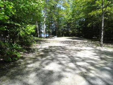
The campground offers dozens of reservable single-family campsites for tent and RV camping. Additional sites are available on a first-come, first-served basis. Each site is equipped with tables and campfire rings with grills, and accessible flush toilets, drinking water and a dump station are provided.
Natural Features
Campsites are somewhat secluded, surrounded by huge pine, hemlock and oak trees and low, shrubby vegetation. Beach grass grows along the lake shore, sometimes buried in light sand.
Nearby Attractions
St. Ignace, Michigan, about 20 miles east of the campground, offers historical and tourist attractions as well as grocery and gas services.
Charges & Cancellations
Please cancel 7 days in advance if you need to cancel your reservation. Reservation sites cannot be traded for walk-up sites.