FASHODA, CA Campground Reservation, Info, Images, Map, Directions

FASHODA, California Campground Images, Info & Reservations

Directions

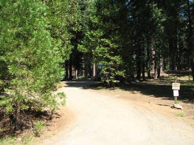
From Placerville, take Highway 50 east for 23 miles. Turn north on Forest Road 3 (Ice House Road) for 15 miles. Look for signs to the campground.

Phone

831-245-6891

Activities

CAMPING, FISHING, HUNTING, WILDLIFE VIEWING, WATER ACTIVITIES

Keywords

FASH,ELDORADO NF – FS

Related Link(s)

Rec Area Info & Images

Forest Service Concessionaire

California State Tourism

California State Road Conditions

Overview

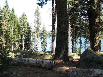
Fashoda Campground, located on a peninsula of the eastern side of Union Valley Reservoir, is an incredibly scenic place to camp. The lake area is a hub for activities like swimming, sailing, boating and fishing. Hiking and biking are also quite popular, and many campers make use of the Union Valley Bike Trail.

Recreation

Head out on a sailboat or take the family water skiing. Union Valley offers a number of water activities. Anglers seek rainbow, brown and mackinaw trout and Kokanee salmon.

The Union Valley Bike Trail stretches 4.8 miles with an easy climb of 300 feet. The trail connects campgrounds on the east side of the lake, starting from Wench Creek on down to Jones Fork Campground.

Facilities

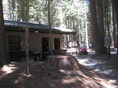
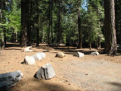
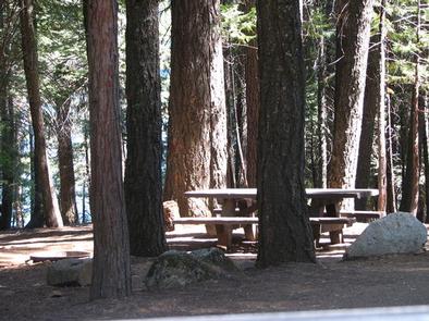
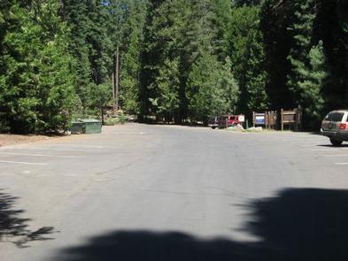
All sites are walk-to tent camping sites. A parking lot is located above the campground. Perks of the campground include vault toilets, drinking water, showers and a picnic area. Campers can make use of the fee dump station at Yellowjacket or Sunset Campgrounds.

Natural Features

Union Valley Reservoir sits in the Crystal Basin, spanning 25,000 acres at an elevation of 5,100 feet. The area is part of the Eldorado National Forest, which is home to the famed gold mining territory of the 1800s. Remnants of the California Gold Rush days can be found throughout the region.

Wildlife thrives in the Eldorado National Forest. Bring a camera and be sure to look for spotted owls, bobcats, mule deer and porcupines.

Nearby Attractions

Climb up Two Peaks and look down on a fantastic view of Union Valley and the Crystal Basin.

Reservation

More from CampingHiking.net:

SILVER DOLLAR, Colorado Campground Images, Info & Reservations

Directions From Leadville, Colorado, drive west on County Road 4 and follow signs to the Turquoise Lake Recreation Area. Turn right on County Road 9C and follow to the campground entrance on the right. Phone 719-486-0749 (FOR INFORMATION ONLY, NO RESERVATIONS) Activities BOATING, HISTORIC & CULTURAL SITE, CAMPING, FISHING, HIKING,

DALE HOLLOW LAKE – PRIMITIVE CAMPING, Tennessee Campground Images, Info & Reservations

Directions Camping locations are dispersed throughout Dale Hollow Lake. Reference primitive camping map or site details for information on how to get to the specific site. Mailing and contact information is for the Resource Manager’s Office. Phone DALE HOLLOW LAKE RESOURCE MANAGERS OFFICE-931-243-3136. SHERIFF’S DEPARTMENT EMERGENCY CONTACTS: CLAY COUNTY 931-243-3266

BABY DOE, Colorado Campground Images, Info & Reservations

Directions From Leadville, Colorado, drive west on County Road 4 about 3.5 miles, turn right on County Road 9C and follow signs to Baby Doe Campground. Phone 719-486-0749 (INFORMATION ONLY, NO RESERVATIONS) Activities BOATING, CAMPING, FISHING, HIKING, WATER SPORTS Keywords BABY,TURQUOISE LAKE,LEADVILLE,PIKE AND SAN ISABEL NF- FS Related Link(s) Rec

BOULDER DAY USE, Illinois Campground Images, Info & Reservations

Directions (Address: 25501 Boulder Access RD, Shattuc, IL 62231). From I-57, take Old U.S. Highway 50 west. Continue for 19 miles through Salem, Odin and Sandoval. Turn north on Boulder Road and follow 7 miles to the day use and recreation area. Phone 618-226-3586 Activities BIKING, BOATING, CAMPING, FISHING, HIKING,

NOTCH CABIN, Montana Campground Images, Info & Reservations

Directions Notch Cabin is about 62 miles from Ennis, Montana. The final 28 miles are gravel, dirt or primitive two-track. From Ennis, take Montana Highway 287 west for 23 miles to Alder. At Alder, turn south toward Ruby Reservoir (County 248) and travel 21 miles. Turn right on Ledford Creek

STUB CREEK CABIN, Colorado Campground Images, Info & Reservations

Directions From Fort Collins, get off I-25 at the Mulberry Street/Highway 14 exit. Travel west on Mulberry to Riverside Ave, then north on College Avenue to Highway 287. Turn left and go west on Highway 14 (Poudre Canyon) for about 60 miles, to County Road 103. Go north on County