

Directions
Important note regarding GPS use: please be advised that GPS units can, and have sent guests down the wrong roads to access the lookout. Please consider following the directions below rather than your GPS unit.
Directions: From Canyonville take West 1st Street and turn onto SE 3rd St/OR-227. Continue to follow OR-227 approximately 23 miles until you reach Tiller. From Tiller take Douglas County Road #46 for 3 miles to the Pickett Butte turn off which is marked as Forest Service Road #3113 (on the right across the bridge). Follow Forest Service Road #3113 approximately 5 miles up to the 300 Spur Road sign (#3113-300). Take the 300 Spur Road up to the lookout (2 miles). The road to the lookout is not snow plowed.
Please use caution during winter months. Pickett Butte’s elevation is 3,200 feet and does receive snow. The road to the lookout is not plowed. While very uncommon, during winter months guests may need to snowmobile, ski or snowshoe up to three miles to reach the lookout.
Phone
541-825-3100
Activities
HISTORIC & CULTURAL SITE, CAMPING, HIKING, WILDLIFE VIEWING, SWIMMING SITE
Keywords
PICB,UMPQUA NF – FS
Related Link(s)
Overview
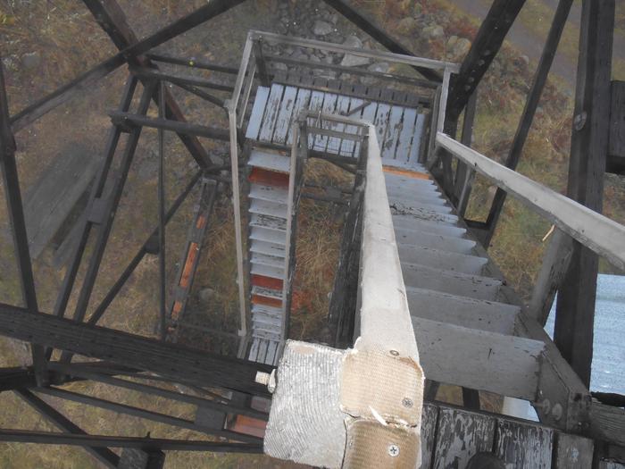
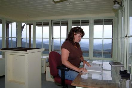
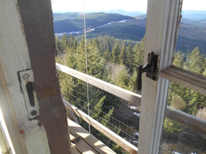
Perched atop Pickett Butte at an elevation of 3,200 feet, this lookout offers visitors a unique lodging experience in Umpqua National Forest in southwest Oregon. After climbing 40 feet up on a very narrow steep stairway to the one-room structure, guests are rewarded with panoramic views of the entire Jackson Creek Drainage and much of the lower elevation lands around the town of Tiller. The original lookout was 25 feet tall and built in 1934. In 1948 the tower was replaced with the current flat top structure. The tower is available for reservations October 15 through July 15 (lookout is utilized for fire season during the summer months). The roads to the lookout are not plowed, nor are they maintained for passenger cars. High clearance or four wheel drive vehicles are recommended for travel to this site, and guests must bring several of their own amenities. Please be aware that while very uncommon, during winter months guests may need to snowmobile, ski or snowshoe up to four miles to reach the lookout.
Recreation
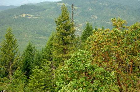
Hiking, birding and wildlife viewing are popular among guests. Seasonal changes envelope the area as snowmelt gives rise to spring flowers and vivid autumn colors welcome a landscape dusted with snow. Guests may enjoy a day of scenic driving along a portion of the 172-miles Rogue-Umpqua National Scenic Byway. Mountain and river scenery unfold along the highway, showcasing everything from rolling oak-covered hills and towering coniferous forests to roaring white water rapids and incised inter-canyon lava flows. Swimming at the Three C Rock Picnic Area, about 7 miles from the lookout, is also a refreshing way to spend a warm summer afternoon.
Facilities
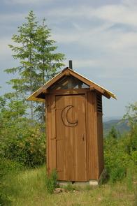
The lookout cabin is a 12 x 12 room, set 40 feet above the ground. It is furnished with a single bed, and a small table and chair, and is equipped with a propane heater, lanterns, cooking stove with oven and a refrigerator (propane is provided). A vault toilet is located at the lookout site. There is a pulley system available to transport items from the ground to the lookout (use at your own risk). There is no water at the site, so visitors must bring plenty for drinking, cooking and washing. Potable water is available at a spigot in front of the Tiller Ranger Station office (20 minutes away via car). Guests must bring several of their own supplies, including food, cooking utensils, sleeping bags, sleeping pads, towels, dish soap, matches, cooking gear, toilet paper and garbage bags. There is no trash service. Pack out all food and garbage.
Natural Features
In 1898, homesteader William T. Pickett rode into this area on horseback and decided to stay and build a life and home. Perched atop the butte named after him, the Pickett Butte Lookout offers a view of the entire Jackson Creek Drainage and much of the lower elevation lands around the town of Tiller. The Rogue-Umpqua Divide, south and east of Pickett Butte, has scenic peak landmarks, which are capped with snow until early summer.
Water is abundant in streams and a handful of lakes in the area, and diverse plant communities provide habitat for abundant wildlife ranging from hummingbird to black bear.
Learn more about bear safety.
Nearby Attractions
Visitors may want to take some time to visit nearby Crater Lake National Park for a glimpse into the area’s fascinating geological and cultural history.