BURNSVILLE LAKE SHELTERS, WV Campground Reservation, Info, Images, Map, Directions

BURNSVILLE LAKE SHELTERS, West Virginia Campground Images, Info & Reservations

Directions

To reach Picnic Shelters 1-4: From Clarksburg, drive south on I-79 to Exit 79 (Burnsville). Turn left and proceed through town until you reach a junction. Turn right onto Route 5 East. Follow approximately 2.5 miles. Turn right and enter the downstream area.
For Shelter 1: Turn right and enter the downstream area; shelter is next to the restroom. For Shelter 2: Turn right and enter the downstream area; shelter is next to the playground and ball field directly below the dam. For Shelters 3-4: Turn left into the Left Fork area adjacent the boat ramp.

To reach Picnic Shelters 5-6: From Clarksburg, drive south on I-79. Take Exit 67 (Flatwoods). Turn left at the stop light and proceed north on Route 19. Follow for 10 miles. Shelters will be on the left, adjacent to the Confederate Overlook.

Phone

(304) 853-2371

Activities

BIKING, BOATING, CAMPING, FISHING, DAY USE AREA

Keywords

BULA,BULLTOWN DAY USE,DOWNSTREAM AREA,BURNSVILLE LAKE

Related Link(s)

Rec Area Info & Images

West Virginia State Tourism

West Virginia State Road Conditions

Overview

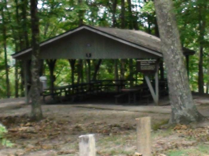
Burnsville Lake Shelters create a wonderful setting for daytime gatherings on Burnsville Lake. The six group picnic shelters are scattered across two ends of the lake. Shelters 1-4 are near the dam while shelters 5 and 6 are upstream near the inflow from the Little Kanawha River.

Recreation

The primary pastime at the picnic shelters, naturally, is picnicking. Activities like biking, hiking and fishing are also quite popular.

Facilities

The shelters are equipped with drinking water and a large charcoal grill; shelters 3 and 5 have electricity. All shelters are close to playgrounds and flush toilets. Groups with young children may prefer shelters 2, 3, 4 and 5, as they are nearest to playground facilities.

Natural Features

The reservoir was built in 1978 for flood control. Its beautiful setting between the Allegheny Mountains and Allegheny Plateau create a lush backdrop of steep hills.

Nearby Attractions

Take a trip back in time at the Bulltown Historical Village to get a taste of life during the Civil War era. The village and visitor center is nearest to shelters 5 and 6.

Reservation

More from CampingHiking.net:

BRIDGEVIEW (RATHBUN LAKE), Iowa Campground Images, Info & Reservations

Directions From Moravia, IA, travel 10 miles west on Highway J18 and follow signs into the campground. Phone FOR CAMPGROUND INQUIRIES DURING MAY-SEPTEMBER PLEASE CALL 641-724-3062. DURING CLOSED SEASON PLEASE CALL 641-647-2464 Activities BIKING, BOATING, CAMPING, FISHING, HIKING, PICNICKING, WILDLIFE VIEWING, DAY USE AREA, INFORMATION SITE, SWIMMING, KAYAKING, CANOEING, WATER

ALLEY CREEK CAMP, Texas Campground Images, Info & Reservations

Directions From Jefferson, TX, travel 3.8 miles northwest on Highway 49. Turn left onto FM 729 and continue for 12 miles to the park entrance on the left. Phone 903-755-2637 Activities BOATING, CAMPING, FISHING, HIKING, HUNTING, WATER SPORTS, WILDLIFE VIEWING, SWIMMING, BIRDING Keywords ACRC,LAKE OF THE PINES,LAKE O THE PINES,FERRELLS

BUCKBOARD, Utah Campground Images, Info & Reservations

Directions Located in Southeast Utah, six miles west of Monticello on paved Forest Road 105. Phone 435-587-2041 Activities AUTO TOURING, BIKING, CAMPING, FISHING, HIKING, HUNTING, PICNICKING, WILDLIFE VIEWING, PHOTOGRAPHY, MOUNTAIN BIKING, STAR GAZING, SCENIC DRIVE, OFF HIGHWAY VEHICLE TRAILS Keywords BUCB,BUCKBOARD,BLUE MTN. CAMPGROUND,MANTI-LASAL NF -FS Related Link(s) Rec Area Info

CANYON RIM, Utah Campground Images, Info & Reservations

Directions Located on Forest Road 095/Red Canyon Road off Highway 44, approximately 40 miles north of Vernal, Utah. Phone 435-784-3445 Activities BOATING, CAMPING, FISHING, HIKING, WILDLIFE VIEWING Keywords CANR,RED CANYON COMPLEX,THE RIM,FLAMING GORGE,ASHLEY NF – FS,Flaming Gorge National Recreation Area Related Link(s) Rec Area Info & Images Utah State Tourism

UNION CREEK CAMPGROUND, Oregon Campground Images, Info & Reservations

Directions From Baker City, Oregon, travel south on Highway 7 for about 18 miles. The campground and day-use entrance is on the left side of the road. Follow the signs in the Union Creek Recreation Area down to the various campground loops and areas. Phone 541-894-2332 Activities BIKING, BOATING, CAMPING,

UPPER SAGE FLAT, California Campground Images, Info & Reservations

Directions In Big Pine, on US Highway 395, turn west at the yellow flashing traffic light onto Crocker Street (Big Canyon Road). Continue on this road for 9 miles to campground, on your left. Phone 760-935-4339 Activities CAMPING, FISHING, HIKING, HORSEBACK RIDING, WILDLIFE VIEWING Keywords UPSF,UPPER SAGE CAMPGROUND,INYO NF –