
Directions
From NH Route 16 in Jackson, turn onto Route 16A. Take Route 16B (Black Mountain Road) and follow for about 2 miles. Just past Black Mountain Ski Area, Rt 16B turns into Dundee Road. Continue on Dundee Road to the trailhead 1 mile on the left with space for 3-5 vehicles. The ski trail reaches the cabin in 1.8 miles via a steep grade.
Phone
603-447-5448
Activities
CAMPING, HIKING, HUNTING, WINTER SPORTS, WILDLIFE VIEWING
Keywords
DOCA,WHITE MOUNTAIN NF -FS
Related Link(s)
New Hampshire State Road Conditions
Overview
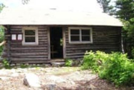
Doublehead Backcountry Cabin is accessible only by hiking, snowshoeing or skiing the 1.8-mile Doublehead Ski Trail. Guests should be prepared to transport all their gear and supplies on foot over an elevation of 1,500 feet. Doublehead Backcountry Cabin and Doublehead Ski Trail were built in the 1930s by the Civilian Conservation Corps as part of a larger project to develop ski runs for the nearby resort town of Jackson. The cabin was used as a warming hut and shelter for skiers traveling on the trail. Some of the other ski trails nearby were developed and commercialized, but Doublehead Ski Trail and the cabin retain their rustic, backcountry ambiance.
Recreation
Guests at Doublehead Backcountry Cabin can expect to see other cross country skiers and snowshoers on the Doublehead Ski Trail. Hikers will find a trail that leads to the south peak of Doublehead Mountain.
Facilities
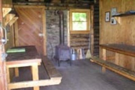
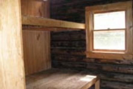
The cabin is very rustic with minimal amenities that include 8 wooden bunks, 2 small tables, benches and a wood stove. An outhouse is located a short distance away with a composting toilet. A broom is provided for tidying up the cabin. Water and electricity are not available. Any water taken from the natural sources should be treated or boiled, but it is recommended that guests bring their own water. Bedding and sleeping pads are not provided. Recommended items include matches, food, cooking utensils, trash bags, toilet paper, a camp stove, first aid kit, flashlight or lantern, extra batteries, firewood and/or a cutting tool for dead and down wood. The amount of available firewood in the area cannot be guaranteed. The cabin is not insulated, so winter guests should be prepared for temperatures inside to be almost the same as the outside, even when the wood stove is in use ( more cabin details )
Natural Features
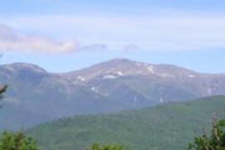
This log cabin sits atop the north summit of Doublehead Mountain at 3,053 feet. This mountain has 2 peaks, and the south peak is 2,939 feet. This vantage point offers views of Mount Washington (6,288 feet), the tallest mountain in the northeastern United States, and other peaks in the Presidential Range.
White Mountain National Forest is home to 237 species of birds. Other inhabitants of the forest include moose and black bears (bear safety information).