Directions
From Marion, VA: Take I-81 to exit 45 and proceed south on VA Route 16 for about 10 miles to VA 695 (Slemp Creek Road) at Sugar Grove, VA. Turn left onto VA 695 (Slemp Creek Road) and go 1 mile before turning left onto VA 614 (Cedar Springs Road) towards Cedar Springs. Drive 4 miles and turn right onto VA 612 (Camp Road) before Cedar Springs, VA. Continue for 5 miles and turn right onto VA 798 (a gravel road – Hale Lake Road). Continue about 3 miles to the top of the mountain and a "T" intersection. Turn right onto VA 672 (Blue Springs Road). After about 0.3 miles, take the first gravel road on the right. This road leads to the cabin gate. Access to Blue Springs Gap Cabin along VA 798 is not suitable for low clearance vehicles
Phone
800-628-7202
Activities
BIKING, CAMPING, FISHING, HIKING, HUNTING, WILDLIFE VIEWING
Keywords
BLSP,Blue Springs Gab Cabin,GEORGE WASHINGTON/JEFFERSON NF-FS
Related Link(s)
Virginia State Road Conditions
Overview
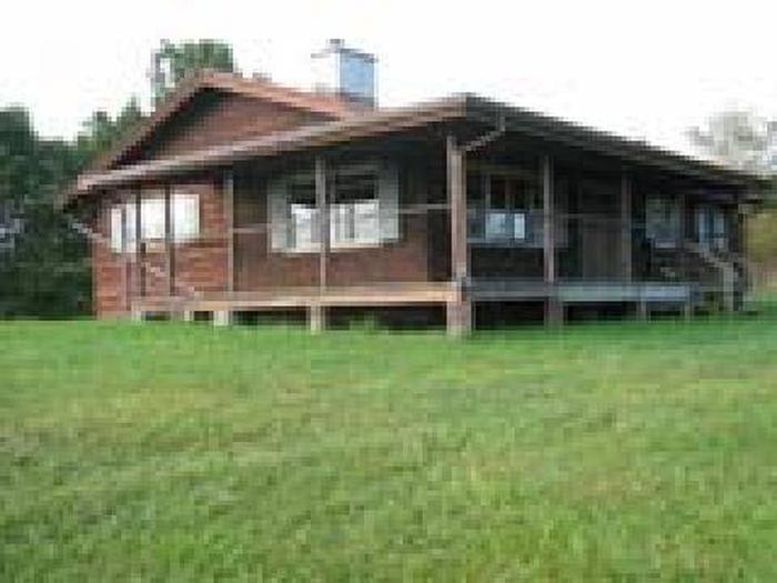
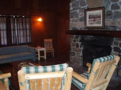
Blue Springs Gap Cabin is located high on a mountaintop near Camp, Virginia, giving visitors the feeling of being on top of the world. The space has three comfortable bedrooms, a kitchen and a living room with a large stone fireplace. Electricity and flush toilet add modern comfort to this rustic mountain setting.
Accessible hiking and biking trails pass near the cabin and Hale Lake is just 2 miles away, providing combined opportunities for bird watching, hiking, biking, fishing and picnicking.
Recreation
The Mount Rogers National Recreation Area features four Congressionally designated wilderness areas; the Virginia Creeper Trail; the Mount Rogers Scenic Byway; the 5,000 acre Crest Zone, featuring elevations over 4,000 feet, large rock formations and a herd of wild, free-ranging ponies; and last but not least, the highest elevated road in the state of Virginia leading to the summit of Whitetop Mountain.
The Blue Springs Trout Fishing stream is just over a mile from the cabin and Hale Lake is about 2 miles away. Hale Lake is popular among anglers who come to these quiet mountainside waters in search of a good day of fishing.
The Hale Lake Trail, 0.58-mile loop trail is an easy hike around that lake, occasionally veering away from the shoreline and into the surrounding hardwood forests. Birders will probably find this site most productive during migration.
In spring, it should be easy to spot several species of warblers and flycatchers. In fall, the lake is likely to invite migrating waterfowl and shorebirds. Wood duck breed in the area and can occasionally be seen on the lake. White-tailed deer and wild turkey roam through the surrounding woodlands, and might be found approaching the lake to quench a thirst.
Facilities
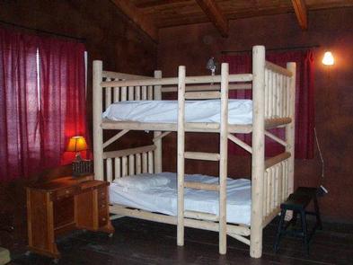
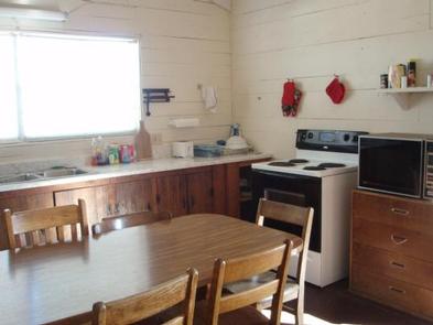
The cabin and grounds can fit a maximum of eight people. The single-story cabin comes with three bedrooms, a kitchen, bathroom and living room. One bedroom has a queen bed, the other has a full sized bunk bed, and the third has a twin bunk bed.
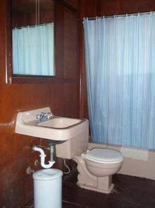
The large stone fireplace provides heat, but there is no other heat source, and no air conditioning either. Electricity is available from April 1 to November 29. Flush toilet is available from April 1-October 31, and a portable toilet is used from November 1 to November 29.
Outside there is a porch with a porch swing, a grill and picnic table. No linens, blankets or pillows are provided, so campers are recommended to bring their own to ensure a comfortable stay. There is a fully stocked kitchen with a refrigerator and microwave available for your use.
Most importantly, there is no water available at the cabin. Visitors must bring plenty of their own for drinking, washing and cooking. Garbage bags, firewood, a flashlight and a first aid kit are also recommended.
Natural Features
Blue Springs Gap is situated in a grassy clearing atop a mountain peak in southwest Virginia. From the cabin’s front porch campers have views of the impressive Appalachian peaks and valleys. Beyond the clearing is a dense stand of mixed hardwoods and pines.
The cabin is located in the Mount Rogers National Recreation Area, a 200,000-acre stretch of land that includes two lakes, 50 miles of streams and multiple historic sites. During the fall months, visitors are treated to an incredible showing of autumn colors, as the foliage display in the area is known as some of the best in the region.
Nearby Attractions
The nearest access to drinking water is 4 miles east at Comers Rock Campground. The nearest phone is 12 miles in Speedwell, Virginia.

