NORTH FORK (ID), ID Campground Reservation, Info, Images, Map, Directions

NORTH FORK (ID), Idaho Campground Images, Info & Reservations

Directions

From Ketchum, Idaho, travel approximately 8 miles north on Highway 75. Campground is on the west side of the road.

Phone

928-537-8888

Activities

BIKING, CAMPING, FISHING, HIKING, WILDLIFE VIEWING

Keywords

NORF,SAWTOOTH NF – FS

Related Link(s)

Rec Area Info & Images

Forest Service Concessionaire

Idaho State Road Conditions

Idaho State Tourism

Overview

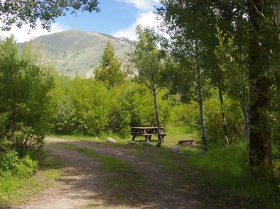
North Fork Campground is situated on the banks of the beautiful Big Wood River at an elevation of 6,300 feet. Visitors enjoy fishing and tubing on the river and exploring the Harriman Trail.

Recreation

This site is part of the Sawtooth National Recreation Area, where outdoor activities abound. Fly-fishing for rainbow, brown and brook trout is popular on the Big Wood River, as is float tubing.

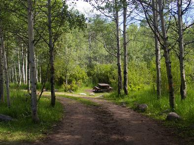
The 20-mile Harriman Trail leads past the campground, offering excellent hiking and biking. Numerous additional trails spur off the Harriman Trail leading to deep canyons, sparkling lakes, swimming holes and more excellent high country fishing.

Facilities

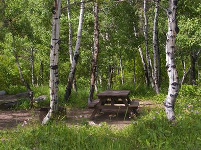
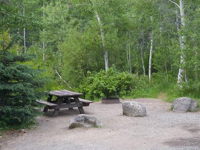
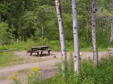
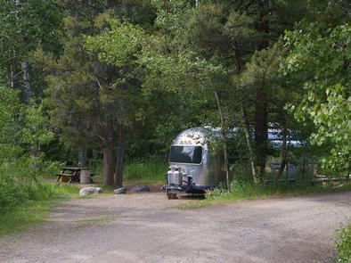
The campground contains several family sites, some of which are offered on a first-come, first-served basis. Vault toilets and drinking water are provided. Firewood is available for purchase from the host. Roads and parking spurs are gravel.

Natural Features

A scenic aspen forest covers North Fork, offering plentiful shade. Pines dot the landscape and colorful summer wildflowers are abundant. Willows and grasses line the riverbank. Temperatures are cool with an average summer high of 78 degrees and a low of 40 degrees.

Nearby Attractions

The Sawtooth National Recreation Area Visitor Center is 1/2-mile from the campground, with a small museum, bookstore and area information. An RV dump station and drinking water are located here as well.

Easley Hot Springs is 6 miles north, offering a swimming pool, hot tubs, showers and a small store.

Popular area events include Wagon Days in Ketchum in September.

Reservation

More from CampingHiking.net:

STONY CABIN, Montana Campground Images, Info & Reservations

Directions From Philipsburg, travel west on Rock Creek Road/County Road 348 for approximately 14 miles, then turn right onto Rock Creek Road/County Road 102 and continue about 5 miles. Turn left at Stony Creek Road/County Road 241 and the cabin is about a quarter-mile on the right. Depending on snow

BIG MEADOWS, Virginia Campground Images, Info & Reservations

Directions From Washington, D.C., metro area, travel west on Interstate 66 to exit 43A. Take US Highway 29 south to Warrenton, Virginia, then merge onto US Highway 211 west to Shenandoah National Park and Skyline Drive Thornton Gap Entrance. Take Skyline Drive south approximately 19 miles and turn right into

BALD RIDGE CREEK, Georgia Campground Images, Info & Reservations

Directions From Atlanta, GA, take SR 400 N to Exit 16, turn right on Pilgrim Mill Rd., turn right on Sinclair Shoals Rd., turn left on Bald Ridge Rd. Follow signs into campground. Phone 770-889-1591 Activities BIKING, BOATING, CAMPING, FISHING, SWIMMING SITE, KAYAKING, WATER ACCESS Keywords BALR,LAKE LANIER,BALD RIDGE,BALL RIDGE,LAKE

ELKHORN CAMPGROUND, Utah Campground Images, Info & Reservations

Directions From Loa, Utah, travel northeast on U-72 for 12 miles. Turn east on Forest Road 206 and travel 8 miles to the campground. The dirt road is narrow, steep and single-lane in some places. Phone 435-836-2811 Activities BIKING, CAMPING, HIKING, VISITOR CENTER Keywords ELKH,FISHLAKE NF – FS Related Link(s)

DEFEATED CREEK PARK, Tennessee Campground Images, Info & Reservations

Directions From Carthage, Tennessee, take SR-25 west for 4 miles. Turn north on SR-80, then east on SR-85. Follow signs to campground. Phone 615-774-3141 Activities BIKING, BOATING, CAMPING, INTERPRETIVE PROGRAMS, FISHING, HIKING, WILDERNESS, SWIMMING SITE, ENVIRONMENTAL EDUCATION, PHOTOGRAPHY, PADDLING, SWIMMING, PADDLE BOATING, WATER ACTIVITIES, KAYAKING, STAR GAZING, WATER ACCESS, WATER

Midway Campground (FL), Florida Campground Images, Info & Reservations

Directions From Naples: Follow US HWY 41 east until you see signs for campground (approximately mile marker 52) From Miami: Follow US HWY 41 west until you see signs for campground (approximately mile marker 52) Phone 1 (239) 695-1205 Activities CAMPING, DAY USE AREA Keywords Midway Campground,Big Cypress Related Link(s)