Directions
From Dayton, take 4th street south for 6 blocks, and turn east on Eckler Mountain Road for about 15 miles. Turn right at the Y intersection. Continue on Forest Road 46 for 12 miles to Godman. The guard station will be on the left. The site is accessible to vehicles from mid to late-June through mid-October to early-November. Call the Pomeroy Ranger District for road and weather conditions at (509)843-1891 Mon-Fri 7:30-4:30 Closed Weekends & Holidays.
Winter use requires skis, snowshoes or snowmobiles. From Dayton, Washington, take 4th Street south. Follow road directions to Bluewood Ski Area. Before the entrance to the ski area, park in the available snowmobile parking at Touchet Corral. Travel the groomed snowmobile route, taking all lefts to Godman, approximately 13 miles. Directional signs lie along the route, put up by the local snowmobile club. Although guests may ski to the cabin, the route is difficult and for advanced skiers only. A Washington State Sno-Park permit is required to park at the Sno-Park. Play close atterntion to weather forecasts as winter weather can change quickly.
Phone
509-843-1891 MONDAY-FRIDAY 7:30-4:30 CLOSED WEEKENDS & HOLIDAYS
Activities
HISTORIC & CULTURAL SITE, CAMPING, HIKING, WINTER SPORTS
Keywords
GOGU,Godman,Godman Station,UMATILLA NF – FS
Related Link(s)
Washington State Road Conditions
Overview
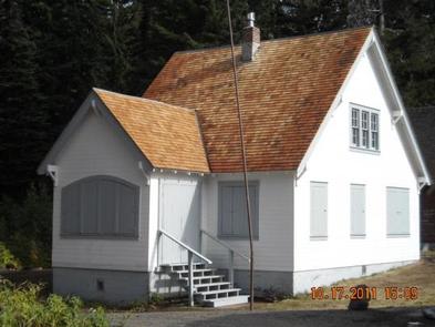
Godman Guard Station, built in the 1930s, sits just outside the impressive Wenaha-Tucannon Wilderness. The complex is adjacent to a historic Civilian Conservation Corps campground. Horseback riding and hiking trails into the wilderness are easily accessed from the cabin. Horses are permitted in the area, however, due to sanitary reasons, horses are not allowed near the guard station. Horses may be tied to the barns hitching rails located about 200 yards up the hill. The barn cannot be used by renters, just the hitching rails and feed bunks. Winter access is by snowmobile, snowshoes or cross country skis. A groomed snowmobile trail passes right by the cabin.
Recreation
Guests will delight in viewing scenery along Skyline Drive Road and the Wenaha-Tucannon Wilderness. During the summer months, horseback riding or hiking in the wilderness are popular pastimes. Many trails descend into the rugged river canyons and offer fishing opportunities. Check with the appropriate state Department of Fish and Wildlife for regulations. The Godman Trailhead can be accessed from the cabin. In winter, campers enjoy snowmobiling on groomed trails, snowshoeing and cross-country skiing.
Facilities
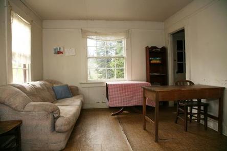
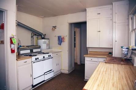
The two-story, wood frame structure sleeps up to eight people and features two bedrooms, a living area, and kitchen. An outhouse is available year-round. Furnishings include two bunkbeds, four single beds, four recliner style chairs, a kitchen table and chairs. Also provided are a propane stove, heat, lights and refrigerator. Outside the cabin there is a firepit and picnic table.
Guests should bring water year-round. A spring is nearby for those who wish to treat and boil water for drinking.
Guests will also need to bring food, bedding, dishes, cooking utensils, pots and pans, trash bags and a first aid kit.
Cabin should be cleaned before departure. Mop, bucket, broom & cleaning supplies are provided.
Natural Features
Godman Guard Station is perched above the Wenaha-Tucannon Wilderness at an elevation of 5,600 feet. From a barn about 100 yards up the hill from the cabin, expansive views of the wilderness can be seen. The wilderness includes nearly 180,000 acres of rugged basaltic ridges, steep canyons, rushing rivers and their tributaries and abundant wildlife. Rocky Mountain Elk, bighorn sheep, white-tailed and mule deer, black bears, cougars, coyotes and pine martens inhabit the region.
Nearby Attractions
The cabin is 28 miles or a one-hour drive from Dayton. Groceries and fuel are available. The Tucannon Last Resort Store is also about an hour’s drive away.


