Directions
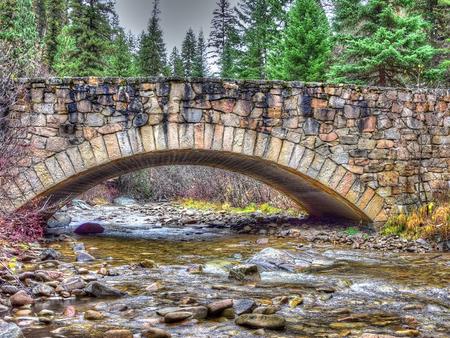
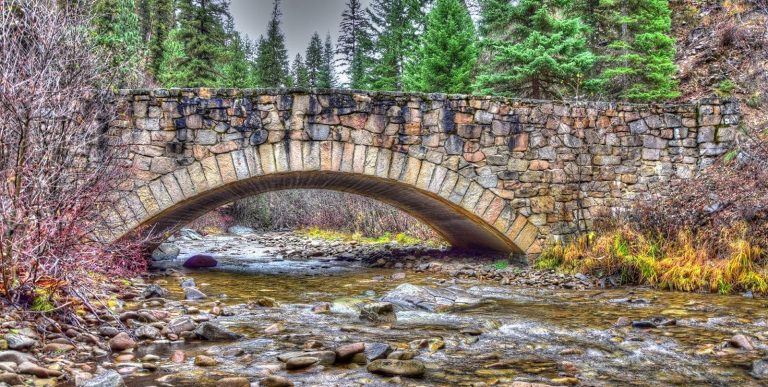
From Darby, Montana, travel south on Highway 93 for 4 miles to West Fork Road/Highway 473. Continue on this road for approximately 14 miles to the Nez Perce Road/Magruder Corridor Road and go another 34 miles on the one-lane gravel, and partially paved road. Just before the Deep Creek meets up with the Selway River, turn south at a stone bridge that crosses the creek. Maps may be purchased by calling the West Fork Ranger District. From June to September, the road is only passable by high-clearance vehicles. From December through mid-May, the cabin can only be accessed by cross country skiing and snowmobiling for up to 30 miles from Little West Fork and more than 60 miles from the Red River Ranger Station.
Phone
406-821-3269
Activities
BIKING, CAMPING, FISHING, HIKING, HUNTING, WINTER SPORTS, WILDLIFE VIEWING, PHOTOGRAPHY, BERRY PICKING, SCENIC DRIVE
Keywords
MAGR,MAGRUDER RANGER STATION,DEEP CREEK WORK CENTER,DEEP CREEK RANGER STATION,MAGRUDER WORK CENTER,HORSE HEAVEN CABIN,MAGRUDER RANGER S HOUSE,BITTERROOT NF -FS
Related Link(s)
Overview
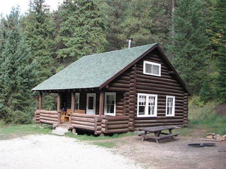
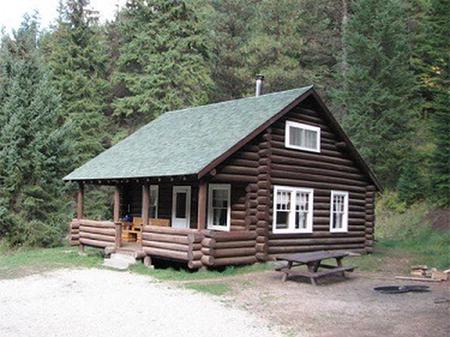
Magruder Rangers House is one of seven buildings still used by Forest Service trail crews and wilderness rangers, but it is open to the public through parts of the year. It provides visitors with access to two designated wilderness areas, plenty of opportunities for sightseeing and exploration and a comfortably equipped place to stay.
Recreation
Hunting and fishing are popular activities enjoyed by visitors to the area. The adjacent Selway River and a variety of nearby mountain streams are well known for trout fishing. Anglers might see bullhead, rainbow, steelhead and cutthroat trout, as well as mountain whitefish. There are a variety of trails that traverse the area, including the 11-mile Sweet Creek Trail. It follows a creek bed and connects to other trails in the area. It is open to hiking and horseback riding. Bicycles and motorized travel are not allowed within wilderness boundaries but is allowed on roads.
Facilities
The two-story, five-room log cabin has two bedrooms, a living area, a kitchen and an indoor bathroom. It has beds with mattresses, as well as futons, to sleep up to 10 people. A wood stove for heat is available in the basement of the cabin and firewood is provided. The kitchen is equipped with a table and chairs, refrigerator, propane stove and propane lights. Cooking and eating utensils are available, as well as various cleaning equipment. During the summer and fall, hot and cold running water is available for the kitchen and bathroom, which has a flush toilet and a shower. The water system is turned off during the winter. Water is turned on from June through mid-October. An outdoor vault toilet is provided. Guests will need to bring their own bedding, towels, food, matches, garbage bags and toilet paper, among other necessities. It is required that guests replenish the cut firewood supply and clean the cabin prior to leaving. The cabin is accessible by four-wheel drive and high-clearance vehicles. Guests are responsible for their own travel arrangements and safety. Livestock are not permitted at the Magruder Cabin compound.
Natural Features
The house is located on the Selway River, between the 1.2-million-acre Selway-Bitterroot Wilderness and the 2.3-million-acre Frank Church-River of No Return Wilderness areas, at an elevation of about 4,000 feet. It was once the residence of the district ranger and his family.
Most of the area is covered by coniferous forests, with open meadows near the river. Because of its size, the wilderness provides a secluded habitat for a wide variety of wildlife. Large populations of mountain lions and grey wolves live in the area, as well as lynx, coyote, fox, bighorn sheep, mountain goats, elk, moose, deer and black bears (learn about outdoor safety).
Nearby Attractions
The adjacent Magruder Road provides drivers with a unique experience in the back country of Montana. The road was built by the Civilian Conservation Corps in the 1930s and remains much the same now as it did then. It continues to the Nez Perce Pass and is open in early June.


