MAPLE GROVE, UT Campground Reservation, Info, Images, Map, Directions

MAPLE GROVE, Utah Campground Images, Info & Reservations

Directions

From Scipio, Utah, take U.S. 50 south. Turn west at Maple Grove Campground sign/Forest Road 101 at milepost 146. Travel 4 miles to the campground.

Phone

435-743-5721

Activities

CAMPING, HIKING

Keywords

MAPL,FISHLAKE NF – FS

Related Link(s)

Rec Area Info & Images

Utah State Tourism

Utah State Road Conditions

Overview

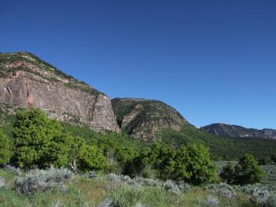
Maple Grove Campground sits in Fishlake National Forest in central Utah. Visitors enjoy fishing and hiking the nearby Rock Canyon Trail.

Recreation

The 3.2-mile Rock Canyon Trail begins in the campground and leads to the top of the Pahvant Range. Younger campers love fishing for rainbow trout in Ivie Creek.

Facilities

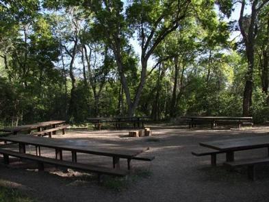
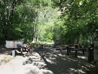
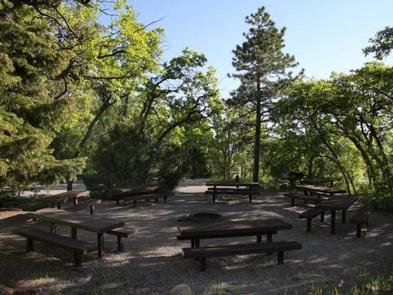
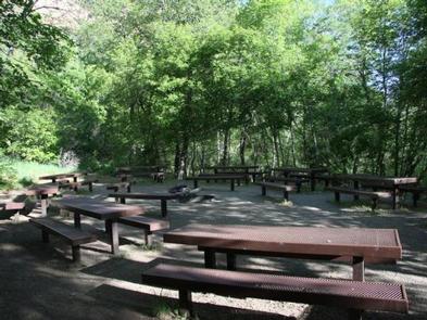
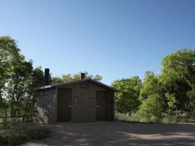
The campground offers three reservable accessible group sites with picnic tables, campfire circles, grills and water spigots. Several single sites are available on a first come, first served basis. Vault toilets and drinking water are provided.

Natural Features

The campground sits beneath towering red cliffs and offers scenic views of the valley below. Thick stands of maple, cottonwood, box elder, oak and pine provide plentiful shade. Gentle Ivie Creek runs through the site.

Reservation

More from CampingHiking.net:

CEDAR BREAKS PARK, Texas Campground Images, Info & Reservations

Directions From I-35, take Farm to Market Road 2338 west for 3.5 miles to D.B. Wood Road. Turn left and continue for 2.5 miles. Turn right onto Cedar Breaks Road and follow signs to the park. Phone 512-930-5253 Activities BOATING, CAMPING, FISHING, HIKING, HUNTING, PICNICKING, PADDLING, MOUNTAIN BIKING Keywords CEDA,LAKE

CAMP MISTY MOUNT, Maryland Campground Images, Info & Reservations

Directions The street address for GPS use is 14764 Park Central Road, Thurmont, MD. From Washington DC, take the George Washington Memorial Parkway north to I-495 onto I-270 north 27 miles to Frederick, MD. Take Route 15 for 17 miles north to Thurmont, MD. Take Route 77 West, the exit

OYSTER POINT CAMPGROUND, North Carolina Campground Images, Info & Reservations

Directions From Newport, take SR 1154 to Forest Road 181 and turn right. Phone 252-638-5628 Activities BOATING, CAMPING, FISHING, HIKING Keywords Related Link(s) Rec Area Info & Images North Carolina State Road Conditions North Carolina State Tourism Overview Oyster Point Campground is located on the banks of the Newport River,

ANCHOR PASS CABIN, Alaska Campground Images, Info & Reservations

Directions The cabin is approximately 50 air miles north of Ketchikan, located on the mainland shore of Anchor Pass across from the east end of Bell Island. It is accessible by floatplane or by boat. A mooring buoy is provided at the site on a first come-first serve basis. Refer

TWIN COVE POINT, Oklahoma Campground Images, Info & Reservations

Directions From Highway 11 in Barnsdall, Oklahoma, take a left onto West Chestnut Avenue and go 0.2 miles. Take a left on South Eighth Street and go 1.5 miles south. Take a right into the Twin Cove Point facility. Phone 918-847-2220 Activities BOATING, CAMPING, FISHING, HUNTING, SWIMMING SITE Keywords Related