
Directions
From Robbinsville, North Carolina, take Highway 129 north. After about 2 miles turn left onto 143 West (Massey Branch Road). Pass the Ranger Office and continue to the stop sign (2.2 miles). At the stop sign, turn right, continuing on 143 West for approximately 6.9 miles. Turn right on NC 1134 toward Joyce Kilmer. Continue only about 50 feet. Turn left onto Forest Service Road 81. Continue on this gravel road approximately 8 miles. Turn right onto Forest Service Road 81F and continue for 2.7 miles. Swan Cabin is located on the left, off of Forest Service Road 81F.
Phone
828-479-6431
Activities
CAMPING, FISHING, HIKING, HUNTING, WILDLIFE VIEWING, RANGER STATION, BIRDING, BACKPACKING
Keywords
SWAC,NFs IN NORTH CAROLINA – FS
Related Link(s)
North Carolina State Road Conditions
Overview
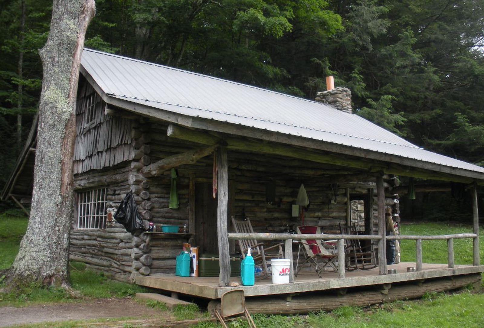
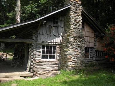
Nestled in a remote area of Nantahala National Forest, this primitive log cabin was built in 1931 by Frank Swan in a different location, then later it was moved to its current location near the Joyce Kilmer-Slickrock Wilderness. The cabin and the surrounding meadows are named for the Swan Family, who came to the area from Pennsylvania in the late 19th century. Swan Cabin offers a peaceful, quiet retreat where visitors can relax on the front porch and enjoy birdsong and views of the surrounding wilderness. This cabin, which sleeps up to ten people, is available from April 1 through December 31.
Recreation
There are several nice hikes in the area, including the 3-mile Swan Meadows and the 7-mile Stratton Bald Trails. There is an easy 5-minute hike from the cabin to a waterfall. Nearby boat ramps are available on Santeetlah Lake.
Facilities
The cabin offers three rooms on the lower floor and a loft on the upper floor. Nine beds are offered, which include three double bunk frames, two single bed frames and a double bed frame. Each are strung with rope to accommodate sleeping bags. A pit toilet is located adjacent to the cabin, and a nearby spring may provide a water source, although it should be boiled or treated. There is no electricity or running water at the cabin. The cabin does not have locks on the door. A picnic table, grill and fire ring are located outside. The woodstove has been removed, so visitors are advised to bring their own heat source.
Visitors may wish to bring their own drinking water, as well as supplies and equipment for food preparation. Tents may be pitched in the surrounding meadows for groups of more than ten. All equipment must be carried in from the parking area, located approximately 100 feet from the cabin. Guests are responsible for their own travel arrangements and safety, and must bring many of their own amenities. No pets are allowed except for service animals. Hunting is also a popular activity enjoyed by visitors to the area from September through December. Hunters and their dogs may frequent the nearby trails during that time. Guests must bring their own water for drinking, cooking and cleaning purposes, as well as lanterns or flashlights, bedding, towels, cooking and eating gear, food, garbage bags, toilet paper and other necessities.
Natural Features
The Joyce Kilmer-Slickrock Wilderness is particularly known for its old-growth forest of oak, poplar and hemlock within the Joyce Kilmer Memorial Forest. This is one of the largest old-growth forests east of the Mississippi. Sun-loving wildflowers are abundant in the spring, and rhododendron, azalea and mountain laurel bloom in the late spring and early summer. The 2 major watersheds in this wilderness are Slickrock Creek and Little Santeetlah Creek. The mouth of Slickrock Creek has the lowest elevation in the wilderness at 1,086 feet. Swan Cabin is situated near the highest elevation in the wilderness: 5,341-foot Stratton Bald in the Unicoi Mountain Range.
Nearby Attractions
Swan Cabin is an ideal base for exploring the pristine Joyce Kilmer-Slickrock Wilderness. Great Smoky Mountains National Park is only a short drive away and makes an excellent day trip.