

Directions
Ben Rover Cabin is located 35 miles north of Columbia Falls, on North Fork Road (County Road 486). From Columbia Falls, travel north on Nucleus Avenue. Turn east at the stop sign, on Railroad Street. The road becomes the North Fork Road as it travels over the railroad overpass. At mile 35 on the North Fork Road, turn east one mile following signs to the town of Polebridge. Turn left (north) to Ben Rover Cabin which is a half-mile from Polebridge on the right. If you cross into Glacier National Park, you have gone too far.
North Fork Road is gravel, intermittently plowed during the winter. A four-wheel-drive vehicle with chains is recommended in winter.
Phone
406-387-3800
Activities
BOATING, CAMPING, FISHING, HIKING, WINTER SPORTS, WILDLIFE VIEWING
Keywords
BENR,ROVER,BEN,FLATHEAD NF – FS
Related Link(s)
Overview
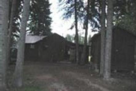
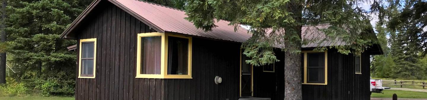
Ben Rover Cabin is located 35 miles north of Columbia Falls, perched near the Wild and Scenic Flathead River. The rustic accommodations provide a delightful setting for photographing scenery, viewing wildlife and enjoying the peaceful sounds of nature. The cabin also provides access to a variety of activities, including hiking, fishing and boating the river.
The cabin is generally accessible by vehicle, however, in winter, four-wheel drive vehicles with chains are strongly recommended. Guests are responsible for their own travel arrangements and safety, and must bring several of their own amenities.
Recreation
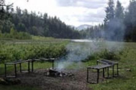
Visitors to the cabin can enjoy fishing, canoeing and kayaking on the river. Floating from Polebridge to Glacier Rim is easy, as the section contains mostly Class I to II rapids.
Cross country skiing, snowshoeing and snowmobiling are popular activities enjoyed by winter visitors. Various designated snowmobile routes and flat areas are available nearby. Trails are available to hiking in good weather.
Facilities
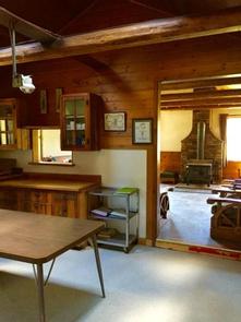
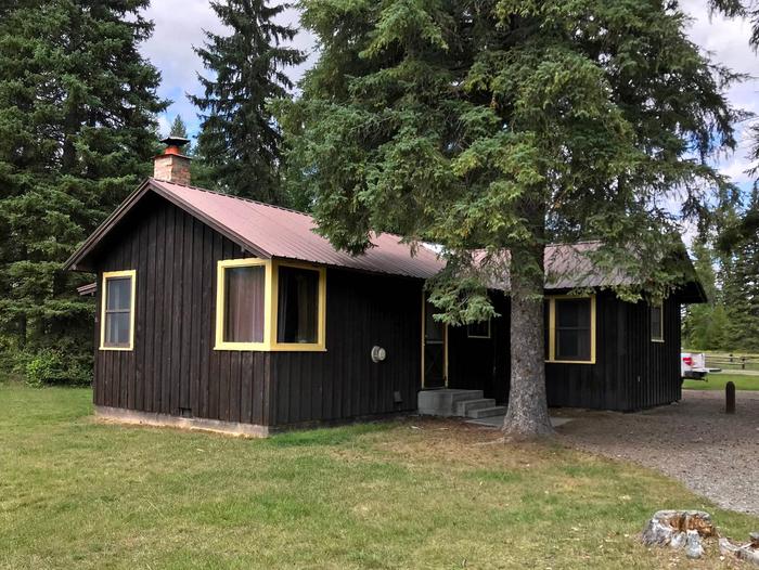
A campfire pit with benches and a vault toilet are located outside, and the water source is a well with a hand pump. Indoor accommodations fit eight guests on two double beds, one bunk and two twin beds.
Amenities include a propane cook stove, propane lights, a heater and a wood stove. The kitchen offers basic cooking pots, pans and eating utensils. Cleaning supplies are also provided. Guests will need to clean the cabin and carry out all trash before leaving.
No electricity is available and guests are advised to bring food, bedding, a cooler, garbage bags, flashlights and all other basic camping gear. Water is not available December through March, so guests should bring plenty for drinking, cooking and cleaning. (Click here for more cabin details.)
Natural Features
The cabin is set along the North Fork of the Flathead River near the western border of Glacier National Park. Aspen trees dot the property as it backs up to a stand of conifers. The front of the cabin opens up to a grassy field, offering views of the peaks of the Livingston Range in Glacier National Park.
Nearby Attractions
Glacier National Park is a short drive away and the Polebridge Mercantile, offering limited supplies, is just a half-mile up the road.