

Directions
From Columbia Falls, travel north on Nucleus Avenue and turn east on Railroad Street at the stop sign. This becomes North Fork Road as it travels over the railroad overpass. Continue north on this gravel road for 42 miles to the intersection with Forest Road 10372 and look for the sign for Schnaus Cabin. Go east for less than a half-mile and turn north at the sign for Schnaus Cabin.
Phone
406-387-3800
Activities
BOATING, CAMPING, FISHING, HIKING, WINTER SPORTS, WILDLIFE VIEWING
Keywords
SCHN,SCHNAUS,SCHNAUS HOUSE,FLATHEAD NF – FS
Related Link(s)
Overview
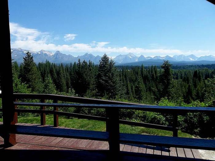
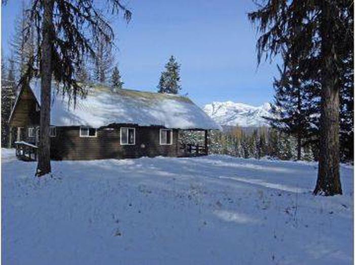
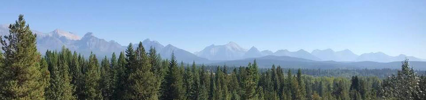
Schnaus Cabin is located near the Wild and Scenic North Fork of the Flathead River, in the Flathead National Forest. It can host up to 12 guests for a scenic, peaceful mountain vacation. The rustic dwelling provides a superb setting for fishing, hiking, bird watching and much more in the Whitefish Mountains.
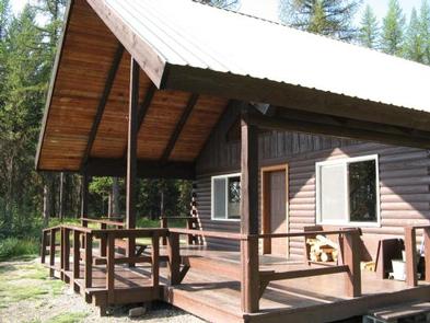
The fully accessible cabin can be reached via vehicle and a parking area is located outside the cabin. Guests are responsible for their own travel arrangements and safety, and must bring several of their own amenities.
Recreation
Summertime activities include hiking, rafting and fishing. In winter, visitors enjoy cross country skiing and snowshoeing. Bird and wildlife watching are also pleasing pastimes, and guests may see elk, moose or bears in the area.
Facilities
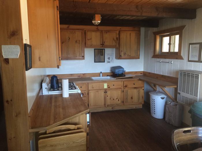
The cabin is equipped with a propane cook stove, heater, lights, a wood stove and accessible vault toilet. Furnishings include two double beds and a bunk bed on the main floor, plus twin beds located in the loft.
No drinking water or electricity is available. Guests should bring plenty of water, bedding, food, flashlights and basic camping gear, among other necessities. Click here for more cabin details.
Natural Features
The cabin sits near a creek and some ponds, a short hike from the North Fork Flathead River. It is surrounded by scattered pine trees and lies within a meadow at an approximate elevation of 3,700 feet, in the Whitefish Range of the Rocky Mountains.
The Glacier View Ranger District is bordered on the east by the North Fork of the Flathead River and Glacier National Park. To the north is Canada and west is the Kootenai National Forest.
Nearby Attractions
Polebridge Mercantile is located seven miles south of Schnaus, offering limited supplies.