STEEL CREEK GROUP CAMPGROUND, ID Campground Reservation, Info, Images, Map, Directions

STEEL CREEK GROUP CAMPGROUND, Idaho Campground Images, Info & Reservations

Directions

From Dubois, Idaho: Travel north on I-15 to the Stoddard Creek Exit (Exit 184). Go east on West Camas-Miners Creek Road (FR 006) for approximately 14 miles to Steel Creek Road (FR 478), turn right and continue 0.75 miles to the campground entrance.

From the Kilgore Store: Travel west/northwest approximately 8.25 miles on the West Camas-Miners Creek Road (FR 006) to Steel Creek Road (FR 478), turn left and continue 0.75 miles to the campground entrance.

Phone

208-270-0094

Activities

BIKING, CAMPING, FISHING, HIKING, HUNTING, WILDLIFE VIEWING, DAY USE AREA

Keywords

STEE,CARIBOU-TARGHEE NF – FS

Related Link(s)

Rec Area Info & Images

Idaho State Road Conditions

Idaho State Tourism

Overview

Steel Creek Group Campground is located 35 miles northeast of the town of Dubois, Idaho, and 9 miles northwest of Kilgore. Visitors come to the area to enjoy the abundance of trails, wildlife viewing opportunities and scenic beauty.

Recreation

Hiking, hunting, fishing, mountain biking and ATV riding are popular activities in area.

Facilities

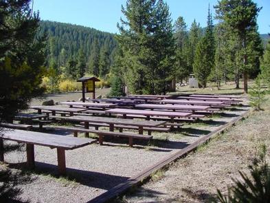
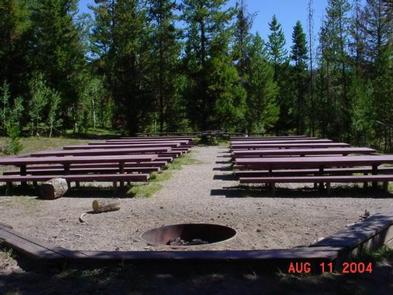
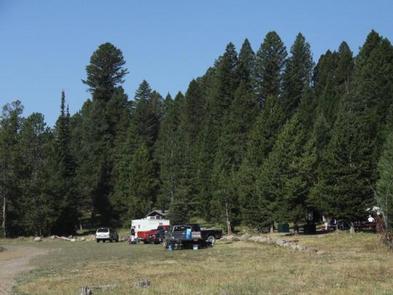
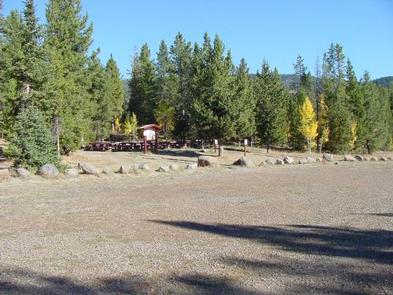
The campground contains one large accessible group site that can accommodate up to 200 people. A common parking area is adjacent to the dining area. Picnic and serving tables, a grill and campfire circle are provided, as are vault toilets and drinking water.

Natural Features

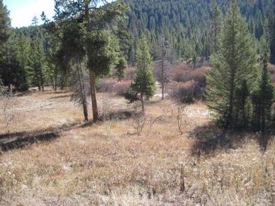
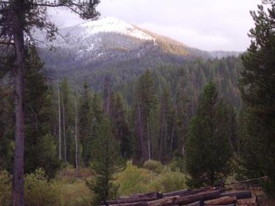
The campground offers picturesque views of the surrounding mountains and is situated among willow and pine trees adjacent to a small stream. A variety of wildlife makes its home around the campground.

Nearby Attractions

Phone, gas, and groceries are available in Dubois, Idaho. Minimal services are available in Kilgore, Idaho at the quaint Kilgore Store.

Reservation

More from CampingHiking.net:

FRENCH CREEK, Idaho Campground Images, Info & Reservations

Directions From Boise, Idaho, travel north on Highway 55 for 85 miles to Cascade. Turn west on Old State Highway and go a half-mile to Lakeshore Drive. Turn south and travel 3 miles to West Mountain Road. Turn west and follow the road 5 miles to the campground. Phone 208-382-7400

MUD LAKE CAMPGROUND, Oregon Campground Images, Info & Reservations

Directions From Baker City, Oregon, head north on Highway 30 toward Haines for approximately 10 miles. In Haines, turn left and follow the Anthony Lake Highway signs (turns into Forest Road 73 and Elkhorn Scenic Byway) for 25 miles to the Anthony Lake Recreation Area. Turn right into the campground

BLANCO RIVER GROUP CAMPGROUND, Colorado Campground Images, Info & Reservations

Directions From Pagosa Springs, Colorado, travel 13 miles south on Highway 84, then turn east on Forest Road 656 for approximately two miles. Phone 970-264-2268 Activities CAMPING, FISHING, HIKING Keywords Blanco,Blanco River,Blanc,Blanko Related Link(s) Rec Area Info & Images Forest Service Concessionaire Colorado State Road Conditions Colorado State Tourism Overview

SOUTH JETTY SAND CAMPING, Oregon Campground Images, Info & Reservations

Directions From Florence, Oregon, travel south on Highway 101 for 1 mile to South Jetty Road. Turn right and proceed 1 ½ miles to Goosepasture Staging on the left. Phone 541-271-6000 Activities CAMPING, FISHING, WILDLIFE VIEWING, BEACHCOMBING Keywords STJY,GOOSEPASTURE,FLORENCE,ODNRA,OREGON DUNES,Sand Dunes,Sand camps,South Jetty ODNRA,SIUSLAW NF – FS Related Link(s) Rec