SPANISH CREEK CAMPGROUND, CA Campground Reservation, Info, Images, Map, Directions

SPANISH CREEK CAMPGROUND, California Campground Images, Info & Reservations

Listen

Directions

From Oroville, travel east on Highway 70 for 75 miles. The turnoff to the campground is two miles past Highway 89. From Quincy, travel west on Highway 70 for 8 miles. Campground is across the Spanish Creek bridge.

Phone

530-283-0555

Activities

CAMPING, FISHING, HIKING, WATER SPORTS, SWIMMING SITE

Keywords

SPNC,Feather River Canyon,Plumas County,Feather River NF – FS,SPANISH CREEK CAMPGROUND,Spanish,Spanish Creek Campground

Related Link(s)

Rec Area Info & Images

California State Road Conditions

Forest Service Concessionaire

California State Tourism

Overview

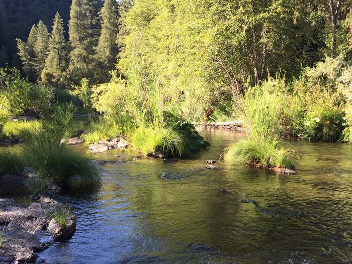
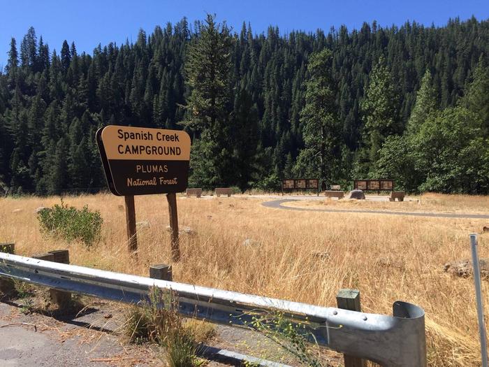
Spanish Creek Campground is located on Highway 70 just east of the Highway 89 intersection; just east of where Banish Creek and Indian Creek merge together to create the east branch of the North Fork Feather River. The campground is right on Spanish Creek with a very popular swimming hole. Although the campground has been recently upgraded, it still holds the charm that it did in years past.

Recreation

Anglers enjoy a healthy supply of rainbow trout in the nearby Feather River, which is within walking distance from the campground. The river and nearby Spanish Creek are also popular for swimming and wading activities.

Facilities

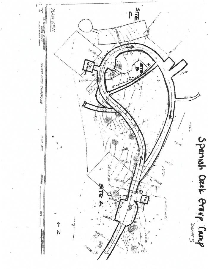
Spanish Creek campground offers several single-family campsites that accommodate both tent and RV camping, however hookups are not available.

Each site is equipped with tables and campfire rings with grills. Vault toilets and drinking water are also provided. A full-service store, gas and phone service is available less than 10 miles away.

Natural Features

This campground is located in the Plumas National Forest, which is attractive to outdoor enthusiasts because of its many streams and lakes, beautiful deep canyons, rich mountain valleys, meadows, and lofty peaks. Spanish Creek is in the Feather River Canyon, at an elevation of 2,000 feet.

Nearby Attractions

Within the Plumas National Forest, Spanish Creek campground is just a few short miles from Indian Falls. This is one attraction not to miss. Some have said that the mist created by the falls resembles a feather — thus naming the Feather River. Just southeast on Highway 70 from Spanish Creek Campground is the quaint high Sierra town of Quincy. We recommend walking around the town if you get a chance. Very close to the campground is the Butterfly Valley Botanical Area. This is also a neat spot to explore. Before you get to the town of Quincy you will pass the Mount Hough Ranger District – a wonderful stop to discover more information about local area attractions.

Reservation

More from CampingHiking.net:

TWIN KNOBS CAMPGROUND, Kentucky Campground Images, Info & Reservations

Listen Directions Coming from Lexington, Kentucky, on I-64, take exit 133. Turn right at the top of the exit ramp to proceed south on KY-801. Proceed 8.4 miles on 801. The campground entrance is on the right. Phone 606-780-7818 Activities BIKING, BOATING, CAMPING, INTERPRETIVE PROGRAMS, FISHING, HIKING, WATER SPORTS, WILDLIFE

TIE FLUME, Wyoming Campground Images, Info & Reservations

Listen Directions From Dayton, Wyoming: Travel 26.5 miles west on U.S. Highway 14 to Burgess Junction. Take a left and continue 5 miles south on U.S. Highway 14, then turn east (right) onto Forest Road 26. Travel about 2 miles to the junction with Forest Road 16, where the campground

TETILLA PEAK, New Mexico Campground Images, Info & Reservations

Listen Directions From Albuquerque, New Mexico, take I-25 north to exit 264. Travel west on State Road 16 to the Tetilla Peak Recreation Area/La Bajada Village turnoff and follow the paved road into the recreation area. Phone 505-465-0274 Activities BOATING, CAMPING, FISHING, HIKING, SWIMMING SITE Keywords TPEA,COCHITI LAKE Related Link(s)

LONE BRANCH, Tennessee Campground Images, Info & Reservations

Listen Directions From Nashville, TN, take I-40 East to exit 229-B/Golden Bear Gateway. Continue straight on Golden Bear Gateway for approximately 9 miles. Entrance to the recreation area will be on your left just passed Cedar Creek Club. * Golden Bear Gateway turns into Benders Ferry Road at the US-70/Lebanon

REUNION FLAT, Wyoming Campground Images, Info & Reservations

Listen Directions From Driggs, Idaho, travel 9 miles east. Turn east at the Key Bank on Little Avenue and follow the road to the forest boundary. Turn right on Forest Road 009 and go 3 miles to the campground. Phone 208-270-0150 OR 541-351-1182 Activities BIKING, CAMPING, FISHING, HIKING, WILDLIFE VIEWING

WILBORN CREEK (GROUP CAMP), Illinois Campground Images, Info & Reservations

Listen Directions From Sullivan, Illinois, go west on State Route 121 for 5 miles. Turn left on County Road 5 and drive 3.5 miles, then make a right on County Road 18 and drive 0.75 miles to the campground. Phone 217-774-3951 Activities BOATING, CAMPING, FISHING, SWIMMING SITE Keywords WCGC,LAKE SHELBYVILLE,WILBORN