


Directions
Access depends on weather conditions. The road is normally plowed within 14 miles of the cabin.
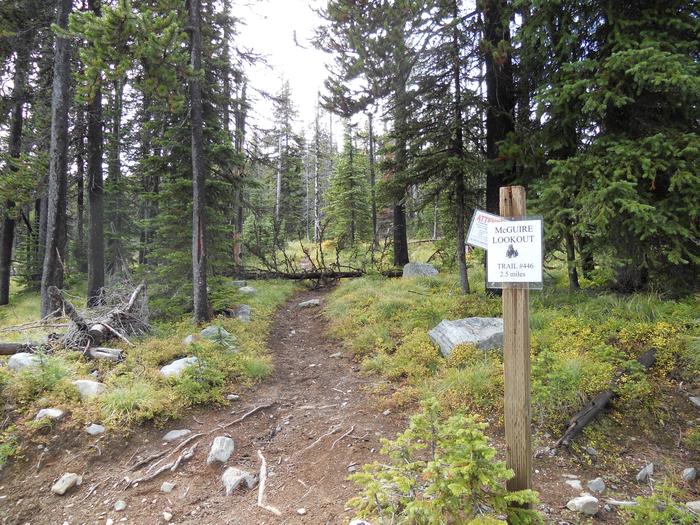
McGuire Mountain is located approximately 14 miles southwest of Eureka and may be reached by taking Othorp Lake Road 854. Stay on this road to Pinkham Creek Road 856 and continue for approximately 13 miles. Turn and follow Sutton Ridge Road 494 west to Little Sutton Mountain, where you will see a sign marking the beginning of the lookout trail.
Park all vehicles and continue from the trailhead to your destination approximately 2.5 miles up trail #446.
Phone
406-296-2536
Activities
CAMPING, HIKING, HUNTING, WILDLIFE VIEWING, FIRE LOOKOUTS/CABINS OVERNIGHT
Keywords
MCGU,MCGUIRE MTN LOOKOUT RENTAL,KOOTENAI NF – FS
Related Link(s)
Overview
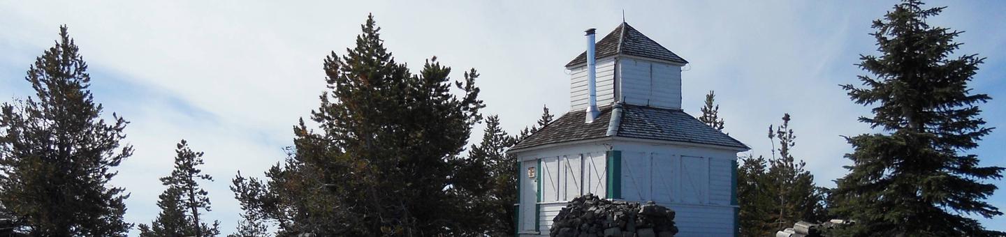
McGuire Mountain Lookout was originally constructed in 1923 and was actively used as an observation point for detecting forest fires for over 20 years before it was abandoned around 1944. The structure was later renovated between 1983 and 1998 and is now available for rent for up to four people.
McGuire Mountain is located approximately 14 miles southwest of Eureka. Access to the lookout requires a 2.5 mile hike from the parking area at Little Sutton Mountain; visitor arrival is dependent on road and weather conditions.
Recreation
Backpacking opportunities abound in the area surrounding McGuire Mountain. Take trail #446 past the lookout and enjoy many more miles of scenic views.
A day trip to Koocanusa Reservoir offers visitors the option of biking, fishing, hiking or boating around the lake. Trail #90, which starts just off of the Koocanusa Reservoir on Hwy 37, follows McGuire Creek closely for a scenic hike along the water.
Because the McGuire Lookout is surrounded by windows on top of one of the area’s tallest summits (almost 7,000 feet), visitors have the best views of the sunrise and sunset over the surrounding cabinet mountains.
Facilities
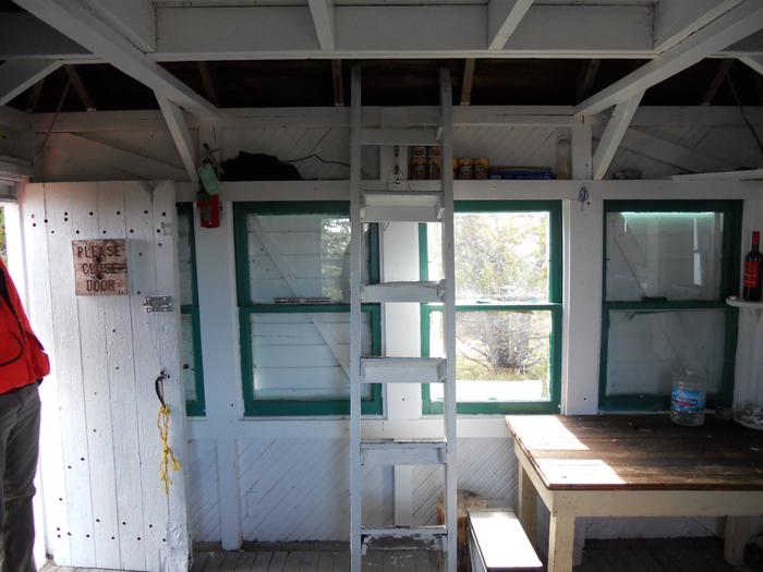
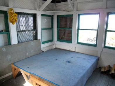
The lookout is a 12 x 12 foot wood-frame cabin with a pyramidal-shaped roof. On top of the roof there is a pyramidal-shaped cupola and a wooden ladder inside the cabin leading up to it. Windows completely surround the structure, providing a 360-degree view of the surrounding area.
The rustic-style cabin is not wired for electricity. The main room is equipped with a modern wood stove, 2 twin size bed boards (no mattresses), a table, a bench, a shovel, a bucket and cleaning gear. Firewood is provided, but the supply cannot be guaranteed.
There is no water available at the lookout and water sources in the area are limited. There is a toilet provided outside the lookout. Guests are advised to bring plenty of their own drinking water.
In addition to water, several supplies are needed to ensure a comfortable stay. Sleeping bags and pads, cooking equipment, toilet paper, lanterns, food supplies and matches are recommended.
Natural Features
The McGuire Mountain Lookout is located in the Rexford Ranger district within the Koocanusa Area, which is primarily centered along the narrow 90-mile Koocanusa Reservoir, formed by the Libby Dam.
The Koocanusa Reservoir is the major recreation attraction in the area and contains a large and stable population of Kookanee salmon, Kamloops (rainbow) trout, bull trout, West slope cutthroat trout and burbot.
The Koocanusa Area is the perfect setting for year round recreational attractions, including: fishing, water sports, rock and ice climbing, and driving for pleasure, especially during the fall Western Larch color change.
Nearby Attractions
Two paved highways running adjacent to the reservoir and extending from Eureka to Libby have been designated by the Forest Service as a Scenic Byway.
Traffic is light and views along the roadways are memorable, including glimpses of the Ural-Tweed Big Horn Sheep herd, located on the eastern side of the reservoir along Hwy 37.