
Directions
From CA State Highway 96 in Happy Camp, turn south on to Elk Creek Road. Drive across the river bridge then follow Elk Creek Rd approx. .5 mile to Curly Jack Rd. Turn right on to Curly Jack Rd., and drive .3 miles to campground entrance.
Phone
530-493-2243
Activities
CAMPING, FISHING, HIKING, WILDLIFE VIEWING, SWIMMING, WHITEWATER RAFTING
Keywords
CURJ,KLAMATH NF – FS
Related Link(s)
California State Road Conditions
Overview
Curly Jack Campground is situated along the Klamath Wild and Scenic River near the town of Happy Camp. Visitors enjoy whitewater boating and fishing on the river, and exploring local hiking trails.
Recreation
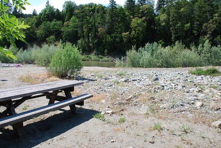
Fishing, birding, hiking and whitewater boating are popular options, as is scenic driving along the State of Jefferson Scenic Byway. Visitors can access a Class III section of the Klamath River from the campground. The campsite is a put-in and take-out point for whitewater rafting – boats must be carried across a gravel bar.
Facilities
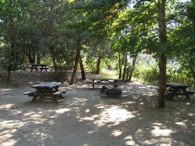
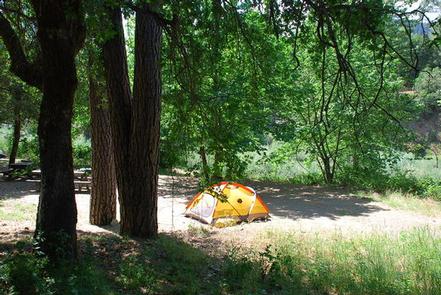
The campground offers shaded single family sites, as well as four group sites that can accommodate up to 30 people each. Many sites have a view of the river. Group sites feature a general area for dispersed tent camping and a large gravel parking area for extra vehicles and trailers.
Natural Features
The campsground sits at an elevation of 1,075 feet on the banks of the Klamath River opposite the town of Happy Camp. The Klamath National Forest is comprised of a vast array of mountains, streams and lakes straddling the California and Oregon border. The nearly 2-million acre forest includes five wilderness areas, one scenic byway, 200 miles of wild and scenic river and 1,100 miles of hiking and equestrian trails. Elevations range from 450 to 8,900 feet, making for varied topography and diverse plant and animal life.
Nearby Attractions
The campground is within walking distance to the town of Happy Camp, where there are restaurants and a grocery store. A whitewater rafting outfitter and several fishing guides are based in Happy Camp.