NANCYTOWN GROUP CAMPGROUND, GA Campground Reservation, Info, Images, Map, Directions

NANCYTOWN GROUP CAMPGROUND, Georgia Campground Images, Info & Reservations

Directions

From Interstate 85 in Georgia, merge onto Interstate 985 via exit 113. Interstate 985 will eventually become State Highways 441/365. Continue north for about 5 miles to Cornelia, then take the Clarkesville/Highway 197 exit and turn right. Turn right again at Dick’s Hill Parkway. Continue approximately a mile and turn left onto Lake Russell Road.

Phone

706-754-6221

Activities

BIKING, BOATING, HISTORIC & CULTURAL SITE, FISHING, HIKING, HUNTING, DAY USE AREA

Keywords

NANC,LAKE RUSSEL GROUP CAMPING,CHATTAHOOCHEE-OCONEE NF – FS

Related Link(s)

Rec Area Info & Images

Georgia State Road Conditions

Georgia State Tourism

Forest Service Concessionaire

Overview

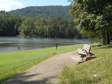
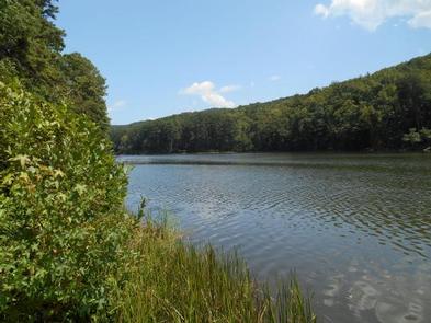
Nancytown is an excellent spot for families, fishermen and picnickers to get away and enjoy the outdoors.

Recreation

Visitors to the area enjoy river and stream fishing. The area has multiple opportunities for anglers and is a great place to catch trout. Boating is also popular on Nancytown Lake.

The short and scenic Nancytown Trail begins at the nearby dam and circles the lake. The campground also has access to the 6.2-mile Ladyslipper hiking and horseback riding trail, as well as the Sourwood foot trail, which is a 2.7-mile hike to several waterfalls.

Facilities

The day use sites offers multiple sites. The area is entirely contained and is gated for security from sunset to sunrise daily. Day use fees apply 365 days a year.

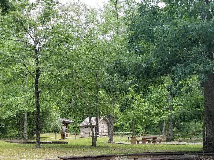
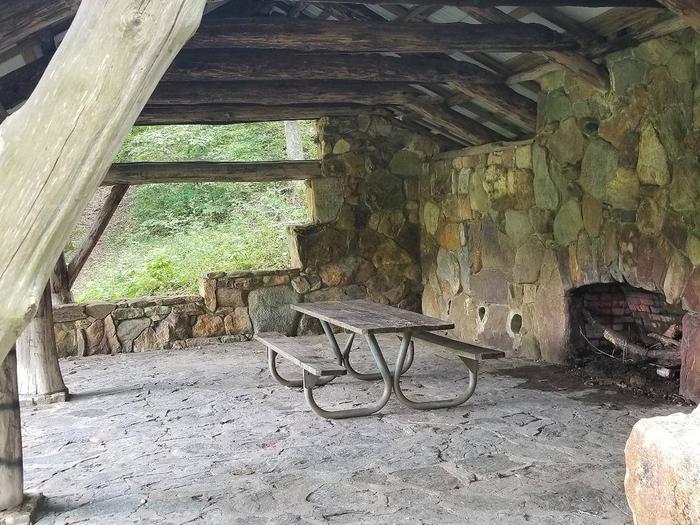
Each site is equipped with tables and grills. Accessible vault toilets is available, as well as a group cooking and eating area and a covered stone shelter containing a large picnic table, grill and fireplace.

Natural Features

The day use site is situated in the southeastern portion of the Chattahoochee National Forest, at the northern point of Georgia. It is adjacent to Nancytown Lake, which drains into the much larger Lake Russell.

Nearby Attractions

Nancytown Day Use is located adjacent to, but not a part of the Lake Russell Wildlife Management Area, near Cornelia, Georgia.

Reservation

More from CampingHiking.net:

NORTH SHORE PICNIC AREA, Idaho Campground Images, Info & Reservations

Directions From Stanley, Idaho, take State Highway 75 south for 4 miles. Turn west onto Forest Road 214 at the Redfish Lake sign and travel approximately 2 miles. Turn right at the North Shore Picnic Area entrance sign. Phone 928-537-8888 Activities BIKING, BOATING, CAMPING, FISHING, HIKING, HORSEBACK RIDING, WATER SPORTS,

WATAUGA POINT RECREATION AREA, Tennessee Campground Images, Info & Reservations

Directions From Elizabethton, take US 19E/321 south for five miles to Hampton. Turn left on US 321/TN 67 south for six miles, then turn left into Watauga Point.  Phone 423-735-1500 Activities BOATING, FISHING, HIKING, KAYAKING, CANOEING, STAR GAZING, NON-MOTORIZED BOATING, WATER ACCESS, SCENIC DRIVE Keywords WATAUGA POINT RECREATION AREA PAVILION

INDIAN CELINA LAKE, Indiana Campground Images, Info & Reservations

Directions From St. Crois, Indiana, travel south on State Route 37 about 2 miles to the Indian-Celina Recreation Area sign. Turn right and continue to the campground. Phone 812-843-4880 Activities BOATING, HISTORIC & CULTURAL SITE, CAMPING, HIKING, HUNTING Keywords INDL,HOOSIER NF – FS Related Link(s) Rec Area Info & Images

SHELL CREEK, Wyoming Campground Images, Info & Reservations

Directions Located 32 miles east of Greybull, Wyoming, on U.S. Highway 14. Turn off onto Paintrock Lakes Road (Forest Road 17). Shell Creek Campground is 1.5 miles from the turnoff. Phone 406-587-9054 Activities BIKING, CAMPING, FISHING, HIKING, HORSEBACK RIDING, WILDLIFE VIEWING Keywords SHEL,BIGHORN NF – FS Related Link(s) Rec Area