POCKET PICNIC SHELTER, GA Campground Reservation, Info, Images, Map, Directions

POCKET PICNIC SHELTER, Georgia Campground Images, Info & Reservations

Directions

From I-75, take Exit 320 (LaFayette/Resaca) and head west on Georgia State Route 136 for approximately 14 miles. Turn left onto Pocket Road and continue approximately 7 miles. The recreation area is on the left. The second driveway leads to the picnic shelter.

Phone

706-695-6736

Activities

HISTORIC & CULTURAL SITE, CAMPING

Keywords

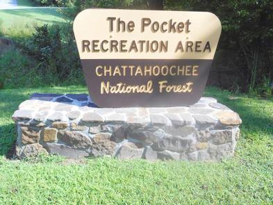
POCK,Pocket Recreation Area,CHATTAHOOCHEE-OCONEE NF – FS

Related Link(s)

Rec Area Info & Images

Georgia State Tourism

Georgia State Road Conditions

Overview

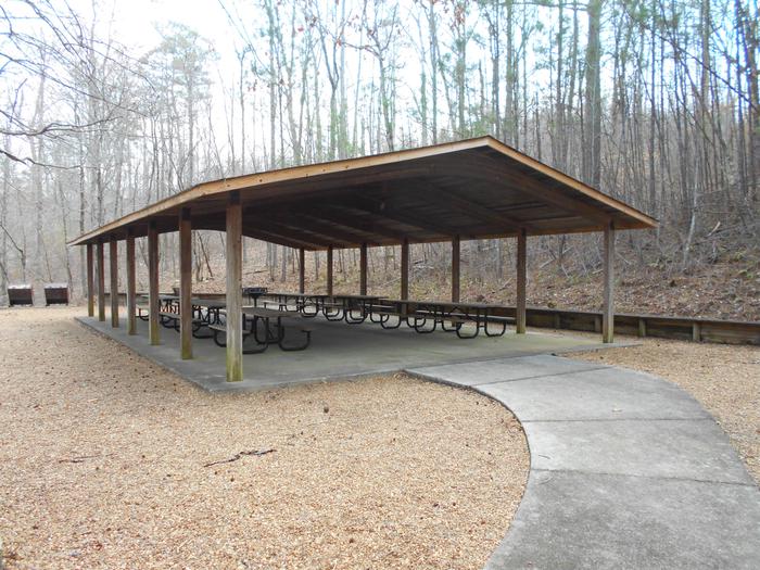
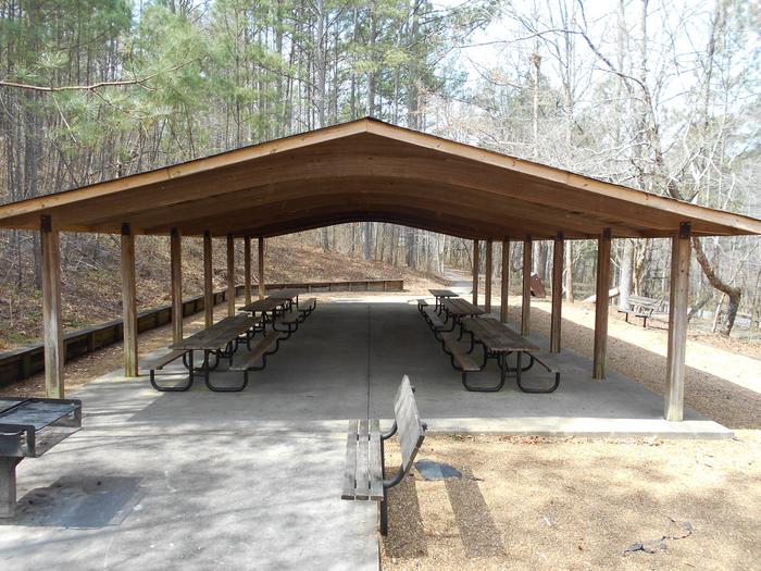
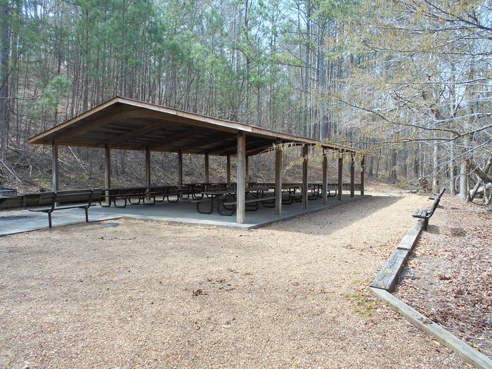
Pocket Picnic Shelter is a popular location for large groups that want to enjoy a secluded area. The densely forested area was a Civilian Conservation Corps camp from 1938 to 1942. Some remains of the old camp are still visible in the area.

Recreation

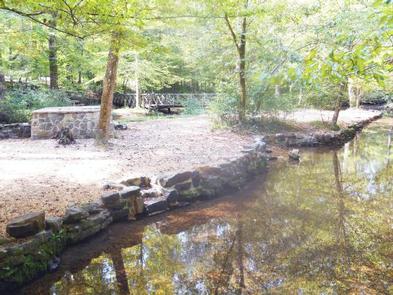
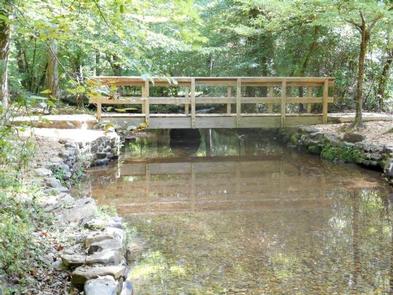
Visitors enjoy the 3.5-mile Pocket Foot Trail that loops between the picnic area and a nearby campground. Interpretive signs are placed along the route, including a brief description of the area. It is a relatively wide path and a nice, easy walk.

Facilities

The accessible picnic shelter is available for group use with a reservation. If the area is not reserved, it is available on a first-come, first-served basis. The facility can accommodate up to 75 people and 20 vehicles.

The site is equipped with tables and grills. Accessible vault toilets are also provided. Drinking water is available across the parking area, in the main picnic area.

Natural Features

The picnic shelter is located off the Ridge and Valley Scenic Byway. The area is named for its unique geology formed when water-soluble limestone was eroded over time, dropping the ground level. The surrounding ridges, which contain iron ore are filled with pockets.

Nearby Attractions

The closest town is Dalton, Georgia, which is about 25 miles east of the picnic area. Dalton has numerous grocery stores, restaurants and gas stations available.

Reservation

More from CampingHiking.net:

CHRISTIE CAMPGROUND, California Campground Images, Info & Reservations

Directions From Susanville, California, take Highway 36 west for 2 miles to County Road A-1. Turn north and continue 14 miles to the Eagle Lake Recreation Area. Continue past Gallatin Road, the first highway you will come to in the lake basin, and follow the signs to Christie Campground. Located

NOTREBES BEND PARK, Arkansas Campground Images, Info & Reservations

Directions From DeWitt Arkansas, take US-165 south for 8.1 miles. Exit onto State Route 44 east and continue south for 5.3 miles to Tichnor. Take Tichnor Blacktop Road for 10 miles, cross the Arkansas Post Canal Bridge, and turn right onto Wilbur D. Mills Road. Continue for 6.5 miles and

THIRTY MILE, Colorado Campground Images, Info & Reservations

Directions From Alamosa, go west on US 160 to South Fork. Turn northwest on State Highway 149 through Creede. Continue on Highway 149 to mile marker 41, turn west (gravel road) on Rio Grande Reservoir Road and continue for 12 miles to Thirty Mile Campground. Phone 719-658-0829 Activities CAMPING, FISHING

WOODRING DAY USE AREA SHELTER, Georgia Campground Images, Info & Reservations

Directions From Atlanta: Take Interstate 75 North until Exit 293, turn right onto Georgia Highway 411 North, travel approximately 30 miles; take a right onto Georgia Highway 136 East; proceed across railroad tracks; turn left onto Old Highway 411 North, continue approximately six (6) miles and turn right onto Highway

SITKOH LAKE (EAST) CABIN, Alaska Campground Images, Info & Reservations

Directions Accessible mid-April through October. Located 35 air miles northeast of Sitka on the southeast side of Chichagof Island, about 30 minutes by floatplane. Also accessible by boat (3-4 hours from Sitka) from Sitkoh Bay, then follow the Sitkoh Lake Trail (in poor condition) 4.3 miles to the cabin. For

DALE HOLLOW LAKE – PRIMITIVE CAMPING, Tennessee Campground Images, Info & Reservations

Directions Camping locations are dispersed throughout Dale Hollow Lake. Reference primitive camping map or site details for information on how to get to the specific site. Mailing and contact information is for the Resource Manager’s Office. Phone DALE HOLLOW LAKE RESOURCE MANAGERS OFFICE-931-243-3136. SHERIFF’S DEPARTMENT EMERGENCY CONTACTS: CLAY COUNTY 931-243-3266