
Directions
From Columbia Falls, Montana, follow State Route 486 north for approximately 20 miles to the campground entrance on the right. The road is pavement for 10 miles and gravel for approximately 9 miles. An alternate route through Glacier National Park would be to enter the park through West Glacier. Take Glacier Route1 Rd/Going to the Sun Rd for 2 miles. Turn left onto Camas Rd for 11 miles. Turn left onto North Fork Rd for 2.7 miles of gravel. Campground will be on your left.
Phone
(406) 752-7924 FOR RESERVATIONS CALL: 1-877-444-6777
Activities
BIKING, BOATING, CAMPING, FISHING, HIKING, WILDLIFE VIEWING
Keywords
BCCG,BIG CREEK,FLATHEAD NF – FS
Related Link(s)
Overview
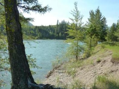
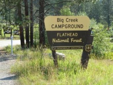
Big Creek Campground lies in the expansive Flathead National Forest in northwestern Montana. Visitors can enjoy access to the Flathead River as well as the countless other recreational opportunities provided by the surrounding forests.
Recreation
Visitors enjoy the ample fishing and floating opportunities provided by the river. Trout are a popular catch amid the calm flow of the water. Boating is also an excellent pastime, as the river is perfect for floating, rafting and canoeing.
Across from the campground is the Glacier Institute’s Big Creek Outdoor Education Center, which provides learning opportunities for visitors of all ages. Programs offered include seminars and guided hikes, which point out the diverse natural and cultural resources of the Glacier National Park and the Crown of the Continent Ecosystem.
Facilities
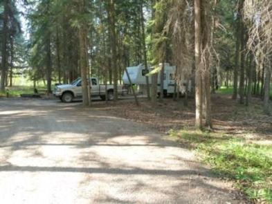
The campground offers several accessible individual campsites for tent and RV camping. Each has convenient access to the river and is equipped with tables and campfire rings with grills.
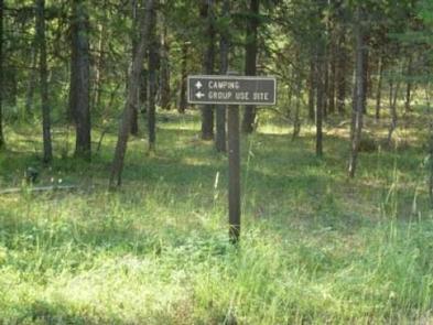
A group camping area is nestled in the middle of the campground and can accommodate up to 200 guests. Campfire circles and group picnic areas are also available.
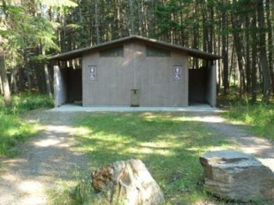
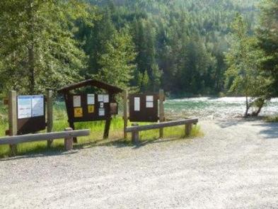
Accessible vault toilets and drinking water are provided. The water is in 2 locations and are hand pumps. They are not for filling your RV so please come with your water full.
Natural Features
In the heart of the Rocky Mountains, west of the continental divide and just south of the Canadian border, lies the 2.4 million acre Flathead National Forest.
Home to lynx, grizzly bear, and bull trout and with numerous lakes, streams, and rivers to enjoy, the forest is a premiere destination for visitors.
The campground sits along the North Fork of the Flathead River, which begins in Canada and joins a couple other forks before depositing into Flathead Lake. It is a forested area of mature pine and fir trees that provide a sparse understory at an elevation of 3,300 feet.
Nearby Attractions
Big Creek Campground is just a few miles from the Camas Creek entrance to the Glacier National Park. Columbia Falls, along the North Fork of the Flathead River, is located 19 miles south of the campground.
Charges & Cancellations
Cancellations made within 14 days of arrival will be “considered” for a refund, by the concessionaire, of Camping fees only and will automatically forfeit the first nights fee. Day of Arrival cancellations must be turned in by calling 1-877-444-6777, then followed up with a call to Cheryl at 406-752-PWAI (7924) or 406-404-4164 to get the information to the campground and to be considered for any refund.