Directions
For security purposes, access to the cabin is through a locked gate; Doors to the cabin are also locked. The combination to the gate lock will be included in your confirmation letter. This same combination will open a security box by the main cabin door, which contains the cabin key. Please contact the Ranger District at 509-653-1401 prior to your arrival at the cabin for current restrictions or conditions, such as fire or road closures, or weather that may affect the quality of your visit. Located off State Route (SR) 410 near milepost 88. From Naches, WA travel west on US Highway 12 for 4.4 miles. Continue straight onto SR 410 W for 27.5 miles. Turn left onto Bumping River Rd / Forest Road 1800. Cross the bridge over American River, then turn left onto the American Forks Campground Road¦ From Enumclaw, WA depart SR 164/Griffin Ave toward Wells St. After ½ mile turn left onto SR 410/Roosevelt Ave. Follow SR 410 approximately 66 miles east to the intersection with Bumping River Road (FR 1800). Turn right onto the American Forks Campground Road¦ The cabin and access road will be on the left shortly after turning onto the campground road. Up to 4 passenger vehicles may be parked at the guard station site. Additional cars and recreational vehicles may be accommodated in the nearby overflow parking off Bumping Road 1800. Major roads accessing the cabin from Naches are plowed in the winter.
Phone
(509) 653-1401 AFTER HOURS VOICEMAIL (509) 653-1436
Activities
FISHING, WILDLIFE VIEWING, BIRDING
Keywords
ARGS,Guard Station,Bumping Guard Station,American Guard Station,OKANOGAN – WENATCHEE NF -FS
Related Link(s)
Washington State Road Conditions
Overview
American River Guard Station is located about 40 miles west of Naches, Washington on the banks of the American River in the eastern Cascade Mountains.
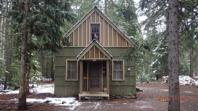
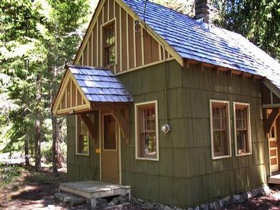
The rustic cabin and outhouse were built by the men of the 932nd Camp Naches Civilian Conservation Corps crew in 1941 as a summer residence and work site for fire patrol and recreation management personnel.
In the 1970s, volunteers and permit holders sporadically used the cabin, until it was found eligible to be listed on the National Register of Historic Places in 1999.
Today, the cabin, which is located in the heart of the central Cascades recreation area in eastern Washington off the scenic Mather Memorial Parkway, offers visitors a wonderful setting for year-round recreation and relaxation.
Recreation
The cabin setting provides ready access to Bumping Lake, where boating and fishing are popular. Hiking and horseback riding trails extend into the William O. Douglas and Norse Peak Wilderness areas, and off-road vehicle and snowmobile access draws visitors to the Little Naches drainage. In winter, snow-shoeing and cross-country skiing are popular in the American River area. The cabin is also conveniently located 30 minutes below the summit of Chinook Pass and Mt. Rainer National Park . A trip along the scenic Mather Parkway is a fantastic outing. The American River, adjacent to the cabin, offers a scenic backdrop for anglers. Its cold, clear waters sustain populations of rainbow and brown trout. Whitewater enthusiasts may enjoy a paddle on the American River or one of its tributaries.
Facilities
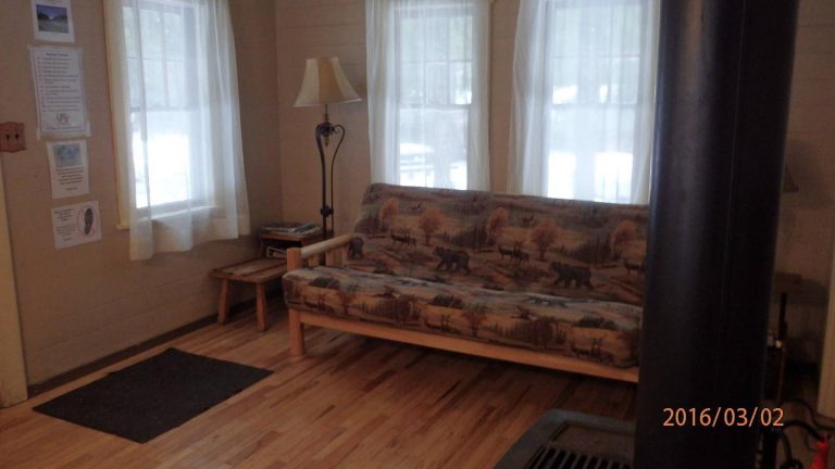
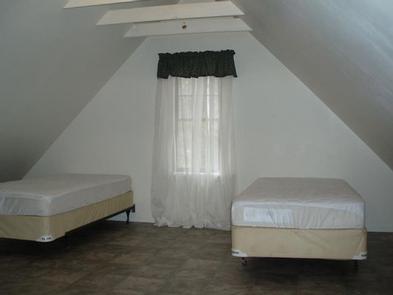
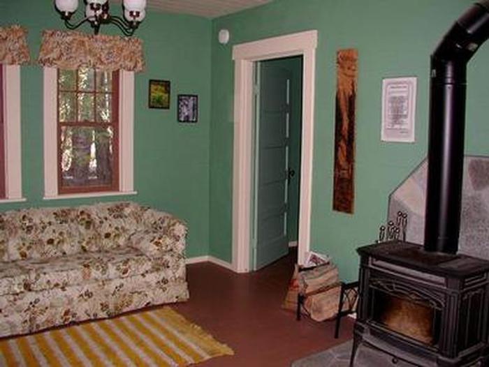
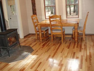
The Depression-era rustic cabin is one and a half stories tall, with a wood frame and shake roof. It has a small kitchen, a living/sleeping area, one bedroom and a full sized sleeping loft and storage room. There is a queen size sleeper sofa in the living room, a full size bed and mattress in the bedroom and four twin size beds with mattresses in the upstairs loft. Sleeping bags and sleeping pads are not provided. The cabin is furnished with a dining table and chairs for four people (with hidden leaf to expand for eight people), a small refrigerator and an electric range. There is a wood stove, electric light fixtures and a living room electric baseboard heater. Guests should be aware that open flame devises such as propane stoves, gas lanterns, and candles are prohibited indoors. The kitchen is equipped with a coffee maker, pots, dishes and glassware, but guests must bring several of their own supplies including food, cooking utensils, dish soap, towels, matches, garbage bags and a first aid kit. Outside, near the cabin, there is a picnic table and campfire ring. The original two-seater outhouse has been restored. Wood may be available, but the supply cannot be guaranteed. There is no water at the cabin, therefore visitors must bring plenty for drinking, cooking and washing. In the summer, drinking water can be obtained from the nearby Cedar Spring Campground. The cabin contains a variety of cleaning supplies. Visitors must remove all food and garbage, and clean the cabin prior to departure. In the summer, waste disposal is provide by a dumpster in the nearby American Forks Campground. When the campground is closed for the season, visitors must “pack it in and pack it out.”
Natural Features
The Okanogan-Wenatchee National Forest is defined by its diverse landscapes, boasting high, glaciated alpine peaks, lush valleys of old growth forest, and rugged shrub-steppe country. The American River Guard Station is nestled in an old-growth forest of Douglas fir, western hemlock, and a cedar understory with grassy areas, ferns and mosses. With the William O. Douglas and Norse Peak Wilderness areas nearby, the location is home to abundant wildlife, including deer, porcupine, native fish, and migratory birds. Endangered and threatened species, including the Northern Spotted Owl, gray wolves and grizzly bears also find havens in local ecosystems. Summer temperatures are generally sunny and warm with little precipitation, and winters boast mostly clear skies, but plenty of snow.
Nearby Attractions
Hikers may want to traverse a portion of the spectacular Pacific Crest Trail (PCT) , one of the world’s premier National Scenic Trails. Enjoy some of North America’s most fantastic scenery, as the trail winds from Mexico to Canada through Washington state. Boulder Cave Trail is one of the most popular places in the Naches District. Visitors can walk the accessible trail along the river or explore Boulder Cave. Interpretive signs along the trail explain the geology, plants, animals and history of the area. Other nearby activities include trails for horseback riding, biking, a lake with motorized and non-motorized access and a boat ramp, and winter opportunities for snowshoeing and xc skiing.

