
Directions
From Albuquerque, drive east on I-40 to Exit 175. Drive south for approximately 4 miles on State Highway 337 (also known as, James McGrane Memorial Highway). Look for the Juan Tomas/242 sign on the east side of the road. Turn left and follow the road until you reach Forest Road 252. Turn left and follow the road for about one mile. Follow the directional signs at the entrance, to Cedro Peak Camping Sites – Robin and Jay.
From the east (Edgewood area) use Exit 175 off I-40. At the bottom of the ramp turn left and go to the light. Turn right at the light. You are now on 333/Old Route 66. Continue until you reach the light at the intersection of State Road 333/66 and State Road 337. Turn left and continue on State Highway 337 for approximately 4 miles on State Highway 337 (also known as, James McGrane Memorial Highway). Look for the Juan Tomas/242 sign on the east side of the road. Turn left and follow the road until you reach Forest Road 252. Turn left and follow the road for about one mile. Follow the directional signs at the entrance, to Cedro Peak Camping Sites – Robin and Jay.
Phone
505-281-3304
Activities
BIKING, CAMPING, HIKING, WILDLIFE VIEWING
Keywords
CDPK,CEDRO CAMPGROUND,CIBOLA NF – FS
Related Link(s)
New Mexico State Road Conditions
Overview
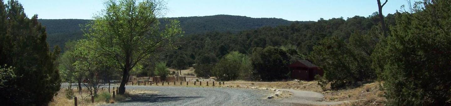
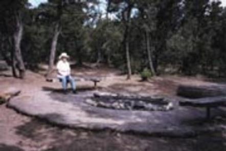
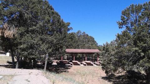
Cedro Peak Camping Sites is a favorite area in the southern portion of the Sandia Ranger District. It is encompassed by ponderosa pine, pinon and juniper trees. Both Cedro Peak camping sites are fully accessible and have plenty of parking. Jay site has a circular turn around drive for those who might bring a small travel trailer.
Recreation
Cedro Peak Camping Sites has room for outdoor games as well as access to the best trail system for mountain biking in the Cibola National Forest. A variety of hiking, mountain biking, horseback riding and off-road vehicle trails connect with the camping area. The region features more than 80 miles of single-track and equestrian trails. Mountain biking trails in the area can accommodate intermediate to advanced riders. The trails offer expansive views of the Sandia Mountains to the north, the Manzanos and the Cedro Peak Camping Site. Limited off-road vehicle trails are available as well.
Please use Leave No Trace ethics when using your public lands.
Facilities
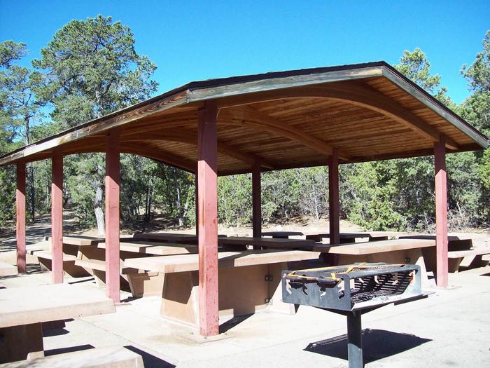
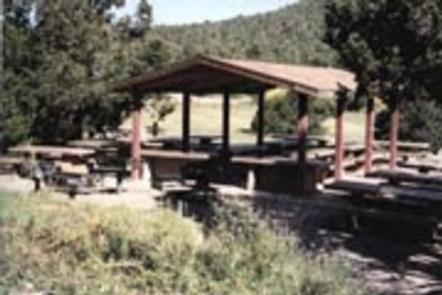
The campground offers two large, fully accessible group campsites.
-Jay can accommodate up to 100 people and 27 vehicles. Rates: $60 for 1-50 people, $80 for 51-75 people, and $100 for 76-100 people.
-Robin can accommodate up to 150 people and 41 vehicles. Rates: $60 for 1-50 people; $80 for 51-75 people, $100 for 76-100 people, $125 for 101-125 people, and $150 for 126-150 people.
Each site is equipped with grills and tables, some of which are covered by picnic shelters. Large campfire circles are also available. Water and electricity, firewood/charcoal are not available at the site. Accessible vault toilets and bear proof trash receptacles are provided. Bears frequent the area; use appropriate containers for food and garbage.
Gate Keys: The gate key, with a refundable $10 deposit, must be picked up at the Sandia Ranger District Office, Monday through Friday between 8 a.m. and 4:30 p.m. There is a key drop box outside the door at the Sandia Ranger District to return your key. Have questions? (505) 281-3304.
Natural Features
The group campground is located in the Manzanita Mountains at an elevation of about 7,400 feet. It is eight miles south off of I-40. The campground is nestled in a pinon pine and juniper forest, amid the arid, hilly landscape.
Charges & Cancellations
There is a $10 non-refundable reservation fee through recreation.gov