
Directions
From Phoenix, Arizona, take I-17 north for 61.8 miles. Take exit 262 toward Cordes Junction/Prescott. Merge onto State Route 69 west and follow for 33.8 miles. At the split, take the ramp for Route 89 south. Turn slight left onto East Gurley Street/89 and follow for about 0.8-mile. Turn left at Mt. Vernon Street and continue for 6.1 miles. The turnoff for the schoolhouse and parking is on the left. Building address is Groom Creek Schoolhouse-64 Senator HWY, Prescott, AZ 86301
Phone
1 (877) 444-6777
Activities
BIKING, HISTORIC & CULTURAL SITE, CAMPING, HIKING, HUNTING, WILDLIFE VIEWING, DAY USE AREA
Keywords
GCSH,GROOM CREEK SCHOOL HOUSE,GROOM CREEK,SCHOOL HOUSE,PRESCOTT NF – FS
Related Link(s)
Overview
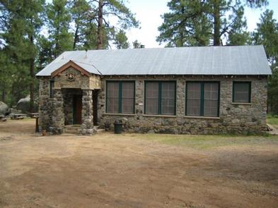
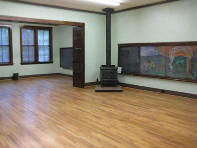
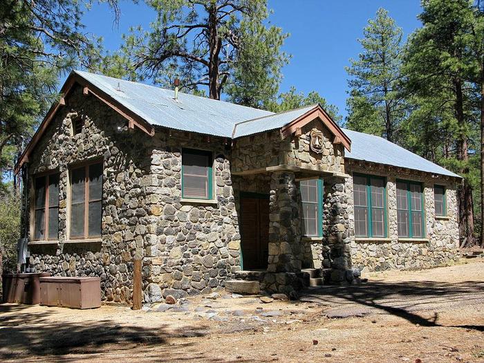
Built in 1902, this historic schoolhouse and adjacent picnic area in Arizona’s Prescott National Forest may be reserved for day use for groups of up to 60 people. The facility offers a picturesque, quiet setting with indoor and outdoor areas for weddings, reunions, luncheons and group meetings.
The schoolhouse served about 10 to 15 children in the early 1900s. The building was an active school until 1952. It is now listed on the National Register of Historic Places and is used for administrative and training purposes. To make reservations click on the availability button to the right to book this site or call 1 (877) 444-6777. For general group site questions contact the Bradshaw Ranger District at 1 (928) 443-8000.
Recreation
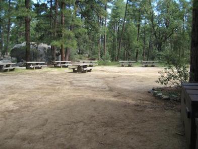
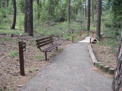
Groups enjoy gathering in the outdoor picnic area during nice weather or heading indoors into the the two-room schoolhouse if the weather turns. A leisurely walk through the forest on the accessible, paved Groom Creek Nature Trail provides a nice afternoon respite, and visitors can camp nearby if desired. Prescott National Forest has miles of hiking, mountain biking and horseback riding trails for visitors wishing to explore the area.
Facilities
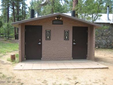
The schoolhouse building has two rooms with new furniture(tables and chairs) for indoor use. The outdoor picnic area is accessible and equipped with 10 picnic tables, vault toilets, an amphitheater (limited access) and parking for 12 vehicles or two buses. No drinking water is available at this site; guests must bring their own.
Natural Features
The group area is set in a ponderosa pine ecosystem, an area dominated by pines and mixed with juniper trees, Gambel oaks and native grasses. A multitude of colorful wildflowers bloom in the spring and during the summer monsoon season. Afternoon thunderstorms are possible from late June through mid-September.
The forest is home to a wide variety of wildlife. Visitors may spot deer, mountain lions, bobcats, coyotes, foxes, rabbits, lizards, snakes and birds.
Nearby Attractions
Upper Wolf Creek Campground is just around the corner if you want to camp overnight. Restaurants, shopping, historic sites and many amenities are nearby in the historic town of Prescott.