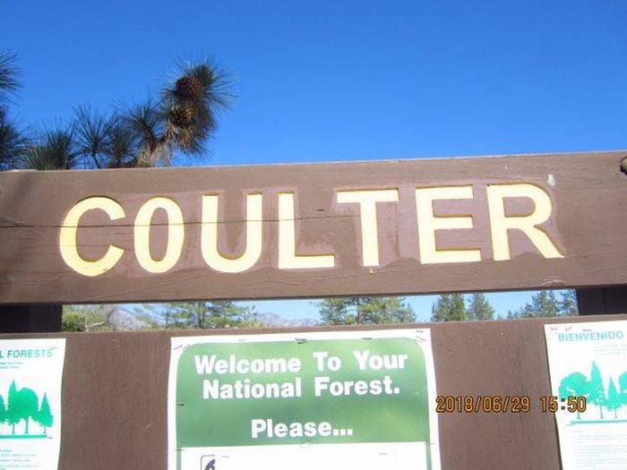
COULTER GROUP CAMPGROUND, CA Campground Reservation, Info, Images, Map, Directions

COULTER GROUP CAMPGROUND, California Campground Images, Info & Reservations

Listen

Directions

From La Canada, CA, at the intersection of I-210 and Angeles Crest Highway (State Rt. 2): Take Rt. 2 east for 25.6 miles to the Chilao Overnight campground sign. Turn left at the sign and go 0.1 miles to a “Y” intersection. Bear left at the “Y” into the Little Pines Loop. Proceed to campsite 18 and turn right on the road blocked by the white gate that goes to Coulter Group Campground. Use the combination you obtained when confirming your reservation to open the gate.

Phone

661-269-2808

Activities

BIKING, CAMPING, HIKING

Keywords

CLTR,ANGELES NF – FS

Related Link(s)

Rec Area Info & Images

California State Tourism

California State Road Conditions

Overview

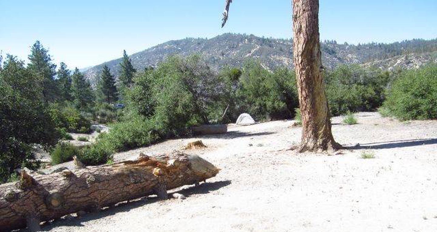
At Coulter Group Campground groups can relax and enjoy the experience of being outdoors without traveling far from the greater Los Angeles metropolitan area. The Angeles Crest Highway, a scenic byway that meanders through oak thickets, chaparral, high desert landscapes and pine tree forests is located nearby.

Recreation

Visitors can explore the Silver Moccasin Trail, open to hiking, horseback riding and mountain biking. The 58-mile trail accesses the extensive Pacific Crest Trail, which stretches from Mexico to Canada.

Facilities

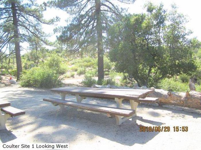
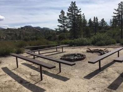
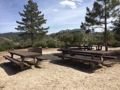
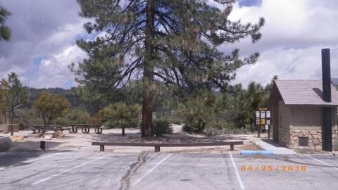
The campground has four group picnic tables, a vault toilet, stoves, a group campfire ring and a water spigot. The maximum RV length is 40 feet.

Natural Features

The campground sits at an elevation of 5,300 feet, less than a mile from the San Gabriel Wilderness. Over 36,000 acres within the Angeles National Forest are designated as the San Gabriel Wilderness Area and have been set aside to preserve their wilderness character.

The area encompasses some extremely rugged terrain, ranging in elevation from 1,600 to 8,200 feet. The lower elevations are covered with dense chaparral which rapidly changes to pine and fir-covered slopes and majestic peaks with glimpses of wildflowers and a variety of wildlife as you enter the upper elevations.

Nearby Attractions

Visit the Chilao Visitor Center, just 1.5 miles east of the campground. The center provides exhibits and interesting information about the region and excellent bird watching opportunities. Visitors can learn about the 10 species of woodpeckers in the area.

Reservation

More from CampingHiking.net:

VIGILANTE CABIN, Montana Campground Images, Info & Reservations

Listen Directions From Sheridan, travel south on Highway 287 for about 10 miles to Alder. Turn south on Ruby River Road and continue about 22 miles to Vigilante Station. The last 20 miles are on a gravel road, which can be slippery when wet or snow-covered. The gate lock code

FORD CABIN, Montana Campground Images, Info & Reservations

Listen Directions From Columbia Falls, travel north on Nucleus Avenue until the road ends at the intersection of Railroad Street. Turn right (east) on Railroad Street. Continue on Railroad Street; it becomes the North Fork Road. Continue north on the North Fork Road for 45 miles. Turn right on Road

ALPINE VIEW CAMPGROUND, California Campground Images, Info & Reservations

Listen Directions From Weaverville: take Highway 3 north for 22.5 miles. Turn right on Guy Covington Road for 2.4 miles to the campground. Phone 530-275-8113 Activities CAMPING, FISHING, HIKING, WATER SPORTS Keywords Trinity Lake,Alpine View Related Link(s) Rec Area Info & Images California State Road Conditions Forest Service Concessionaire California

HOYER, Arizona Campground Images, Info & Reservations

Listen Directions From Show Low, Arizona, take Highway 260 southeast 42 miles to Highway 373. Take Highway 373 south 3 miles to the campground, which is on the right. Phone 928-735-7313 Activities CAMPING, PICNICKING, DAY USE AREA Keywords HOYE,APACHE-SITGREAVES NF-FS Related Link(s) Rec Area Info & Images Forest Service Concessionaire

MIDDLE RIDGE CABIN, Alaska Campground Images, Info & Reservations

Listen Directions Middle Ridge Cabin is located on Wrangell Island, approximately 20 miles from Wrangell, Alaska. There are no roads to Wrangell. Access is by the Alaska Marine Highway or via Alaska Airlines. From Wrangell, head south on Zimovia Highway approximately 11 miles to Pat’s Creek Road (Road 6259) and

CAMPBELL POINT, Missouri Campground Images, Info & Reservations

Listen Directions From Cassville, Missouri, take Highway 76 to Highway 39, then turn southeast onto the Highway YY access road and follow to the campground. Phone 417-858-3903 Activities BIKING, BOATING, CAMPING, FISHING, HIKING, PICNICKING, VISITOR CENTER, WATER SPORTS, WILDLIFE VIEWING, DAY USE AREA, SWIMMING SITE, PHOTOGRAPHY, SWIMMING, RANGER STATION, KAYAKING