Directions
Angeles National Forest 701 N. Santa Anita Ave. Arcadia, CA 91006 (626) 574-1613 M-F 8 a.m. – 4:30 p.m Closed for lunch between 1:00 – 1:30 PM
Activities
BIKING, CAMPING, INTERPRETIVE PROGRAMS, HIKING, HORSEBACK RIDING, OFF HIGHWAY VEHICLE, PICNICKING, RECREATIONAL VEHICLES, VISITOR CENTER, WILDLIFE VIEWING, FIRE LOOKOUTS/CABINS OVERNIGHT, SWIMMING, HORSE CAMPING
Camping Reservations
Reserve your campsite at these camping areas:
LIGHTNING POINT GROUP CAMPGROUND
Hiking Trails
Looking for nice hiking areas to take a hike? Choose from these scenic hiking trails:
Devil’s Canyon (Hwy 2) Trailhead
Mt. Wilson Rd/Eaton Saddle Trailhead
Mt. Baden Powell via Vincent’s Gap
East Fork Day Use Pking Trailhead
Related Link(s)
More California Recreation Areas
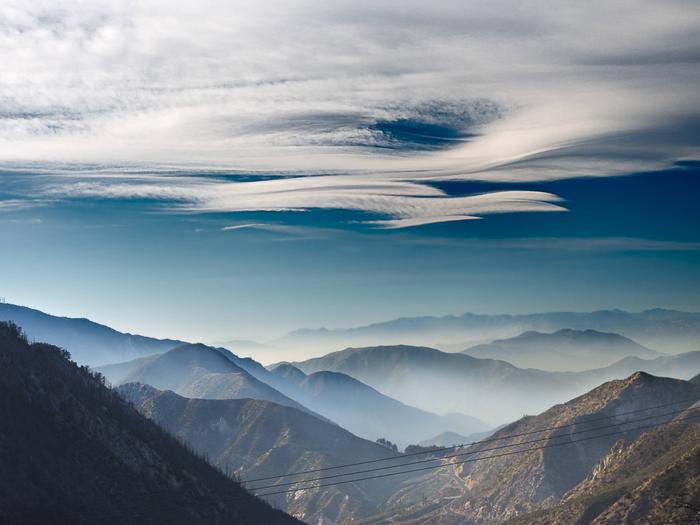
The Angeles National Forest was established by Executive Order in December 1892. It covers about 700,000 acres and is the backyard playground to the huge metropolitan area of Los Angeles. The Angeles manages the watersheds within its boundaries to provide valuable water to southern California and to protect surrounding communities from catastrophic floods. The land within the Forest is as diverse in appearance and terrain as it is in the opportunities it provides for enjoyment. Elevations range from 1,200 to 10,064 feet. Much of the Forest is covered with dense chaparral which changes to pine and fir-covered slopes as you reach the majestic peaks of the higher elevations. The Angeles National Forest offers natural environments, spectacular scenery, developed campgrounds and picnic areas, swimming, fishing, skiing and the solitude of quiet wilderness areas. Trails winding throughout the forest accommodate hikers, equestrians, mountain bikers, and off-highway vehicle enthusiasts.


