BOLAR MOUNTAIN RECREATION AREA, VA Campground Reservation, Info, Images, Map, Directions

BOLAR MOUNTAIN RECREATION AREA, Virginia Campground Images, Info & Reservations

Directions

From Covington, take 220 North to Hwy 39 and turn left on Hwy 39. Take Hwy 39 to Hwy 600 (Bolars Draft Road) and turn left on Hwy 600 to the campground. Turn right on Twin Ridge Drive. To store & marina, stay on Hwy 600 for 1 mile. Store and marina are on the right.

Phone

540-279-4144

Activities

BOATING, CAMPING, INTERPRETIVE PROGRAMS, FISHING, HIKING, HUNTING, WATER SPORTS, WILDLIFE VIEWING, SWIMMING SITE

Keywords

BMRA,LAKE MOOMAW CAMPGROUND,CAMPGROUND ONE,CAMPGROUND TWO,CAMPGROUND THREE,MOOMAW,LAKE MOOMAW,GEORGE WASHINGTON/JEFFERSON NF-FS

Related Link(s)

Rec Area Info & Images

Virginia State Tourism

Virginia State Road Conditions

Forest Service Concessionaire

Overview

Bolar Mountain Recreation Area is a great destination for visitors looking for a fun getaway on Lake Moomaw. The area provides plenty of activities, including boating, fishing and hiking, as well as volleyball and a playground.

Recreation

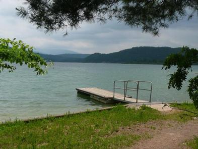
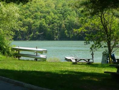
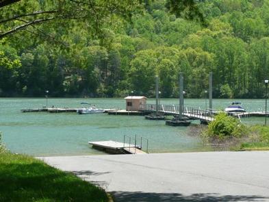
Boating, canoeing, water skiing and relaxing on the beach are popular activities at the lake. Anglers fish for brown and rainbow trout, bass and crappie. A boat ramp is located at the Bolar Flat Marina, which has a modern dock with boat slips.

Bolar Mountain boasts 11 miles of hiking trails that lead to two impressive scenic overlooks: Islands Overlook Spur and Grouse Point Overlook.

Facilities

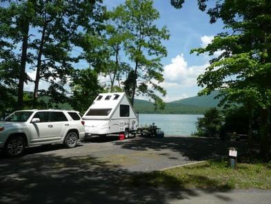
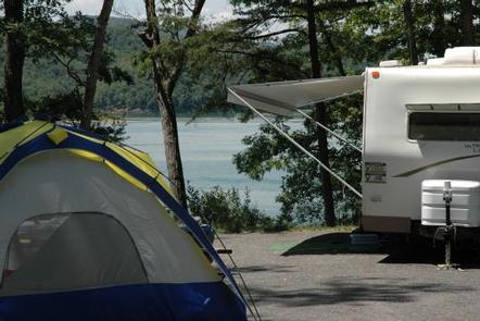
Campsites are divided into three loops, the first of which has many sites with electric hookups. Picnic tables, lantern posts and campfire rings with grills are provided. Drinking water, flush toilets and showers are among the amenities at the campground.

Natural Features

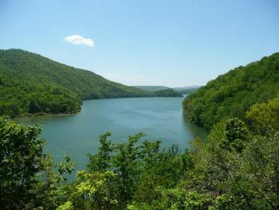
The campground sits on the northern end of Lake Moomaw, a manmade lake covering 2,530 acres along the Jackson River. The lake’s average depth is 80 feet and it has 43 miles of wooded shoreline.

Bolar Mountain is part of the George Washington and Jefferson National Forests which span across Virginia and parts of West Virginia and Kentucky. These forests protect 40 tree species within mostly Appalachian hardwood and mixed pine-hardwood forests, 60 species of mammals and 200 species of birds.

Nearby Attractions

Head to Warm Springs for restaurants, shopping and a visit to the Bath County Historical Society.

Reservation

More from CampingHiking.net:

WILLOW LAKE, Utah Campground Images, Info & Reservations

Directions From Ferron Utah Willow Lake is located approximately 25 miles up Ferron Canyon, on Forest Road 022. From Mayfield Utah Willow Lake is located approximately 27 miles from Mayfield. Head East from up Forest Road 022, turn left on Skyline Drive at 12 Mile Campground then following signage towards

SPRINGFIELD, Georgia Campground Images, Info & Reservations

Directions From Interstate 85 in South Carolina, take exit 11 onto Highway 187 south. Turn on Providence Church Road and follow signs to the park. 1915 PROVIDENCE CHURCH ROAD Anderson, SC 29625 Phone 888-893-0678 Activities BOATING, CAMPING, FISHING, SWIMMING SITE Keywords SPRF,HARTWELL LAKE PROJECT Related Link(s) Rec Area Info &

BEAR CREEK BUNKHOUSE, Montana Campground Images, Info & Reservations

Directions From Ennis, take Highway 287 south for 11 miles, to Cameron, Montana. From Cameron, turn east on Bear Creek Loop and continue approximately 6 miles to the cabin. The last several miles is gravel or dirt, which may be muddy or snow-covered and may not always be plowed. Maps

JORDAN PINES, Utah Campground Images, Info & Reservations

Directions From I-215, take the 6200 south exit and travel a mile east to Wasatch Blvd. Take Wasatch Blvd a mile south to junction with Big Cottonwood Canyon/Highway 190. Make a left at the junction and travel up Big Cottonwood Canyon 9.2 miles to the campground. Phone SALT LAKE RANGER

ASPEN HOLLOW GROUP, California Campground Images, Info & Reservations

Directions From Fresno, California, take Highway 180 east to Grants Grove. Drive approximately 12 miles, then take a right onto Hume Road and continue 4 more miles, passing Christian Camps. Take a right at the Aspen Hollow sign. Go 3/4 mile reaching the entrance of the campground. Phone 559-335-2232 Activities

LADYBIRD LANDING, Oklahoma Campground Images, Info & Reservations

Directions From Porum, Oklahoma, take Highway 71 west for 8 miles, then follow signs to the campground. Phone 918-799-5843 Activities BOATING, CAMPING, FISHING, HIKING, SWIMMING SITE Keywords Dam Site South Related Link(s) Rec Area Info & Images Oklahoma State Road Conditions Oklahoma State Tourism Overview Ladybird Landing Campground sits along