TWIN BRIDGES GROUP SHELTER, TX Campground Reservation, Info, Images, Map, Directions

TWIN BRIDGES GROUP SHELTER, Texas Campground Images, Info & Reservations

Directions

From I-35, take exit 330B Hwy 6 N toward Meridian for about 6 miles. After passing over the lake on the Twin Bridges, take the first exit toward Lake Waco/Speegleville Park. Turn left on the access road and the park entrance will be on the right.

Phone

254-756-5359

Activities

BOATING, CAMPING, FISHING, SWIMMING, WATER ACCESS

Keywords

TBRI,WACO LAKE

Related Link(s)

Rec Area Info & Images

Texas State Tourism

Texas State Road Conditions

Overview

Twin Bridges, located on one of Waco Lake’s sandy beaches, is ideal for families and friends to enjoy picnicking, sightseeing and water activities, all while staying within the Waco city limits.

Recreation

The main lake shoreline has a large amount of submerged timber, which typically holds fish year-round. Anglers will find plenty of catfish, crappie, large and smallmouth bass as well as sunfish. Swimming beaches, boat ramp and dock all help visitors enjoy the lake.

Facilities

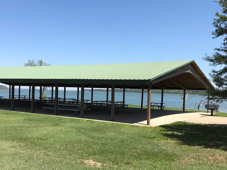
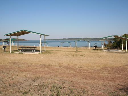
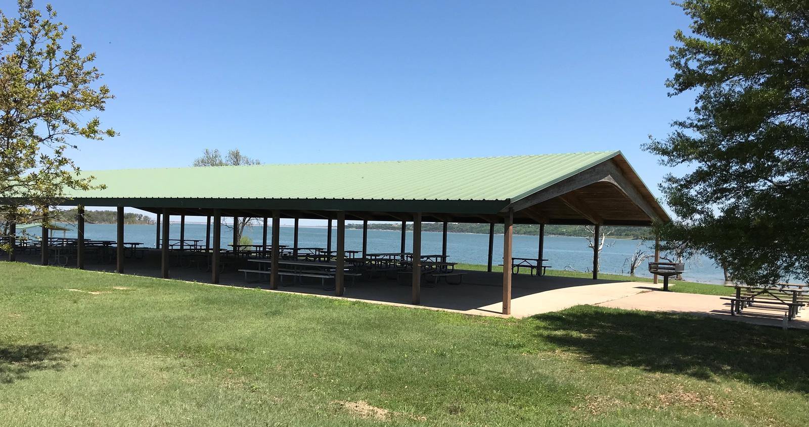
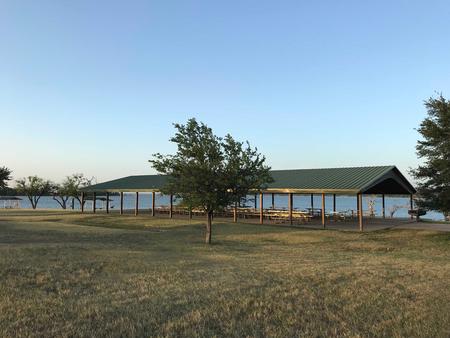
Twin Bridges has two swimming beaches, horseshoe pits, a covered playground and a sand volleyball court. The group shelters can accommodate up to 225 guests.

Natural Features

The shelter is located on the west shore of the Waco Lake. The lake is primarily fed by the Bosque River, which runs for 115 miles through central Texas.

Nearby Attractions

Horseback riding, hiking and biking can be done on the 20-mile Lacy Point Hiking and Biking Trail. The trail is accessible from the Lacy Point boat ramp or Reynolds Creek Park.

Reservation

More from CampingHiking.net:

SAN MIGUEL ISLAND, California Campground Images, Info & Reservations

Directions Boat transportation can be arranged with Island Packers from Ventura Harbor. Air transportation can be arranged with Channel Islands Aviation from Camarillo airport. To park headquarters in Ventura, California: Highway 101, exit Victoria or Seaward to Ventura Harbor. Phone 805-658-5730 Activities BOATING, HISTORIC & CULTURAL SITE, CAMPING, INTERPRETIVE PROGRAMS,

Little Lava Lake, Oregon Campground Images, Info & Reservations

Directions From Bend, travel 38.4 miles southwest on Cascade Lakes Hwy (46), then 0.7 miles east on Forest Road 4600 500, and then 0.4 miles east on Forest Road 4600 520. Phone 541-323-1746 Activities CAMPING, FISHING Keywords LILA,Lava Lake,Lava,Little Lava Related Link(s) Rec Area Info & Images Forest Service Concessionaire

LIMBERLOST CAMPGROUND, Oregon Campground Images, Info & Reservations

Directions From McKenzie Bridge, travel east on Hwy 126 to Hwy 242. Follow Hwy 242 approximately 2 miles east to Limberlost Campground. Phone 801-226-3564 Activities BIKING, BOATING, HIKING Keywords Limberlost Campground Related Link(s) Rec Area Info & Images Forest Service Concessionaire Oregon State Road Conditions Oregon State Tourism Overview This

BONAPARTE LAKE CAMPGROUND, Washington Campground Images, Info & Reservations

Directions From Tonasket, Washington, take State Route 20 East for 24 miles. Turn left onto the Bonaparte Recreation Area turnoff (Okanogan County Road 4953). Continue on Okanogan County Road #4953 for approximately 6 miles to the Bonaparte Lake Campground entrance on the left hand side of the road. Phone 509-486-2186

GROUP LANDING, Florida Campground Images, Info & Reservations

Directions From the intersection of Hwy 441 and Hwy 90 in Lake City, FL, drive east on Hwy 90 for 12.6 miles. Turn left at the flashing light onto Pine Street. Cross over the railroad tracks. After about half a mile, you will see a sign directing you to turn

JENNINGS FERRY, Alabama Campground Images, Info & Reservations

Directions From Demopolis, Alabama, take Highway 43 north towards Eutaw. At Highway 14, take a right. Proceed for approximately seven miles to the park. Phone 205-372-1217 Activities CAMPING, FISHING, HIKING Keywords JENF,BLACK WARRIOR Related Link(s) Rec Area Info & Images Alabama State Tourism Alabama State Road Conditions Overview Jennings Ferry