
Directions
From Kemmerer, WY, follow US-189 north to the junction of La Barge Road, just south of the town of La Barge. Turn left on La Barge Road and travel 25 miles (the first 11 miles of this road are paved) to the forest boundary. Continue following La Barge Road/Forest Road 10138 for 14 more miles to the Tri Basin Divide/Forest Road 10072 junction and turn left. Drive 1/2-mile and turn left. La Barge Guard Station is at the end of the road.
From Afton, WY, follow US-89 south 14.5 miles to the Smith’s Fork Road/Forest Road 10072 junction. Turn left at the junction and follow Smith’s Fork Road for about 22 miles to the La Barge Guard Station road. Turn right. La Barge Guard Station is at the end of the road.
Winter access is by snowmobile only on a 22-mile trail.
Phone
307-877-4415
Activities
BIKING, HISTORIC & CULTURAL SITE, CAMPING, FISHING, HIKING, HORSEBACK RIDING, HUNTING, WINTER SPORTS, WILDLIFE VIEWING
Keywords
LABA,LA BARGE CABIN,BRIDGER-TETON NF – FS
Related Link(s)
Overview
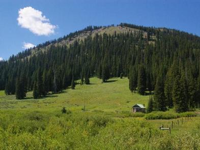
Historic La Barge Guard Station is located 87 miles north of Kemmerer, Wyoming in the Hams Fork Area of Bridger-Teton National Forest. The cabin is situated in beautiful La Barge Meadow, among vibrant summer wildflowers at the base of pine-covered Commissary Ridge.
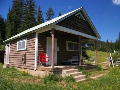
Constructed in 1933 by the Civilian Conservation Corps (CCC), the rustic cabin welcomes guests for sightseeing, hiking, fishing and more. Pets and horses are allowed at the cabin.
Recreation
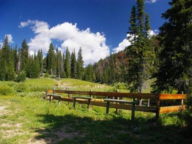
Hiking, mountain biking and horseback riding are popular summer activities in the surrounding area. The Wagner Pass Trail begins behind the cabin, offering scenic hiking as it follows the Lander Cutoff Historical Trail. Snowmobiling and cross country skiing can be done right out the front door in winter.
La Barge Creek offers pleasant trout fishing opportunities.
Facilities
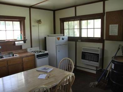
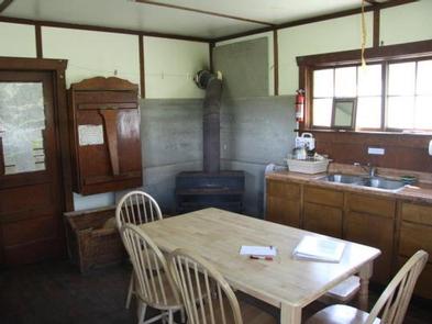
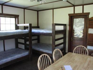
The guard station is a basic, 1930s style CCC cabin with two rooms. It sleeps six people on three bunkbeds with mattresses. The cabin is available year-round. The cabin is equipped with a propane oven, refrigerator, lights and a wood stove. Water is not guaranteed and if water is on, indoor plumbing is still not available. A vault toilet is located behind the cabin. Some dishes, pots, pans and utensils are provided, but the presence of these items is not guaranteed.
No electricity, linens or bedding are provided. In winter, no drinking water is available, so guests should bring plenty for drinking and cooking. Recommended items to bring include dish soap, dish towels, toilet paper, garbage bags and a flashlight. If firewood is on site, this is a courtesy but is not guarenteed. If available, please use only what you need. Always be prepared to collect wood locally or bring to site from local resources.
Natural Features
The cabin sits near La Barge Creek in a grassy meadow at about 8,500 feet in elevation. Pine trees dot the land around the cabin and cover the surrounding hillsides.
Moose, elk, eagles and sandhill cranes are among the wildlife likely to be seen. An abundance of wildflowers color the landscape in summer.
The Bridger-Teton National Forest offers more than 3.4 million acres of public land for outdoor recreation. With its pristine watersheds, abundant wildlife and immense wildlands, the forest comprises a large part of the Greater Yellowstone Ecosystem, the largest intact ecosystem in the lower 48 states.