Parkway Drive-Volleyball Courts, DC Campground Reservation, Info, Images, Map, Directions

Parkway Drive-Volleyball Courts, District of Columbia Campground Images, Info & Reservations

Listen

Directions

The volleyball courts near the Lincoln Memorial are most easily accessed by Metrorail or bus. Visitors utilizing Metrorail should exit at the Foggy Bottom/GWU station and walk about one-half mile south to the courts www.wmata.com. Paid parking garages can be found around the downtown area outside of National Mall and Memorial Parks. Street parking is extremely limited. Parking and towing rules are strictly enforced.

Phone

202-245-4715

Activities

BIKING, BOATING, HISTORIC & CULTURAL SITE, CAMPING, OTHER RECREATION CONCESSION SITE

Keywords

Related Link(s)

Rec Area Info & Images

District of Columbia State Road Conditions

District of Columbia State Tourism

Overview

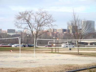
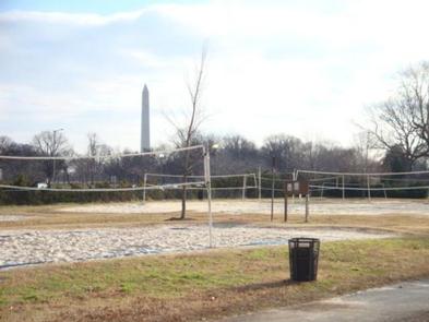
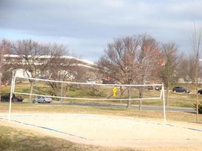
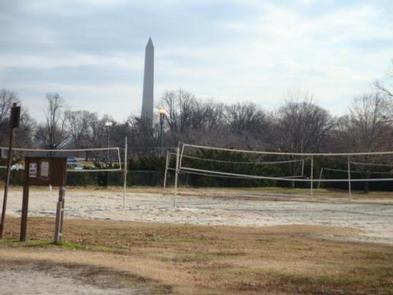
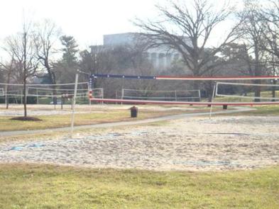
The Parkway Drive Volleyball courts are located along the Potomac River, northwest of the Lincoln Memorial. The Parkway Drive Volleyball Courts are the only public courts within the memorial core, from the U.S. Capitol to the Potomac River.

Recreation

The Parkway Drive Volleyball Courts, offer opportunities for small group and team play, on a casual use and competitive use basis.

Facilities

The Parkway Drive Volleyball Courts are comprised of eleven volleyball courts with sand, nets and court lines. There is also a bulletin board for public information.

Natural Features

The courts are set along the Potomac River, in the shadows of the Lincoln Memorial. The courts are interspersed with tree canopies and hedges.

Nearby Attractions

The Parkway Drive Volleyball Courts are within easy walking distance to the Lincoln Memorial, the Vietnam Veterans Memorial, the Vietnam Women’s Memorial and the Korean War Veterans Memorial. A running/walking trail is along its western border and across the street from three softball fields.

Reservation

More from CampingHiking.net:

Rohrbach Group Campground, Maryland Campground Images, Info & Reservations

Listen Directions The visitor center is located at 5831 Dunker Church Rd. off of MD Rt 65, ten miles south of I-70 and one mile north of historic Sharpsburg, Maryland. The campground is located at 18316 Burnside Bridge Road, Sharpsburg, MD 21782. Phone (301) 432-5124 Activities BIKING, HISTORIC & CULTURAL

SILVER DOLLAR, Colorado Campground Images, Info & Reservations

Listen Directions From Leadville, Colorado, drive west on County Road 4 and follow signs to the Turquoise Lake Recreation Area. Turn right on County Road 9C and follow to the campground entrance on the right. Phone 719-486-0749 (FOR INFORMATION ONLY, NO RESERVATIONS) Activities BOATING, HISTORIC & CULTURAL SITE, CAMPING, FISHING,

LEWIS CANYON, Arizona Campground Images, Info & Reservations

Listen Directions Drive to Pinedale, Arizona, on State Highway 260, approximately 14 miles northwest of Show Low. Turn south on Forest Road 130 and continue approximately 2.3 miles to Junction 130A. Turn right to the group site, following the signs.  Phone 928-368-2100 Activities BIKING, CAMPING, HIKING Keywords LEWI,APACHE-SITGREAVES NF-FS Related

POSEY LAKE CAMPGROUND, Utah Campground Images, Info & Reservations

Listen Directions From Highway 12 in Escalante, turn north at 300 East at the elementary school at the Posey Lake/Hell’s Backbone sign. Travel 14 miles to junction of Forest Roads 153 and 154, keep left and travel 2 miles to Posey Lake Campground. Site access can be difficult; about 14

COAL MINE, New Mexico Campground Images, Info & Reservations

Listen Directions From Grants, take New Mexico State Highway 547 for 10 miles to the campground. Phone 505-287-8833 Activities CAMPING, HIKING, SCENIC DRIVE Keywords COAM,CIBOLA NF – FS Related Link(s) Rec Area Info & Images New Mexico State Tourism New Mexico State Road Conditions Overview Coal Mine Campground is situated