PALISADES GROUP CAMPGROUND, CA Campground Reservation, Info, Images, Map, Directions

PALISADES GROUP CAMPGROUND, California Campground Images, Info & Reservations

Directions

From U.S. Highway 395, take the Tom’s Place exit, 13 miles south of Mammoth Lakes or 30 miles north of Bishop. Turn left on Rock Creek Road and follow for about 6 miles to Palisades Group Campground on the right.

Phone

760-935-4825

Activities

BOATING, HISTORIC & CULTURAL SITE, CAMPING, FISHING, HIKING

Keywords

PALISADES GROUP CAMPGROUND (CA),Palisades Group Campground

Related Link(s)

Rec Area Info & Images

California State Road Conditions

Forest Service Concessionaire

California State Tourism

Overview

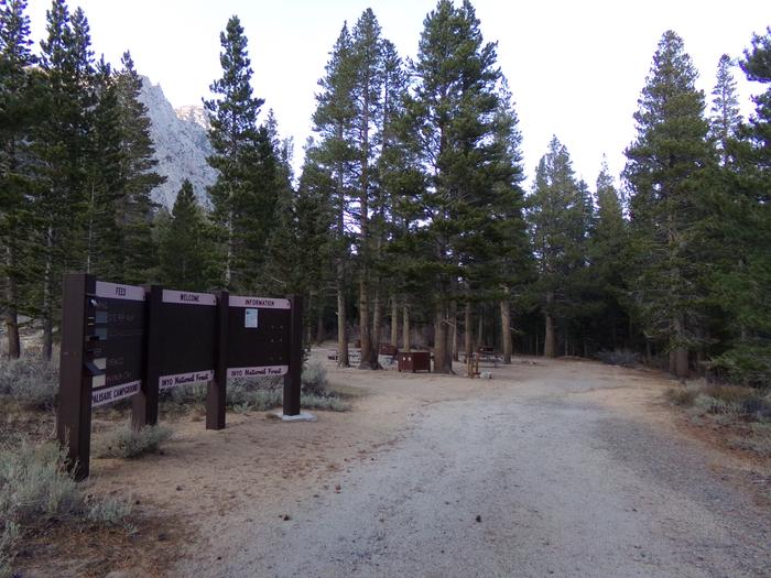
Palisades Group Campground lies along Rock Creek in Inyo National Forest, near Mammoth Lakes and Bishop, California. Well-suited for large families and groups, the facility provides access to fishing, hiking, scenic driving, photography and wildlife viewing.

Recreation

Hiking and fishing opportunities abound, with local lakes and streams within walking and driving distance. The eastern Sierra Nevada Mountains are known for their exceptional trout fishing. A catch from the creek may including brook, brown, rainbow and stocked Alpers trout, while anglers may be treated to golden trout in the backcountry.

There are several hiking trails in and around Rock Creek Canyon, some of which meander around high-elevation alpine lakes.
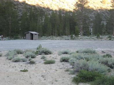
Facilities

Palisades has ample shade and a private loop with five tables and campfire rings. The site can also serve as an overflow group campground for groups of 25 or less who are not able to reserve the nearby Rock Creek Lake Group site.

Natural Features

The campground sits at an elevation of 8.800 feet, at the bottom of a steep canyon adjacent to Rock Creek and amidst aspen and lodgepole pine trees.

The area is home to abundant wildlife, including black bear, mountain lions, mule deer, pine martin, pika and many species of fish and birds.

Nearby Attractions

For campers interested in local events, Mule Days are held in nearby Bishop over Memorial Day weekend, and the Mammoth Jazz Jubilee is hosted in Mammoth in mid-July.

Reservation

More from CampingHiking.net:

Sylvania (Clark Lake) Campground, Michigan Campground Images, Info & Reservations

Directions From Watersmeet, MI, take US 2 west approximately 3.5 miles to County Road 535, turn left onto County Road 535 and travel approximately 3.5 miles to the Sylvania Wilderness Recreation Area entrance on left. Phone 906-396-5428 Activities BIKING, BOATING, CAMPING, FISHING, HIKING, HUNTING, WILDLIFE VIEWING, SWIMMING SITE Keywords Related

BEAR CANYON, Utah Campground Images, Info & Reservations

Directions From I-15, take Nephi exit 225. Travel about 5 miles east on Highway 132 to the Nebo Loop Scenic Byway. Turn left onto the byway and travel 3.5 miles to the Bear Canyon turnoff. Turn left. Bear Canyon Campground is located at the end of the road, just past

CAVE SPRING, Arizona Campground Images, Info & Reservations

Directions From Phoenix, take I-17 to Highway 179 north toward Sedona. Turn north on Highway 89A and continue for 11 miles into Oak Creek Canyon. From Flagstaff, take I-17 to Highway 89A south. Follow 89A for 18 miles to Oak Creek Canyon. Phone 928-282-1629 Activities CAMPING, FISHING, HIKING, WILDLIFE VIEWING,

LITTLE BEAR CABIN, Montana Campground Images, Info & Reservations

Directions From Bozeman, MT: Drive west towards Four Corners, then south towards Big Sky/West Yellowstone on US Highway 191 for 14 miles to Little Bear Road which is on the left (east) side of Highway 191. This road turns into Forest Service Road 980. Summer, June 16 to December 31:

HUGH SMITH LAKE CABIN, Alaska Campground Images, Info & Reservations

Directions The cabin is located approximately 55 air miles southeast of Ketchikan on the mainland south of Marten Arm. Accessible by floatplane. No moorage available. This cabin is in a designated Wilderness area, and access by helicopter is illegal. Refer to USGS Ketchikan A-3. In fall, winter and early spring,