SHEEP BRIDGE, Oregon Campground Reservation, Info, Images, Map, Directions

SHEEP BRIDGE, Oregon Campground Images, Info & Reservations

Directions

From Bend, Oregon: Travel 26.8 miles south on Hwy 97 to Wickiup Junction, then 11.0 miles west on County Road 43, then continue 4.6 miles west on Forest Road 42 , and finally 0.8 miles south on Forest Road 4260.

Phone

541-323-1746

Activities

BOATING, CAMPING, FISHING, HIKING

Keywords

SHEEP BRIDGE (OR),Sheep

Related Link(s)

Rec Area Info & Images

Oregon State Road Conditions

Forest Service Concessionaire

Oregon State Tourism

Overview

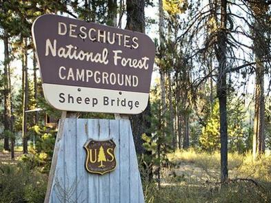
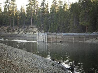
Sheep Bridge Campground is located at the point where the Deschutes River flows into Wickiup Reservoir.

Recreation

Sheep Bridge Campground offers great access for fishing. A short drive away, visitors can find numerous trailheads leading into the Three Sisters Wilderness.

Facilities

Sheep Bridge Campground can accommodate both tent and RV camping, however, hookups are not available. The campground offers picnic tables, campfire rings, drinking water and vault toilets.

A boat ramp for river access is also available at the campground.
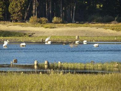
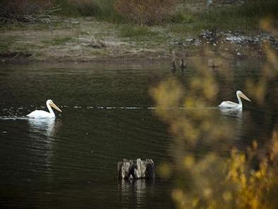
Natural Features

The Deschutes River provides habitat for a variety of fish species, including rainbow trout, whitefish, bull trout and kokanee salmon.

Nearby Attractions

Visitors can explore wilderness areas, rivers, lakes and reservoirs, and approximately hundred of miles of trail. Newberry National Volcanic Monument, approxiately 45 minutes by vehicle, is a great starting point for visitors to learn about the diverse landscape and history of the area through interpretive programs and exhibits. Visitors can explore Lava River Cave, the longest continuous lava tube in Oregon. Visitors enjoy traveling the Cascade Lakes Scenic Bywaywhich climbs 66 miles through the Cascade Range, weaving past snow-capped peaks and alpine lakes.

Reservation

More from CampingHiking.net:

FIFIELD (IA), Iowa Campground Images, Info & Reservations

Directions 1672 HWY G28 Pella, Iowa 50219 From Pella, Iowa, follow county road G28 west for 6 miles, then follow signs to Fifield. Phone 641-828-7522 Activities BIKING, PICNICKING, WILDLIFE VIEWING, BIRDING Keywords None Related Link(s) Rec Area Info & Images Iowa State Road Conditions Iowa State Tourism Overview Fifield is

PRINTER BOY, Colorado Campground Images, Info & Reservations

Directions From Leadville, Colorado, drive west on County Road 4 and follow signs to the Turquoise Lake Recreation Area. Phone 719-486-0749 (FOR INFORMATION ONLY. NO RESERVATIONS.) Activities BOATING, CAMPING, FISHING, HIKING Keywords PRIN,PIKE AND SAN ISABEL NF- FS Related Link(s) Rec Area Info & Images Forest Service Concessionaire Colorado State

SOAPSTONE, Utah Campground Images, Info & Reservations

Directions From Salt Lake City, Utah, take I-80 east for approximately 30 miles to Exit 146 for Highway 40 toward Park City/Heber City/Vernal. Take Exit 4 onto Highway 248 toward Kamas. Take left onto UT 32 then right onto Highway 150 (Mirror Lake Scenic Byway). Go 15 miles to campground.

TRAIL CREEK, Wyoming Campground Images, Info & Reservations

Directions Located 7 miles southeast of Victor, Idaho, adjacent to Wyoming Highway 22, 2 miles south of Mike Harris Campground. Phone 208-270-0150 OR 541-351-1182 Activities BIKING, CAMPING, FISHING, HIKING, HUNTING Keywords TRCR,TRAIL CREEK CAMPGROUND,CARIBOU-TARGHEE NF – FS Related Link(s) Rec Area Info & Images Forest Service Concessionaire Overview Trail Creek

LOST BRIDGE NORTH, Arkansas Campground Images, Info & Reservations

Directions From Rogers, Arkansas, take Highway 62 east for about 13 miles to Garfield. Turn right on Highway 127 and continue for 6 miles. Turn left on Marina Road and follow signs to the park. Phone 479-359-3312 Activities BOATING, CAMPING, HIKING, WATER SPORTS, SWIMMING SITE Keywords LOST,BEAVER LAKE,NORTH PARK,BEAVER LAKE