BOB SHETLER PICNIC AREA, IA Campground Reservation, Info, Images, Map, Directions

BOB SHETLER PICNIC AREA, Iowa Campground Images, Info & Reservations

Directions

From I-35, take the Ankeny Exit #90 (Oralabor Road) and go west 4.8 miles; the road turns into HWY 415. Turn left (west) onto NW 37th Street and go 0.3 mile, then turn right onto NW Horseshoe Rd. Turn right and drive across the Saylorville Lake Dam to the campground.

From I-80, take Exit #135 (2nd Avenue/Highway 415) exit and go north 3.5 miles. Turn left (west) onto Oralabor Road (Highway 415) and go 2.6 miles. Turn left (west) onto NW 37th Street and go 0.3 mile, then turn right onto NW Horseshoe Rd. Turn right and drive across the Saylorville Lake Dam to the campground.

Phone

515-276-4656

Activities

BIKING, CAMPING, FISHING, HIKING, WILDLIFE VIEWING

Keywords

BOB SHETLER PICNIC AREA (IA)

Related Link(s)

Rec Area Info & Images

Iowa State Tourism

Iowa State Road Conditions

Overview

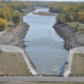
Bob Shetler Picnic Area is a day-use facility located in the tailwater area below Saylorville Dam, and is a popular destination for shoreline fishermen.

The 26,000-acre Saylorville Lake Project stretches over 50 miles up the Des Moines River Valley. The lake provides a wide variety of recreational activities, including boating, swimming, fishing, hiking and hunting.

Recreation

Visitors come to Saylorville Lake for its great boating, sailing, water skiing, windsurfing and swimming opportunities. Anglers fish for walleye, wiper, largemouth bass, catfish, crappie and northern pike.

The paved Neal Smith Trail winds 24 miles from Des Moines to Big Creek State Park and connects the campgrounds on the east side of the lake. It is designated as a National Recreation Trail and is used for biking, hiking, jogging, walking and in-line skating.

Facilities

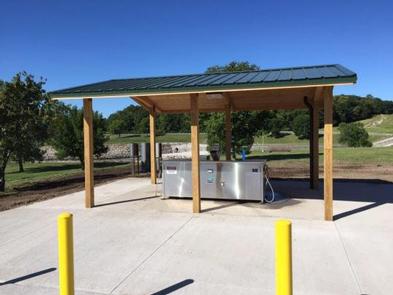
The day-use area offers two large group picnic areas with water and electric hookups. Amenities include flush toilets, a volleyball court, playground and hiking trails.

Natural Features

Large shade trees dot the open grassy land around the picnic area, which offers pleasant views of the Des Moines River.

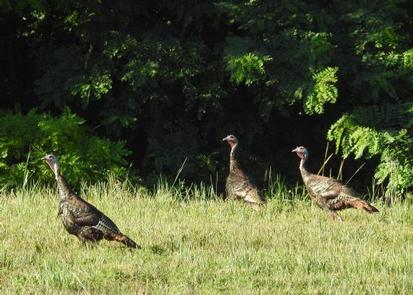
Wildlife is abundant throughout the project. White-tailed deer, turkeys, pheasants, waterfowl, and other small game animals roam the lands around the lake.

Reservation

More from CampingHiking.net:

EEL CREEK CAMPGROUND, Oregon Campground Images, Info & Reservations

Directions From Reedsport, Oregon travel south 10 miles to the Eel Creek Campground. Campground entrance is located on west side of Highway 101 at mile post 222. Phone 541-271-6000 Activities CAMPING, FISHING, HIKING Keywords EELC,OREGON DUNES,LAKESIDE OREGON,TUGMAN STATE PARK,SIUSLAW NF – FS Related Link(s) Rec Area Info & Images Oregon

LAKE ALPINE – LODGEPOLE GROUP, California Campground Images, Info & Reservations

Directions From Angel Camp, drive 50 miles east on Highway 4. Phone 209-753-6350 Activities BOATING, CLIMBING, CAMPING, INTERPRETIVE PROGRAMS, FISHING, HIKING, PICNICKING, RECREATIONAL VEHICLES, VISITOR CENTER, WILDERNESS, DAY USE AREA, SWIMMING SITE, SWIMMING, MOTOR BOAT, OFF ROAD VEHICLE TRAILS, PADDLE BOATING, WATER ACTIVITIES, KAYAKING, NON-MOTORIZED BOATING, DISC GOLF, SCENIC DRIVE,

DIAMOND BUTTE LOOKOUT, Montana Campground Images, Info & Reservations

Directions From Ashland, Montana: travel east on State Highway 212 for approximately 3 miles. Turn south onto Otter Creek Road hwy 484 and travel 20 miles. Just past the Fort Howes Work Center, turn east onto Taylor Creek Road and travel 12 miles to Sonnette Divide Road. Turn north onto

SURVEYORS LOOKOUT, Idaho Campground Images, Info & Reservations

Directions From the St. Joe River Road (FH50) to Beaver Creek, drive 29 miles east of Avery to the junction of the Red Ives Road 218. Turn south (right) and drive 8 miles to the junction of Beaver Creek Road 303 (just past Beaver Creek Campground). Drive about 7.5 miles

NIZHONI, Utah Campground Images, Info & Reservations

Directions From Blanding, Utah, travel north on Highway 191 approximately two miles. Turn left on E. Pinion Ridge Road (National Forest Access sign: Dry Wash Reservoir) and proceed 3/4-mile to the stop sign. Turn right on Forest Road 079 and continue approximately 10 miles to the campground on the right

FOSCUE CREEK, Alabama Campground Images, Info & Reservations

Directions From Demopolis, Alabama, drive three miles west on U.S. Highway 80, and turn right at Maria Street. Go approximately two miles and follow signs to the campground entrance. Phone 334-289-5535 Activities BOATING, CAMPING, FISHING, WATER SPORTS Keywords DAMF,DEMOPOLIS LAKE,FOSCUE CREEK PARK,FOSCUE PARK,BLACK WARRIOR Related Link(s) Rec Area Info &