OAK GROVE PICNIC AREA, IA Campground Reservation, Info, Images, Map, Directions

OAK GROVE PICNIC AREA, Iowa Campground Images, Info & Reservations

Directions

Physical Address: 4801 NW 98th Ave, Polk City, IA 50226

From Ankeny, travel 3.4 miles west on 1st Street. Turn right onto HWY 415 for 0.9 miles, then left onto NW 44th street, which turns slightly right and becomes NW 98th Ave. Picnic area is on the right.

Phone

515-276-4656

Activities

BIKING, CAMPING, FISHING, HIKING, WILDLIFE VIEWING, SWIMMING SITE

Keywords

OAK GROVE PICNIC AREA (IA),Oak Grove,oak grove

Related Link(s)

Rec Area Info & Images

Iowa State Tourism

Iowa State Road Conditions

Overview

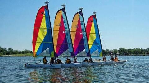
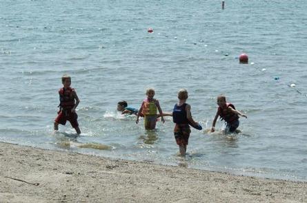
Oak Grove Picnic Area is a day-use facility located on the 26,000-acre Saylorville Lake Project, which stretches over 50 miles up the Des Moines River Valley. The lake provides a wide variety of recreational activities, including boating, swimming, fishing, hiking and hunting.

Recreation

Visitors come to Saylorville Lake for its great boating, sailing, water skiing, windsurfing and swimming opportunities. Anglers fish for walleye, wiper, largemouth bass, catfish, crappie and northern pike.

The paved Neal Smith Trail winds 24 miles from Des Moines to Big Creek State Park and connects the campgrounds on the east side of the lake. It is designated as a National Recreation Trail and is used for biking, hiking, jogging, walking and in-line skating.

Facilities

This day-use area offers two group picnic shelters with electric and water hookups. Amenities include flush toilets, a playground, volleyball court and hiking trails.

Natural Features

Oak Grove lies among a heavily wooded forest of stately oak trees on the east side of the lake. A large beach is within walking distance.

Wildlife is abundant throughout the project. White-tailed deer, turkeys, pheasants, waterfowl, and other small game animals roam the lands around the lake.

Reservation

More from CampingHiking.net:

SALMON LA SAC, Washington Campground Images, Info & Reservations

Directions From Seattle, take I-90 east for nearly 80 miles. Take exit 80 toward Salmon La Sac and turn left on Bullfrog Road. Continue to the 2nd traffic circle and take the second exit onto WA-903 north. Continue onto Salmon La Sac road. The campground is on the left, just

VIRGIL POINT, Oklahoma Campground Images, Info & Reservations

Directions From Hugo, OK, take Highway 70 east for 10 miles, then turn north onto Highway 147. Continue for 2 miles and follow the posted signs to the campground. Phone 580-326-0173 Activities BIKING, BOATING, CAMPING, FISHING, HIKING, HUNTING, WATER SPORTS, WILDLIFE VIEWING Keywords VIRP,HUGO LAKE,HUGO LAKE Related Link(s) Rec Area

WASHINGTON LAKE, Utah Campground Images, Info & Reservations

Directions From Salt Lake City, Utah, take I-80 east for approximately 30 miles to Exit 146 for Highway 40 toward Park City/Heber City/Vernal. Take Exit 4 onto Highway 248 toward Kamas. Take left onto UT 32 then right onto Highway 150 (Mirror Lake Scenic Byway). Go north approximately a half-mile

FIREFIGHTERS CAMPGROUND, Utah Campground Images, Info & Reservations

Directions From Vernal, Utah, take U.S. 191 north about 41 miles. From Manila, Utah, take Highway 44 for 28 miles. Turn left on U.S. 191 and travel approximately 3 miles north. From Rock Springs, Wyoming, take I-80 west toward Green River about 6 miles to the junction with U.S. 191/Flaming