

Directions
Bus: S51 from Staten Island Ferry Terminal to the park entrance on Bay Street.
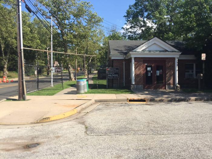
Auto: Verrazano Narrows Bridge from Brooklyn: Take lower level of bridge if possible and stay to the far right. If lower level is closed, take upper level bridge and stay to your far right. After toll, take the Bay Street exit: bear right and proceed to the traffic light. At the light turn right onto Bay Street and follow to park entrance where the booth is located. Make a right into the parking lot at the Camp Gateway Ranger Station, building #220 and check in upon arrival.
Auto: Outerbridge from New Jersey: After paying the toll, follow the West Shore Expressway all the way to the Staten Island Expressway and take the right ramp toward Brooklyn/Verrazzano-Narrows Bridge. Take the last exit before toll plaza which is Lily Pond Avenue Exit (Exit 15). At the Lily Pond traffic light make a left (Lily Pond automatically changes to School Road) . Make a right onto Bay Street. Proceed to the entrance of the park/NPS guard booth. Make a right into the parking lot at the Camp Gateway Ranger Station, building #220 and check in upon arrival.
Auto: Goethal’s Bridge from New Jersey: After paying toll, stay on the Staten Island Expressway, following the Brooklyn/Verrazano-Narrows Bridge signs. Take the last exit before toll which is Lily Pond Avenue Exit (Exit 15). At the Lily Pond traffic light make a left (Lily Pond automatically changes to School Road) . Make a right onto Bay Street. Proceed to the entrance of the park/NPS guard booth. Make a right into the parking lot at the Camp Gateway Ranger Station, building #220 and check in upon arrival.
Phone
718-354-4655
Activities
BIKING, BOATING, HISTORIC & CULTURAL SITE, CAMPING, INTERPRETIVE PROGRAMS, FISHING, HIKING, VISITOR CENTER, OTHER RECREATION CONCESSION SITE, OBSERVATION SITE, RANGER STATION, BIRDING, EVENING PROGRAMS, GUIDED INTERPRETIVE WALKS, RECREATION PROGRAMS
Keywords
Camp Gateway Statin Island,Army Base,Military Base,Navy Lodge,Fort,Wadsworth,Gateway,Seabee
Related Link(s)
New York State Road Conditions
Overview
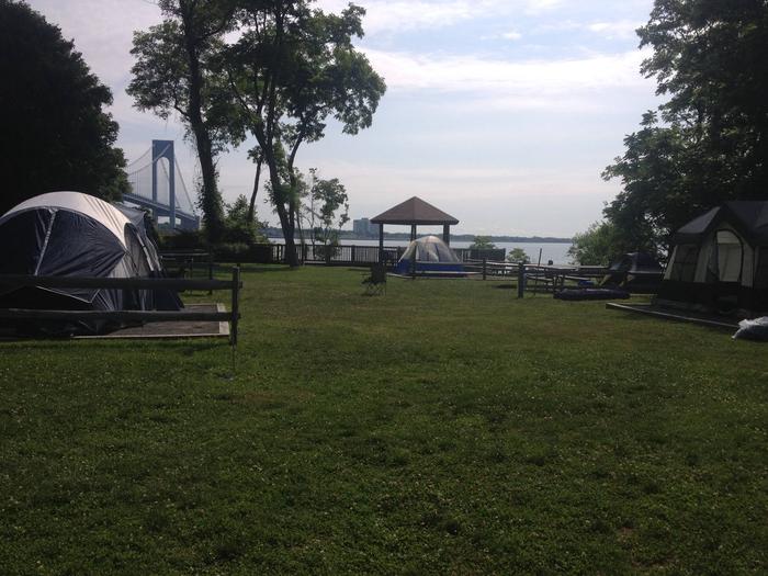
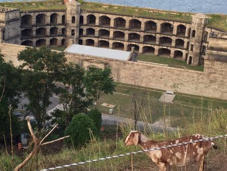
This campground boasts a spectacular view of the Verrazzano-Narrows Bridge, the longest vehicle suspension span in the United States. When it opened in 1964, it was the longest span in the world for 17 years. It connects Fort Hamilton in Brooklyn and Fort Wadsworth in Staten Island.
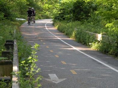
Not far from the campground is an overlook area which features a vantage point to view the Statue of Liberty NM, the Manhattan Skyline and various forts and batteries in the New York Harbor region. Fortification tours are available on site. Connecting to the bike path, near the campground, is a NYC Parks and Recreation boardwalk where bike rentals and food concessions are available offsite.
Recreation
Surf fishing at the beach is available for campers with a fishing license (see DEC for details). In addition, campers can experience a ranger-led tour of the historic structures or visit the park’s museum. In the summer months, campers may enjoy walking/sunbathing (no Lifeguard on duty) on the beach at Fort Wadsworth. Swimming where lifeguards are on duty, is available at Gateway NRA- Great Kills Beach or NYC Parks and Recreation beaches. Bird watching, kayaking, biking and playground areas are all located within the Staten Island Unit of Gateway (Fort Wadsworth, Miller Field and Great Kills Park sites).
Facilities
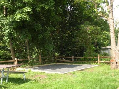
Campground accommodates tent camping only. There is no day use (overnight camping only) allowed and no electrical outlets at the campground.
Seasonal bathrooms and showers are available. To go to Manhattan, take the NYC Public Transportation bus to the St. George Ferry terminal, Staten Island (approx. 25 minute ride from Fort Wadsworth). Board the ferry to New York City, in Lower Manhattan (25 minute boat ride). From there, various types of public transportation are available (e.g. bike rentals, taxis, subways). Bus service running inside Fort Wadsworth stops at 7:00 p.m. daily, though there is service just outside of the park entrance. Check MTA for schedule and pricing https://bustime.mta.info/
Natural Features
Thousands of years ago, glacial activity created a morainal hilltop, that is Fort Wadsworth Overlook. Located at the Narrows in New York Harbor, visitors can look out at the hills of Bay Ridge in Brooklyn and eastern Staten Island. Part of Gateway National Recreation Area (NRA), Staten Island Unit, has various topographic features, such as hills, fields, maritime forest and dunes, as well as beaches.
Nearby Attractions
Alice Austin House, Snug Harbor, Staten Island Zoo, and Staten Island Museum are all within a 10 mile or less radius.
Charges & Cancellations
Changes & Cancellations
Recreation.gov refund and cancellation policy:
https://www.recreation.gov/rules-reservation-policies