ROCKLAND RECREATION AREA, TN Campground Reservation, Info, Images, Map, Directions

ROCKLAND RECREATION AREA, Tennessee Campground Images, Info & Reservations

Directions

From Nashville, TN, take I-65 North to TN-386/Vietnam Veterans Blvd. Continue East on TN-386/Vietnam Veterans Blvd. to exit 3 for US-31E toward Hendersonville. Turn right onto Rockland Road (1st red light you come to), travel approximately 0.6 miles. Turn right onto Power Plant Road. Turn left onto Overlook Circle. You are now in Rockland Recreation Area.

Phone

615-822-4846

Activities

BOATING, FISHING, PICNICKING, ARCHERY

Keywords

Related Link(s)

Rec Area Info & Images

Tennessee State Road Conditions

Tennessee State Tourism

Overview

Rockland Recreation Area is located on the shore of Old Hickory Lake in Hendersonville, Tennessee. Old Hickory Lake was created by the Army Corps of Engineers on the Cumberland River. The lake is named after former president Andrew Jackson, nicknamed for his tough and aggressive personality.

Recreation

Visitors enjoy a vast array of recreational opportunities at Old Hickory including waterskiing, fishing, boating, swimming and hiking. The area provides excellent fishing for several species including bass, crappie, walleye, sauger and catfish.

Facilities

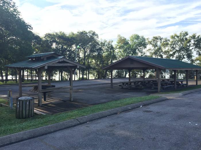
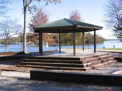
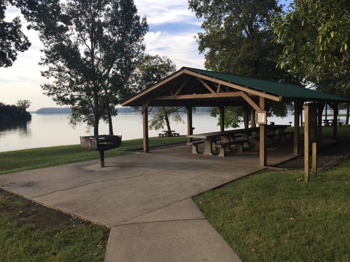
Rockland Recreation Area contains five group shelters and one gazebo. All shelters are covered and readily equipped with tables and grills. Many of the visitors to the shelters find the ease of bank fishing popular within the Rockland Recreation Area. A volleyball court, playground, and large grassy areas are also available.

Natural Features

Set in a moderately wooded area, Rockland Recreation Area is host to numerous wetland species that occupy the wooded areas along the nature trails within the area. Migratory birds visit the area during the winter months as well as year-round forest birds.

Nearby Attractions

Nashville, Tennessee, is located within a 20 to 25 minute sdrive from Rockland Recreation Area. The Old Hickory Lake Resource Manager’s Office and Visitor Center are located directly within the Rockland Recreation Area. A trip to the Visitor Center is an excellent way to learn more about the history, navigational facilities and other programs at Old Hickory Lake. There are numerous stores with amenities within the Old Hickory Lake area.

Reservation

More from CampingHiking.net:

MOOSEHORN, Utah Campground Images, Info & Reservations

Directions From Salt Lake City, Utah, take I-80 east for approximately 30 miles to Exit 146 for Highway 40 toward Park City/Heber City/Vernal. Take Exit 4 onto Highway 248 toward Kamas. Take left onto UT 32 then right onto Highway 150 (Mirror Lake Scenic Byway). Go 31 miles to campground.

ROBINSON CREEK NORTH, California Campground Images, Info & Reservations

Directions Take U.S. Highway 395 through Bridgeport. Turn south on Twin Lakes Road at the Shell gas station. Travel 9.3 miles on Twin Lakes Road, then turn left into the campground. Phone 760-932-7092 Activities CAMPING, FISHING, HIKING, WILDLIFE VIEWING Keywords ROBI,HUMBOLDT-TOIYABE NF-FS Related Link(s) Rec Area Info & Images California

BEAR CREEK COVE, Oklahoma Campground Images, Info & Reservations

Directions From Newkirk, Oklahoma, take Peckham Road and travel east for about 8 miles, turn right on Bear Creek Road and continue south for 3 miles. Campground will be on the right. Phone 580-762-5611 Activities BOATING, CAMPING, FISHING, WILDLIFE VIEWING Keywords BRCC,KAW LAKE,KAW LAKE,OKLAHOMA,OKLAHOMA,KAW LAKE Related Link(s) Rec Area Info

MOOSE LAKE CABIN, Montana Campground Images, Info & Reservations

Directions From Philipsburg, travel south on Highway 1 for about 7 miles to the junction with Skalkaho Highway/Highway 38. Turn right onto Highway 38 and continue west for about 9 miles and turn left onto Moose Lake Road/Forest Road 5106. Travel another 9 miles to the cabin. Winter weather conditions

WATCHMAN CAMPGROUND, Utah Campground Images, Info & Reservations

Directions From Las Vegas, St. George or other points south on Interstate 15: Travel north to Exit 16, towards Hurricane. Follow State Route 9 east for 12 miles to La Verkin and turn right to continue on State Route 9 towards Zion National Park. After passing through Springdale, arrive at